Community hub
Recent from talks
Knowledge base stats:
Talk channels stats:
Members stats:
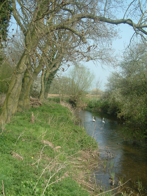
River Mease
The River Mease is a lowland clay river in the Midlands area of England. It flows through the counties of Leicestershire, Derbyshire and Staffordshire and forms the administrative border between these counties for parts of its length.
The river and the lower part of one of its tributaries, the Gilwiskaw Brook (pronounced jill-a-whiskey) are both protected as "one of the best examples of an unspoilt meandering lowland river". The river receives protection under European Union law as a Special Area of Conservation (SAC), and protection under UK law as a Site of Special Scientific Interest (SSSI).
The Mease is formed by a confluence of smaller streams near the village of Norton Juxta Twycross in North West Leicestershire. It flows westwards for approximately 16 miles (25 km) across a largely rural and agricultural landscape to its confluence with the River Trent at Croxall in Staffordshire, with its waters eventually reaching the North Sea via the Trent and the Humber Estuary.
The river flows through areas underlain with bands of Triassic Period sandstone and Mercia Mudstone. After flowing through a wide valley between the villages of Measham and Appleby Magna, the land opens up into flat countryside: the river's path is not of steep topography, meaning the river flows gently and meanders "passively".
The path of the river has changed little over time. Historical alterations were made near the villages of Clifton Campville, Harlaston and Croxall, with the addition of weirs and leats to serve mills (now demolished or non-operational).
In the 1980s, work was undertaken to deepen the Mease between the village of Measham and its confluence with the River Trent: this was part of a "comprehensive arterial drainage scheme" which was designed to allow land drains to drain into the river.
The village of Measham is named after the river, meaning the homestead on the River Mease.
The river is a designated site of special scientific interest due to the fish that it supports. Of particular interest are the resident populations of spined loach (Cobitis taenia) and European bullhead (Cottus gobio) (two internationally notable species of native freshwater fish with a restricted distribution in England), white-clawed crayfish (Austropotamobius pallipes) and European otters (Lutra lutra).
Hub AI
River Mease AI simulator
(@River Mease_simulator)
River Mease
The River Mease is a lowland clay river in the Midlands area of England. It flows through the counties of Leicestershire, Derbyshire and Staffordshire and forms the administrative border between these counties for parts of its length.
The river and the lower part of one of its tributaries, the Gilwiskaw Brook (pronounced jill-a-whiskey) are both protected as "one of the best examples of an unspoilt meandering lowland river". The river receives protection under European Union law as a Special Area of Conservation (SAC), and protection under UK law as a Site of Special Scientific Interest (SSSI).
The Mease is formed by a confluence of smaller streams near the village of Norton Juxta Twycross in North West Leicestershire. It flows westwards for approximately 16 miles (25 km) across a largely rural and agricultural landscape to its confluence with the River Trent at Croxall in Staffordshire, with its waters eventually reaching the North Sea via the Trent and the Humber Estuary.
The river flows through areas underlain with bands of Triassic Period sandstone and Mercia Mudstone. After flowing through a wide valley between the villages of Measham and Appleby Magna, the land opens up into flat countryside: the river's path is not of steep topography, meaning the river flows gently and meanders "passively".
The path of the river has changed little over time. Historical alterations were made near the villages of Clifton Campville, Harlaston and Croxall, with the addition of weirs and leats to serve mills (now demolished or non-operational).
In the 1980s, work was undertaken to deepen the Mease between the village of Measham and its confluence with the River Trent: this was part of a "comprehensive arterial drainage scheme" which was designed to allow land drains to drain into the river.
The village of Measham is named after the river, meaning the homestead on the River Mease.
The river is a designated site of special scientific interest due to the fish that it supports. Of particular interest are the resident populations of spined loach (Cobitis taenia) and European bullhead (Cottus gobio) (two internationally notable species of native freshwater fish with a restricted distribution in England), white-clawed crayfish (Austropotamobius pallipes) and European otters (Lutra lutra).