
Recent from talks
St. Johns River
Knowledge base stats:
Talk channels stats:
Members stats:
St. Johns River
The St. Johns River (Spanish: Río San Juan) is the longest river in the U.S. state of Florida and its most significant for commercial and recreational use. At 310 miles (500 km) long, it winds through or borders twelve counties, three of which are the state's largest. The drop in elevation from the headwaters to the mouth is less than 30 feet (9 m). Like most Florida waterways, the St. Johns has a very slow flow rate at 0.3 mph (0.13 m/s), and is often described as "lazy". Numerous lakes are formed by the river or flow into it, but as a river its widest point is 3 miles (5 km) across, spanning several miles between Palatka and Jacksonville, the latter being the largest urban area on the river. The narrowest point is in the headwaters, an unnavigable marsh in Indian River County. In all, 3.5 million people live within the various watersheds that feed into the St. Johns River.
With a drainage basin of 8,840 square miles (22,900 km2), the St. Johns is one of the major interior wetlands of Florida. It is separated into three major basins and two associated watersheds for Lake George and the Ocklawaha River, all managed by the St. Johns River Water Management District. Like all waterways in Florida, the St. Johns is fed primarily by rainfall, most of which is immediately deposited into the river and its tributaries as stormwater runoff. Much of the water flowing into the St. Johns also comes from the Floridan Aquifer, a natural underground reservoir that serves as the fresh water source for populations living north of St. Petersburg.
The banks of the St. Johns have been populated by Archaic people, Timucua, Mocama, French, Spanish, and British settlers, Seminoles, slaves and freemen, Florida crackers, land developers, tourists, and retirees. The river has been the subject of William Bartram's journals, Marjorie Kinnan Rawlings' books, and Harriet Beecher Stowe's letters home. Although Florida was the location of the first permanent European colony in what would become the United States, it was the last U.S. territory on the east coast to be developed, and it remained an undeveloped frontier into the 20th century. When attention was turned to the state, however, much of the land was rapidly overdeveloped in a national zeal for progress. The St. Johns, like many Florida rivers, was altered to make way for agricultural and residential centers. It suffered severe pollution and human interference that has diminished the ecology in and around the river. It was named one of 14 American Heritage Rivers in 1998 but was included on a list of America's Ten Most Endangered Rivers in 2008. Restoration efforts are underway for the basins around the St. Johns as Florida's population continues to increase.
Starting in Brevard County and meeting the Atlantic Ocean at Duval County, the St. Johns is Florida's primary commercial and recreational waterway. It flows north from its headwaters, originating in the direction of the Lake Wales Ridge, which is only slightly elevated at 30 feet (9.1 m) above sea level. Because of this low elevation drop, the river has a long backwater. It ebbs and flows with tides that pass through the barrier islands and up the channel. Uniquely, it shares the same regional terrain as the parallel Kissimmee River, although the Kissimmee flows south.
The river is separated into three basins and two associated watersheds managed by the St. Johns River Water Management District. Because the river flows in a northerly direction, the upper basin is located in the headwaters at its southernmost point. The river begins as a network of marshes in Indian River County, at a point west of Vero Beach aptly named the St. Johns Marsh. It is a blackwater stream, meaning that it is fed primarily by swamps and marshes lying beneath it; water seeps through the sandy soil and collects in a slight valley. The upper basin measures approximately 2,000 square miles (5,200 km2); the St. Johns transforms into a navigable waterway in Brevard County. The river touches on the borders of Osceola and Orange Counties and flows through the southeast tip of Seminole County, transitioning into its middle basin a dozen miles (19 km) or so north of Titusville.
The upper basin was significantly lowered in the 1920s with the establishment of the Melbourne Tillman drainage project. This drained the headwaters eastward to the Indian River through canals dug across the Ten-Mile Ridge near Palm Bay. In 2016 the U.S. Army Corps of Engineers completed a restoration project, returning natural flow to much of the area.
The river is at its narrowest and most unpredictable in this basin. Channel flows are not apparent and are usually unmarked. The most efficient way to travel on this part of the river is by airboat. Approximately 3,500 lakes lie within the watershed; all are shallow, with maximum depths between 3 and 10 feet (1 and 3 m). The river flows into many of the lakes which further confuses navigation. Eight larger lakes and five smaller ones lie in the upper basin; one of the first is named Lake Hell 'n Blazes (sometimes polished to read as Lake Helen or Hellen Blazes), referencing oaths yelled by boatmen and fishermen in the early 19th century, frustrated when trying to navigate through floating islands of macrophytes, or muck and weeds, as the islands changed location with the creeping flow. Lakes Washington, Winder, and Poinsett are located further along this stretch of the river. The northernmost points of the upper basin contain the Tosohatchee Wildlife Management Area, created in 1977 to assist with filtration of waters flowing downstream.
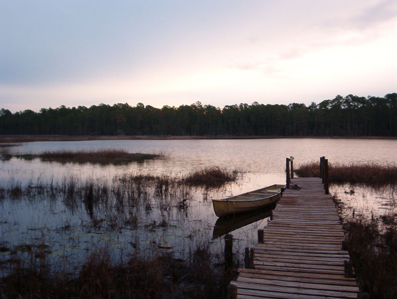
Wetlands in the upper and middle basin are fed by rainwater trapped by the structure of the surrounding land. It is an oxygen- and nutrient-poor environment; what grows usually does so in peat which is created by centuries of decaying plant material. Water levels fluctuate with the subtropical wet and dry seasons. Rain in central and north Florida occurs seasonally during summer and winter, but farther south rain in winter is rare. All plants in these basins must tolerate water fluctuation, both flooding and drought. Sweetbay (Magnolia virginiana), cypress (Taxodium), and swamp tupelo (Nyssa biflora) trees often find great success in this region on raised land called hammocks. Trees that live in water for long periods usually have buttressed trunks, tangled, braided roots, or protrusions like cypress knees to obtain oxygen when under water, but the majority of plant life is aquatic. Wetland staples include the American white waterlily (Nymphaea odorata), pitcher plants, and Virginia iris (Iris virginica). In the southernmost points of the river, Cladium, or sawgrass, grows in vast swaths of wet prairie that at one time extended into the Everglades. These wetland flora are remarkably successful in filtering pollutants that otherwise find their way into the river.
Hub AI
St. Johns River AI simulator
(@St. Johns River_simulator)
St. Johns River
The St. Johns River (Spanish: Río San Juan) is the longest river in the U.S. state of Florida and its most significant for commercial and recreational use. At 310 miles (500 km) long, it winds through or borders twelve counties, three of which are the state's largest. The drop in elevation from the headwaters to the mouth is less than 30 feet (9 m). Like most Florida waterways, the St. Johns has a very slow flow rate at 0.3 mph (0.13 m/s), and is often described as "lazy". Numerous lakes are formed by the river or flow into it, but as a river its widest point is 3 miles (5 km) across, spanning several miles between Palatka and Jacksonville, the latter being the largest urban area on the river. The narrowest point is in the headwaters, an unnavigable marsh in Indian River County. In all, 3.5 million people live within the various watersheds that feed into the St. Johns River.
With a drainage basin of 8,840 square miles (22,900 km2), the St. Johns is one of the major interior wetlands of Florida. It is separated into three major basins and two associated watersheds for Lake George and the Ocklawaha River, all managed by the St. Johns River Water Management District. Like all waterways in Florida, the St. Johns is fed primarily by rainfall, most of which is immediately deposited into the river and its tributaries as stormwater runoff. Much of the water flowing into the St. Johns also comes from the Floridan Aquifer, a natural underground reservoir that serves as the fresh water source for populations living north of St. Petersburg.
The banks of the St. Johns have been populated by Archaic people, Timucua, Mocama, French, Spanish, and British settlers, Seminoles, slaves and freemen, Florida crackers, land developers, tourists, and retirees. The river has been the subject of William Bartram's journals, Marjorie Kinnan Rawlings' books, and Harriet Beecher Stowe's letters home. Although Florida was the location of the first permanent European colony in what would become the United States, it was the last U.S. territory on the east coast to be developed, and it remained an undeveloped frontier into the 20th century. When attention was turned to the state, however, much of the land was rapidly overdeveloped in a national zeal for progress. The St. Johns, like many Florida rivers, was altered to make way for agricultural and residential centers. It suffered severe pollution and human interference that has diminished the ecology in and around the river. It was named one of 14 American Heritage Rivers in 1998 but was included on a list of America's Ten Most Endangered Rivers in 2008. Restoration efforts are underway for the basins around the St. Johns as Florida's population continues to increase.
Starting in Brevard County and meeting the Atlantic Ocean at Duval County, the St. Johns is Florida's primary commercial and recreational waterway. It flows north from its headwaters, originating in the direction of the Lake Wales Ridge, which is only slightly elevated at 30 feet (9.1 m) above sea level. Because of this low elevation drop, the river has a long backwater. It ebbs and flows with tides that pass through the barrier islands and up the channel. Uniquely, it shares the same regional terrain as the parallel Kissimmee River, although the Kissimmee flows south.
The river is separated into three basins and two associated watersheds managed by the St. Johns River Water Management District. Because the river flows in a northerly direction, the upper basin is located in the headwaters at its southernmost point. The river begins as a network of marshes in Indian River County, at a point west of Vero Beach aptly named the St. Johns Marsh. It is a blackwater stream, meaning that it is fed primarily by swamps and marshes lying beneath it; water seeps through the sandy soil and collects in a slight valley. The upper basin measures approximately 2,000 square miles (5,200 km2); the St. Johns transforms into a navigable waterway in Brevard County. The river touches on the borders of Osceola and Orange Counties and flows through the southeast tip of Seminole County, transitioning into its middle basin a dozen miles (19 km) or so north of Titusville.
The upper basin was significantly lowered in the 1920s with the establishment of the Melbourne Tillman drainage project. This drained the headwaters eastward to the Indian River through canals dug across the Ten-Mile Ridge near Palm Bay. In 2016 the U.S. Army Corps of Engineers completed a restoration project, returning natural flow to much of the area.
The river is at its narrowest and most unpredictable in this basin. Channel flows are not apparent and are usually unmarked. The most efficient way to travel on this part of the river is by airboat. Approximately 3,500 lakes lie within the watershed; all are shallow, with maximum depths between 3 and 10 feet (1 and 3 m). The river flows into many of the lakes which further confuses navigation. Eight larger lakes and five smaller ones lie in the upper basin; one of the first is named Lake Hell 'n Blazes (sometimes polished to read as Lake Helen or Hellen Blazes), referencing oaths yelled by boatmen and fishermen in the early 19th century, frustrated when trying to navigate through floating islands of macrophytes, or muck and weeds, as the islands changed location with the creeping flow. Lakes Washington, Winder, and Poinsett are located further along this stretch of the river. The northernmost points of the upper basin contain the Tosohatchee Wildlife Management Area, created in 1977 to assist with filtration of waters flowing downstream.
Wetlands in the upper and middle basin are fed by rainwater trapped by the structure of the surrounding land. It is an oxygen- and nutrient-poor environment; what grows usually does so in peat which is created by centuries of decaying plant material. Water levels fluctuate with the subtropical wet and dry seasons. Rain in central and north Florida occurs seasonally during summer and winter, but farther south rain in winter is rare. All plants in these basins must tolerate water fluctuation, both flooding and drought. Sweetbay (Magnolia virginiana), cypress (Taxodium), and swamp tupelo (Nyssa biflora) trees often find great success in this region on raised land called hammocks. Trees that live in water for long periods usually have buttressed trunks, tangled, braided roots, or protrusions like cypress knees to obtain oxygen when under water, but the majority of plant life is aquatic. Wetland staples include the American white waterlily (Nymphaea odorata), pitcher plants, and Virginia iris (Iris virginica). In the southernmost points of the river, Cladium, or sawgrass, grows in vast swaths of wet prairie that at one time extended into the Everglades. These wetland flora are remarkably successful in filtering pollutants that otherwise find their way into the river.
Recent media