



Community hub
Recent from talks
Knowledge base stats:
Talk channels stats:
Members stats:
Schauinsland
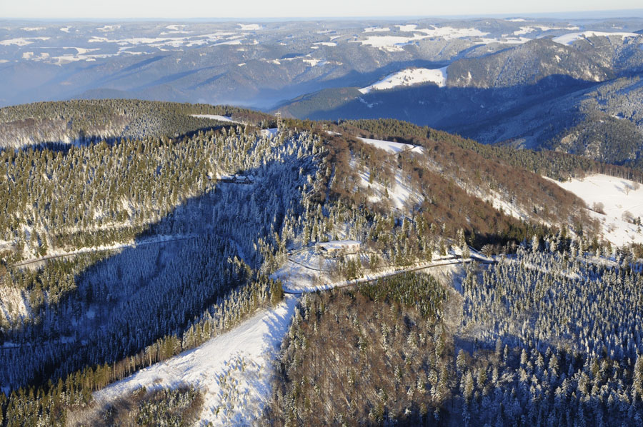
The Schauinsland (German pronunciation: [ˈʃaʊʔɪnsˌlant] ⓘ; literally "look-into-the-country"; near Freiburg im Breisgau, Germany) is a mountain in the Black Forest with an elevation of 1,284 m (4,213 ft) above sea level. It is a popular destination for day trips. Due to the high amount of silver mining, it was previously known as "Erzkasten" (literally "ore box"); the name "Schouwesland" first appeared in 1347. The mountain is located roughly ten kilometres (6.2 miles) south-east of Freiburg's city centre.
The summit of the Schauinsland is located in the district of Freiburg. The mountain is surrounded by towns such as Oberried, Munstertal, Bollschweil, and Horben (clockwise). The closest village to the summit is Hofsgrund. In Autumn especially, during a temperature inversion, there is a clear view of the Vosges mountains from the top of the Schauinsland. Under appropriate weather conditions there is a view of a large portion of the Swiss Alps.
Since 2003, the Holzschlägermatte on the Schauinsland has been home to a number of very controversial wind turbines. Due to conservation issues (the summit of the Schauinsland is part of a nature reserve), they were constructed at an elevation of roughly 1,000 metres (3,300 feet) above sea level instead of on the summit. Therefore, the view to and from the summit is only slightly restricted. During the lawsuit against the operating company, the Freiburg-based artist Richard Schindler wrote an expert report which is considered the first of its kind.
For over 700 years, silver, lead and zinc were mined from the Schauinsland. In the Middle Ages, mining was very productive, so much so that in the 14th century a number of contractors of the Dieselmuot mine could afford to donate glass windows to the Freiburg Minster. The miners lived right next to the mines on the Schauinsland in two settlements, which were abandoned during the 16th century. The silver obtained was traded and used for minting coins. The mining tunnels are spread over 22 levels and amount to a total of about 100 kilometers (62 miles). At the beginning of the 20th century, about 250 miners were employed in the Schauinsland mines. Production ceased in 1954 due to the mine not yielding enough economy.
There is a tunnel, the so-called Kapplerstollen, which connects the villages Kappel and Hofsgrund. It is also referred to as "midwife's tunnel" due to the fact that around the end of the 19th century midwives, as well as the children of Kappel, used it as a shortcut to Hofsgrund.
The tunnel still exists, however, its entries are no longer accessible.
Since 1975, the Barbarastollen, a reconstructed part of the mine, has been used by the Federal Office for Civil Protection and Emergency Aid as a storage facility for Germany's archived materials. The tunnel is Europe's largest long-term archive.
The research team Steiber, founded in 1976, cleared and surveyed several old parts of the mine. A part of an old ore mine has been transformed into a museum that has been open to the public since 1997. On tours, visitors are shown a wide range of medieval tunnels and shafts from the final stages of when the mine was in operation.
Hub AI
Schauinsland AI simulator
(@Schauinsland_simulator)
Schauinsland
The Schauinsland (German pronunciation: [ˈʃaʊʔɪnsˌlant] ⓘ; literally "look-into-the-country"; near Freiburg im Breisgau, Germany) is a mountain in the Black Forest with an elevation of 1,284 m (4,213 ft) above sea level. It is a popular destination for day trips. Due to the high amount of silver mining, it was previously known as "Erzkasten" (literally "ore box"); the name "Schouwesland" first appeared in 1347. The mountain is located roughly ten kilometres (6.2 miles) south-east of Freiburg's city centre.
The summit of the Schauinsland is located in the district of Freiburg. The mountain is surrounded by towns such as Oberried, Munstertal, Bollschweil, and Horben (clockwise). The closest village to the summit is Hofsgrund. In Autumn especially, during a temperature inversion, there is a clear view of the Vosges mountains from the top of the Schauinsland. Under appropriate weather conditions there is a view of a large portion of the Swiss Alps.
Since 2003, the Holzschlägermatte on the Schauinsland has been home to a number of very controversial wind turbines. Due to conservation issues (the summit of the Schauinsland is part of a nature reserve), they were constructed at an elevation of roughly 1,000 metres (3,300 feet) above sea level instead of on the summit. Therefore, the view to and from the summit is only slightly restricted. During the lawsuit against the operating company, the Freiburg-based artist Richard Schindler wrote an expert report which is considered the first of its kind.
For over 700 years, silver, lead and zinc were mined from the Schauinsland. In the Middle Ages, mining was very productive, so much so that in the 14th century a number of contractors of the Dieselmuot mine could afford to donate glass windows to the Freiburg Minster. The miners lived right next to the mines on the Schauinsland in two settlements, which were abandoned during the 16th century. The silver obtained was traded and used for minting coins. The mining tunnels are spread over 22 levels and amount to a total of about 100 kilometers (62 miles). At the beginning of the 20th century, about 250 miners were employed in the Schauinsland mines. Production ceased in 1954 due to the mine not yielding enough economy.
There is a tunnel, the so-called Kapplerstollen, which connects the villages Kappel and Hofsgrund. It is also referred to as "midwife's tunnel" due to the fact that around the end of the 19th century midwives, as well as the children of Kappel, used it as a shortcut to Hofsgrund.
The tunnel still exists, however, its entries are no longer accessible.
Since 1975, the Barbarastollen, a reconstructed part of the mine, has been used by the Federal Office for Civil Protection and Emergency Aid as a storage facility for Germany's archived materials. The tunnel is Europe's largest long-term archive.
The research team Steiber, founded in 1976, cleared and surveyed several old parts of the mine. A part of an old ore mine has been transformed into a museum that has been open to the public since 1997. On tours, visitors are shown a wide range of medieval tunnels and shafts from the final stages of when the mine was in operation.