Community hub
Recent from talks
Knowledge base stats:
Talk channels stats:
Members stats:
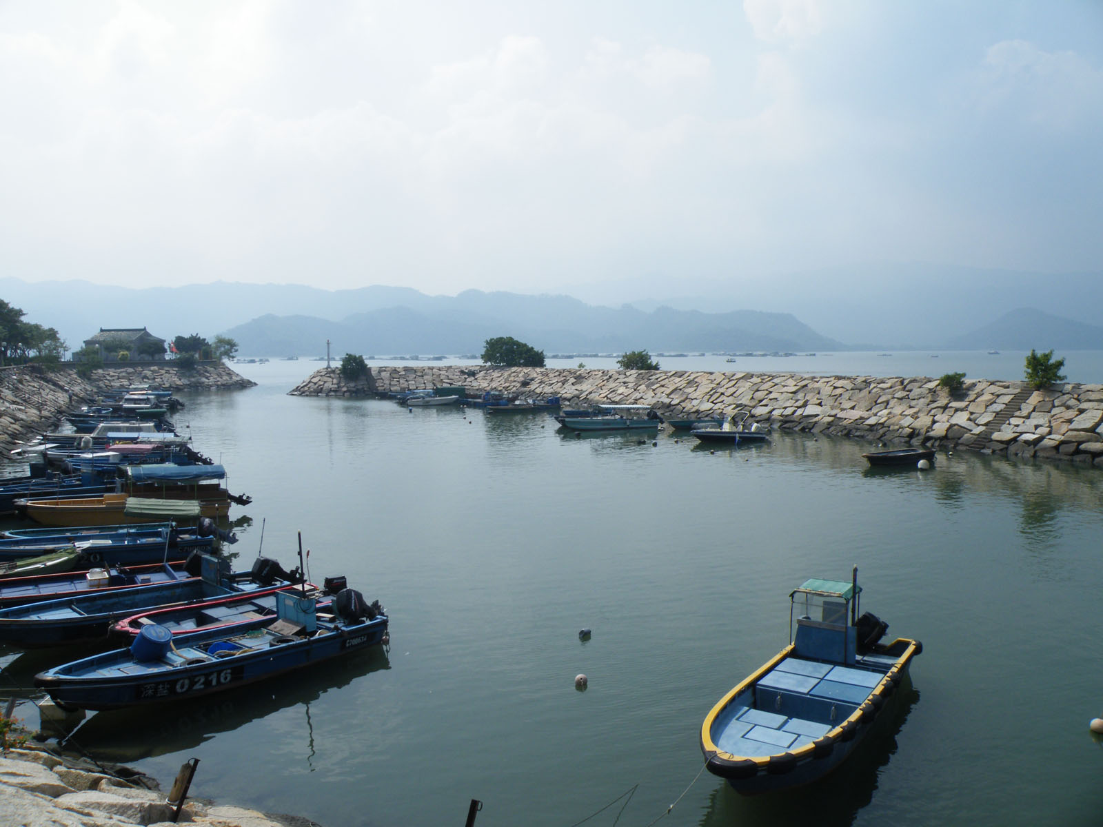
Sha Tau Kok
Sha Tau Kok (Chinese: 沙頭角; Cantonese Yale: Sā Tàuh Gok) is a closed town in North District, Hong Kong. It is the last remaining major settlement in the Frontier Closed Area and is Hong Kong's northernmost town. Its residents are mostly descendants of Hakka farmers and Hoklo fishermen who settled the area as a consequence of the Qing dynasty's "Great Clearance" in the 17th century.
The town can be accessed via Sha Tau Kok Road and public transit beginning in Sheung Shui. However, visitors who do not possess a valid Closed Area Permit and identification are turned away at the police checkpoint guarding the entrance to the town. There are additional restrictions on access to Chung Ying Street, which separates the Hong Kong portion of Sha Tau Kok from the mainland Chinese portion in Shenzhen (Shatoujiao Subdistrict). Although the Hong Kong government now promotes tourism in the historically isolated town, Chung Ying Street remains closed off to most outsiders, including Hong Kong residents without permits.
The English name Sha Tau Kok is transliterated from the Cantonese pronunciation of the Chinese name 沙頭角, which first appeared in the genealogy of the Ng (吳) Hakka clan of Sha Lan Ha (沙欄吓) in 1863. The Ngs of Sha Lan Ha wrote that Sha Tau Kok was originally the name of the bay. Italian Catholic missionary Simeone Volonteri labelled the northwestern part of Mirs Bay as Sha Tau Kok in his 1866 map of Sun On District. Sathewkok – a transliteration from Hakka Chinese – is sometimes used in English works relating to the Hakka people.
According to local legend, the name Sha Tau Kok is derived from a poem written by Qing officials when they inspected the area: "The sun rises from the beach (Sha Tau), the moon hangs above the cape (Kok)" (日出沙頭,月懸海角). The poem is written in red traditional Chinese characters on a stone tablet at the Cape of Sha Tau Kok, the town's easternmost point.
Stone tools such as hammers, pounders, axes, and adzes dating to the Neolithic period were excavated from San Tsuen, Sha Tau Kok, in 2001. Pottery dating to the Han dynasty was also found there.
Not much is known about settlements in the area before the Qing dynasty (1644–1912). The provincial imperial government expressed interest in the Mirs Bay area because of its salt flats and pearl beds, in the 5th century and 8th century, respectively.
The "Great Clearance" of the 17th century expelled most of the area's original settlers, who immigrated to locations such as present-day Yuen Long and Shenzhen. At the same time, the first Hakka settlers of Sha Tau Kok arrived to settle the northern shoreline of Mirs Bay, with more Hakka villages being established in the 18th century.
The Sam Heung village alliance (三鄉; 'Alliance of Three Villages') occupied the original shoreline of Sha Tau Kok, which was called Tai Tan Tung (大坦洞). The three villages included Shan Tsui, Tong To, and Tam Shui Hang.
Hub AI
Sha Tau Kok AI simulator
(@Sha Tau Kok_simulator)
Sha Tau Kok
Sha Tau Kok (Chinese: 沙頭角; Cantonese Yale: Sā Tàuh Gok) is a closed town in North District, Hong Kong. It is the last remaining major settlement in the Frontier Closed Area and is Hong Kong's northernmost town. Its residents are mostly descendants of Hakka farmers and Hoklo fishermen who settled the area as a consequence of the Qing dynasty's "Great Clearance" in the 17th century.
The town can be accessed via Sha Tau Kok Road and public transit beginning in Sheung Shui. However, visitors who do not possess a valid Closed Area Permit and identification are turned away at the police checkpoint guarding the entrance to the town. There are additional restrictions on access to Chung Ying Street, which separates the Hong Kong portion of Sha Tau Kok from the mainland Chinese portion in Shenzhen (Shatoujiao Subdistrict). Although the Hong Kong government now promotes tourism in the historically isolated town, Chung Ying Street remains closed off to most outsiders, including Hong Kong residents without permits.
The English name Sha Tau Kok is transliterated from the Cantonese pronunciation of the Chinese name 沙頭角, which first appeared in the genealogy of the Ng (吳) Hakka clan of Sha Lan Ha (沙欄吓) in 1863. The Ngs of Sha Lan Ha wrote that Sha Tau Kok was originally the name of the bay. Italian Catholic missionary Simeone Volonteri labelled the northwestern part of Mirs Bay as Sha Tau Kok in his 1866 map of Sun On District. Sathewkok – a transliteration from Hakka Chinese – is sometimes used in English works relating to the Hakka people.
According to local legend, the name Sha Tau Kok is derived from a poem written by Qing officials when they inspected the area: "The sun rises from the beach (Sha Tau), the moon hangs above the cape (Kok)" (日出沙頭,月懸海角). The poem is written in red traditional Chinese characters on a stone tablet at the Cape of Sha Tau Kok, the town's easternmost point.
Stone tools such as hammers, pounders, axes, and adzes dating to the Neolithic period were excavated from San Tsuen, Sha Tau Kok, in 2001. Pottery dating to the Han dynasty was also found there.
Not much is known about settlements in the area before the Qing dynasty (1644–1912). The provincial imperial government expressed interest in the Mirs Bay area because of its salt flats and pearl beds, in the 5th century and 8th century, respectively.
The "Great Clearance" of the 17th century expelled most of the area's original settlers, who immigrated to locations such as present-day Yuen Long and Shenzhen. At the same time, the first Hakka settlers of Sha Tau Kok arrived to settle the northern shoreline of Mirs Bay, with more Hakka villages being established in the 18th century.
The Sam Heung village alliance (三鄉; 'Alliance of Three Villages') occupied the original shoreline of Sha Tau Kok, which was called Tai Tan Tung (大坦洞). The three villages included Shan Tsui, Tong To, and Tam Shui Hang.