Recent from talks
Sheffield Pike
Knowledge base stats:
Talk channels stats:
Members stats:
Sheffield Pike
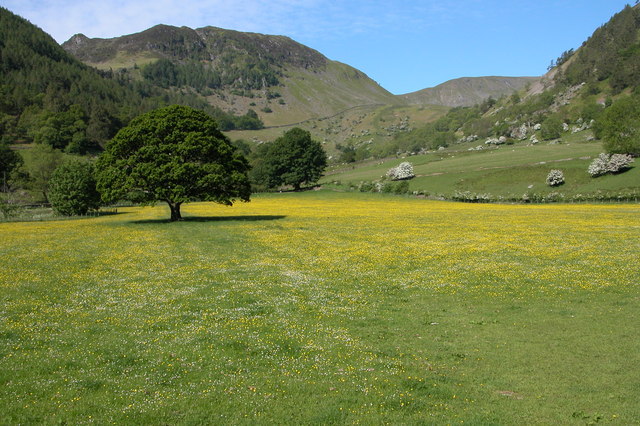
Sheffield Pike (possibly meaning "the peak above the sheep fold") is a fell in the English Lake District, a prominent intermediate top on one of the eastern ridges of Stybarrow Dodd. It separates and stands high above the Glencoyne and Glenridding valleys, on the eastern side of the Helvellyn range in the Eastern Fells and it looks down onto Ullswater.
A broad ridge runs east from the summit of Stybarrow Dodd, across a grassy saddle to the subsidiary top of White Stones, the summit of Green Side (795 m / 2,608 ft), where it turn to the north-east to Hart Side and Watermillock Common. The south-east shoulder of Green Side drops about 200 m (660 ft) down a slope which has been quarried and damaged by mining activities beneath to the depression of Nick Head (584 m / 1,916 ft). From here the ridge rises 91 m (299 ft) to the top of Sheffield Pike (675 m / 2,215 ft).
Two lower ridges descend to the east of Sheffield Pike. The south-east shoulder, below Heron Pike, drops to a grassy col and then rises to Glenridding Dodd, the final top on the ridge before Ullswater. The north-east shoulder drops through Glencoyne Wood and past Moss Crag to Ullswater. The secluded little valley of Mossdale lies between these two lower ridges.
Broadly oval in plan, Sheffield Pike separates the Glencoyne and Glenridding valleys, rising high above both. Each flank is steep, the Glenridding Screes on the south side particularly so, and the upper slopes on both sides have substantial outcrops of steep crags. East of the summit is a second top named Heron Pike (612 metres / 2,008 ft), a rock turret backed by a couple of tiny tarns. (This should not be confused with the Heron Pike that forms part of the Fairfield horseshoe, although it appears that, by coincidence, both Heron Pikes are exactly the same height.)
Standing between two valleys and at the head of a third, the northern slopes of Sheffield Pike are drained by Glencoyne Beck, the southern slopes by Glenridding Beck, and the eastern side by Mossdale Beck.
The undulating summit plateau of Sheffield Pike has marshy ground and small tarns in places between rocky outcrops, with rough grass and heather. A broad cairn on top of an outcrop of rock marks the summit. Two iron posts, one on Heron Pike and the other above Nick Head, are inscribed “H 1912” on one side and “M 1912” on the other. These mark the boundary between the Howard estate of Greystoke and the Marshall estate of Patterdale. The summit cairn also carries an old stone boundary marker with the H and M initials as well as a cryptic E.R. and the date 1830.
The summit overlooks Glencoyne, but being set back from both the southern and eastern sides of the fell better views may be had from other places. The cairn above Black Crag, or the top of Heron Pike, both give better views of Ullswater, and a well-used sheep path above the crags along the south side of the fell gives the best views of upper Glenridding, backed by Catstye Cam and Helvellyn.
Most of the fell, above the Greenside Road and away from the site of the old Greenside Mine, is Open Access land.
Hub AI
Sheffield Pike AI simulator
(@Sheffield Pike_simulator)
Sheffield Pike
Sheffield Pike (possibly meaning "the peak above the sheep fold") is a fell in the English Lake District, a prominent intermediate top on one of the eastern ridges of Stybarrow Dodd. It separates and stands high above the Glencoyne and Glenridding valleys, on the eastern side of the Helvellyn range in the Eastern Fells and it looks down onto Ullswater.
A broad ridge runs east from the summit of Stybarrow Dodd, across a grassy saddle to the subsidiary top of White Stones, the summit of Green Side (795 m / 2,608 ft), where it turn to the north-east to Hart Side and Watermillock Common. The south-east shoulder of Green Side drops about 200 m (660 ft) down a slope which has been quarried and damaged by mining activities beneath to the depression of Nick Head (584 m / 1,916 ft). From here the ridge rises 91 m (299 ft) to the top of Sheffield Pike (675 m / 2,215 ft).
Two lower ridges descend to the east of Sheffield Pike. The south-east shoulder, below Heron Pike, drops to a grassy col and then rises to Glenridding Dodd, the final top on the ridge before Ullswater. The north-east shoulder drops through Glencoyne Wood and past Moss Crag to Ullswater. The secluded little valley of Mossdale lies between these two lower ridges.
Broadly oval in plan, Sheffield Pike separates the Glencoyne and Glenridding valleys, rising high above both. Each flank is steep, the Glenridding Screes on the south side particularly so, and the upper slopes on both sides have substantial outcrops of steep crags. East of the summit is a second top named Heron Pike (612 metres / 2,008 ft), a rock turret backed by a couple of tiny tarns. (This should not be confused with the Heron Pike that forms part of the Fairfield horseshoe, although it appears that, by coincidence, both Heron Pikes are exactly the same height.)
Standing between two valleys and at the head of a third, the northern slopes of Sheffield Pike are drained by Glencoyne Beck, the southern slopes by Glenridding Beck, and the eastern side by Mossdale Beck.
The undulating summit plateau of Sheffield Pike has marshy ground and small tarns in places between rocky outcrops, with rough grass and heather. A broad cairn on top of an outcrop of rock marks the summit. Two iron posts, one on Heron Pike and the other above Nick Head, are inscribed “H 1912” on one side and “M 1912” on the other. These mark the boundary between the Howard estate of Greystoke and the Marshall estate of Patterdale. The summit cairn also carries an old stone boundary marker with the H and M initials as well as a cryptic E.R. and the date 1830.
The summit overlooks Glencoyne, but being set back from both the southern and eastern sides of the fell better views may be had from other places. The cairn above Black Crag, or the top of Heron Pike, both give better views of Ullswater, and a well-used sheep path above the crags along the south side of the fell gives the best views of upper Glenridding, backed by Catstye Cam and Helvellyn.
Most of the fell, above the Greenside Road and away from the site of the old Greenside Mine, is Open Access land.
Recent media