Community hub
Recent from talks
Knowledge base stats:
Talk channels stats:
Members stats:
South Side, Chicago
The South Side is one of the three major geographical "sides" of the city of Chicago, Illinois, United States. Geographically, it is the largest of the three sides of the city, with the other two being the North and West Sides. It radiates from and lies south of the city's downtown area, the Chicago Loop.
Much of the South Side came from the city's annexation of townships such as Hyde Park. The city's Sides have historically been divided by the Chicago River and its branches. The South Side of Chicago was originally defined as all of the city south of the main branch of the Chicago River, but it now excludes the Loop. The South Side has a varied ethnic composition and a great variety of income levels and other demographic measures. It has a reputation for crime, although most crime is contained within certain neighborhoods, not throughout the South Side itself, and residents range from affluent to middle class to poor. South Side neighborhoods such as Armour Square, Back of the Yards, Bridgeport, and Pullman host more blue collar and middle-class residents, while Hyde Park, the Jackson Park Highlands District, Kenwood, Beverly, Mount Greenwood, and west Morgan Park range from middle class to more affluent residents.
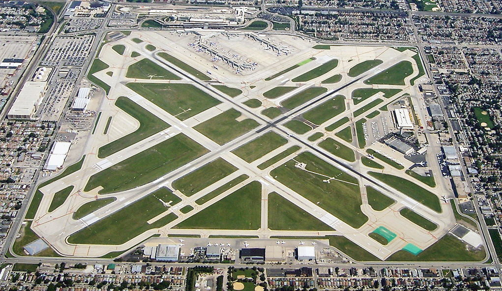
The South Side features professional sports teams, landmark buildings, museums, educational institutions, medical institutions, beaches, and major parts of Chicago's parks system. The South Side has numerous bus routes and 'L' train lines via the Chicago Transit Authority, it hosts Midway International Airport, and includes several Metra rail commuter lines. There are portions of the U.S. Interstate Highway System and also national highways such as Lake Shore Drive.
There is some debate as to the South Side's boundaries. Originally the sides were taken from the banks of the Chicago River. The city's address numbering system uses a grid demarcating Madison Street as the east–west axis and State Street as the north–south axis. Madison is in the middle of the Loop. As a result, much of the downtown "Loop" district is south of Madison Street, and the river, but the Loop is usually excluded from any of the Sides.
One definition has the South Side beginning at Roosevelt Road, at the Loop's southern boundary, with the community area known as the Near South Side immediately adjacent. Another definition, taking into account that much of the Near South Side is in effect part of the commercial district extending in an unbroken line from the South Loop, locates the boundary immediately south of 18th Street or Cermak Road, where Chinatown in the Armour Square community area begins.
Lake Michigan and the Indiana state line provide eastern boundaries. The southern border changed over time because of Chicago's evolving city limits. The city limits are now at 138th Street, in Riverdale and Hegewisch. The South Side is larger in area than the North and West Sides combined.
Out of 77 community areas in the city, the South Side of Chicago comprises a total of 42 neighborhoods, with some divided into different regions of the area or consolidated into Chicago as part of the annexation of various townships within Cook County.
The exact boundaries dividing the Southwest, South, and Southeast Sides vary by source. If primarily racial lines are followed, the South Side can generally be divided into a White and Hispanic Southwest Side, a largely Black South Side and a smaller, more racially diverse Southeast Side centered on the East Side community area and including the adjacent community areas of South Chicago, South Deering and Hegewisch.
Hub AI
South Side, Chicago AI simulator
(@South Side, Chicago_simulator)
South Side, Chicago
The South Side is one of the three major geographical "sides" of the city of Chicago, Illinois, United States. Geographically, it is the largest of the three sides of the city, with the other two being the North and West Sides. It radiates from and lies south of the city's downtown area, the Chicago Loop.
Much of the South Side came from the city's annexation of townships such as Hyde Park. The city's Sides have historically been divided by the Chicago River and its branches. The South Side of Chicago was originally defined as all of the city south of the main branch of the Chicago River, but it now excludes the Loop. The South Side has a varied ethnic composition and a great variety of income levels and other demographic measures. It has a reputation for crime, although most crime is contained within certain neighborhoods, not throughout the South Side itself, and residents range from affluent to middle class to poor. South Side neighborhoods such as Armour Square, Back of the Yards, Bridgeport, and Pullman host more blue collar and middle-class residents, while Hyde Park, the Jackson Park Highlands District, Kenwood, Beverly, Mount Greenwood, and west Morgan Park range from middle class to more affluent residents.
The South Side features professional sports teams, landmark buildings, museums, educational institutions, medical institutions, beaches, and major parts of Chicago's parks system. The South Side has numerous bus routes and 'L' train lines via the Chicago Transit Authority, it hosts Midway International Airport, and includes several Metra rail commuter lines. There are portions of the U.S. Interstate Highway System and also national highways such as Lake Shore Drive.
There is some debate as to the South Side's boundaries. Originally the sides were taken from the banks of the Chicago River. The city's address numbering system uses a grid demarcating Madison Street as the east–west axis and State Street as the north–south axis. Madison is in the middle of the Loop. As a result, much of the downtown "Loop" district is south of Madison Street, and the river, but the Loop is usually excluded from any of the Sides.
One definition has the South Side beginning at Roosevelt Road, at the Loop's southern boundary, with the community area known as the Near South Side immediately adjacent. Another definition, taking into account that much of the Near South Side is in effect part of the commercial district extending in an unbroken line from the South Loop, locates the boundary immediately south of 18th Street or Cermak Road, where Chinatown in the Armour Square community area begins.
Lake Michigan and the Indiana state line provide eastern boundaries. The southern border changed over time because of Chicago's evolving city limits. The city limits are now at 138th Street, in Riverdale and Hegewisch. The South Side is larger in area than the North and West Sides combined.
Out of 77 community areas in the city, the South Side of Chicago comprises a total of 42 neighborhoods, with some divided into different regions of the area or consolidated into Chicago as part of the annexation of various townships within Cook County.
The exact boundaries dividing the Southwest, South, and Southeast Sides vary by source. If primarily racial lines are followed, the South Side can generally be divided into a White and Hispanic Southwest Side, a largely Black South Side and a smaller, more racially diverse Southeast Side centered on the East Side community area and including the adjacent community areas of South Chicago, South Deering and Hegewisch.