Recent from talks
Spanish Sahara
Knowledge base stats:
Talk channels stats:
Members stats:
Spanish Sahara
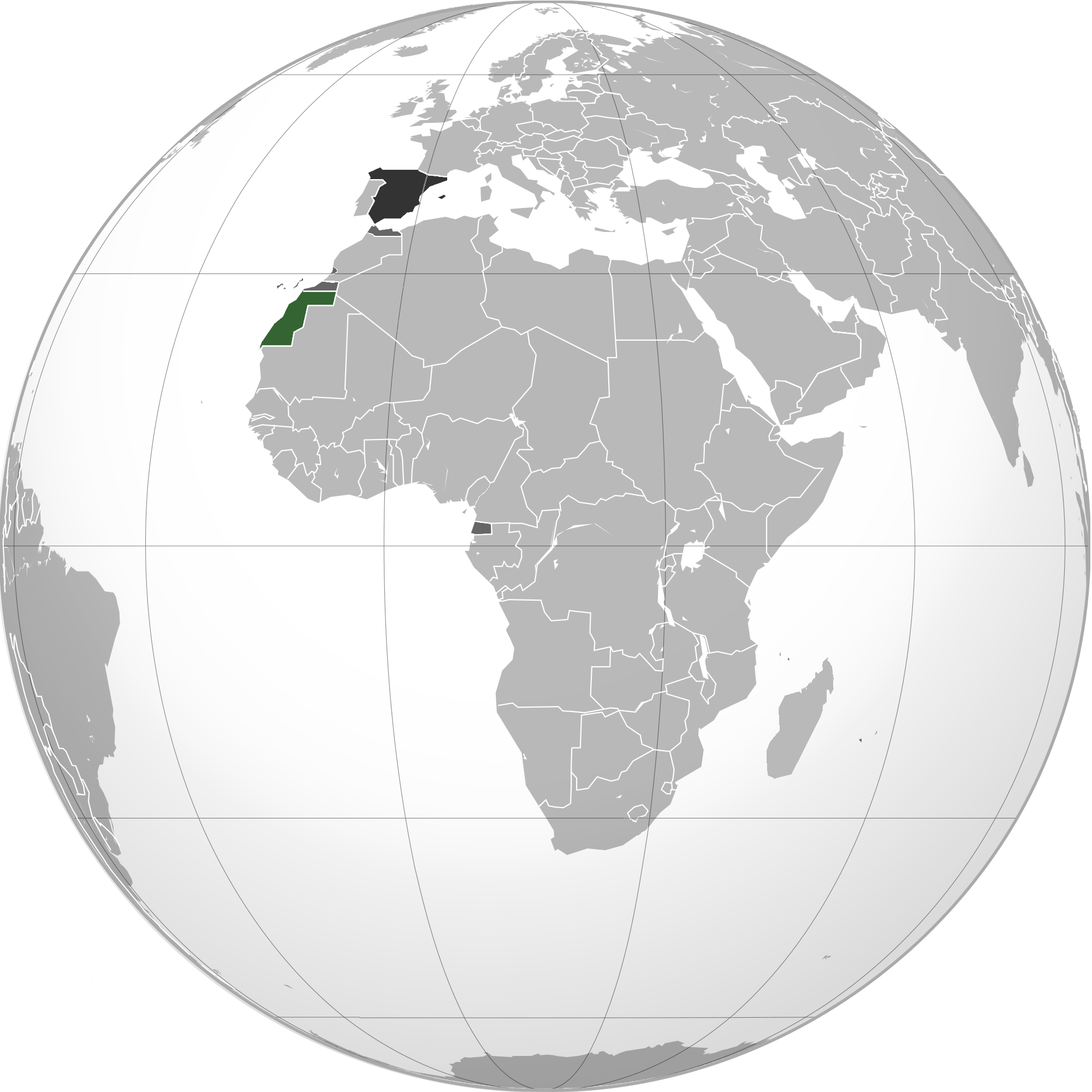
Spanish Sahara (Spanish: Sáhara Español; Arabic: الصحراء الإسبانية, romanized: aṣ-Ṣaḥrā' al-Isbānīyah), officially the Spanish Possessions in the Sahara from 1884 to 1958, then Province of the Sahara between 1958 and 1976, was the name used for the modern territory of Western Sahara when it was occupied and ruled by Spain between 1884 and 1976. It had been one of the most recent acquisitions as well as one of the last remaining holdings of the Spanish Empire, which had once extended from the Americas to the Spanish East Indies.
Between 1946 and 1958, the Spanish Sahara was amalgamated with the nearby Spanish-protected Cape Juby and Spanish Ifni to form a new colony, Spanish West Africa. This was reversed during the Ifni War when Ifni and the Sahara became provinces of Spain separately, two days apart, while Cape Juby was ceded to Morocco in the peace deal.
Spain gave up its Saharan possession following international pressure, mainly from United Nations resolutions regarding decolonisation. There was internal pressure from the native Sahrawi population, through the Polisario Front, and the claims of Morocco and Mauritania. After gaining independence in 1956, Morocco laid claim to the territory as part of a claimed historic pre-colonial territory. Mauritania also claimed the territory for a number of years on a historical basis.
In 1976, Mauritania and Morocco invaded the territory, now known as Western Sahara, but the Polisario Front, promoting the sovereignty of an independent Sahrawi Arab Democratic Republic, fought a guerrilla war against both, forcing Mauritania to relinquish its claim in 1979. The war against Morocco continued until 1991, when the UN negotiated a ceasefire and has tried to arrange negotiations and a referendum to let the population vote on its future. Today, Morocco occupies about two-thirds of the territory, while the Sahrawi Arab Democratic Republic controls the rest. Spain continues to be the de jure administering power of Western Sahara.
Officially the territory was called the Province of Sahara from 1958 to 1976. However before 1958 it was divided into three administrative zones, Rio De Oro, the "occupied zone" and the Southern Protectorate.
Since the 18th century, Spanish fishermen from the Canary Islands had been coming to the shores of Western Sahara, where fish are plentiful. At the end of the 19th century, several Africanist societies, like the Spanish Association for the Exploration of Africa, were formed to explore and colonize this still largely unknown territory. These associations formed a lobby group to put pressure on the Spanish government of Canovas de Castillo to provide government assistance to their ventures. They were assisted in this by large business interests, who hoped to capitalize on the trans Saharan caravan trade and exploit the fishing resources of the coast of Rio de Oro. They also received support from King Alfonso in the form of a donation. The Spanish also feared the French in Arguin or the British North West Africa Company may claim the region and undermine Spanish interests in Morocco and the Canaries. Despite his personal misgivings regarding the venture, due to the various reasons above, De Castillo proceeded to claim the Saharan coast for Spain at the Congress of Berlin.
In September 1881, the Sociedad Pesquerías Canario-Africanas built a pontoon in the Rio de Oro bay after they were ceded the Dakhla peninsula by local leaders. In 1884, fearing a British or French takeover of the region the Sociedad Española de Africanistas y Colonistas sent Emilio Bonelli to the Saharan coast to negotiate with the tribes to establish a Spanish presence. On November 28 1884, Bonelli signed a treaty with three representatives of the Oulad Bou Sbaa which authorised the establishment of trading posts in Río de Oro, Cape Blanc and Angra de Cintra.
Using Bonelli's treaty as justification, the Africanistas persuaded the Spanish government to declare a protectorate over Rio de Oro, Cape Blanc and Angra de Cintra in December 1884. Their claim was later ratified at the Berlin Conference the following month. However the Spanish only settled in Rio de Oro. Construction of a fort was begun in January 1885 by the Spanish Africa Commercial Company at Rio de Oro. However it was later abandoned in May due to an attack from the Oulad Delim. However Canovas de Castillo pledged to the Cortes to maintain the Spanish presence, and the fort was reoccupied by a detachment of soldiers commanded by Captain Jose Chacon in June. They rebuilt the fort, naming it Vila Cisneros after the Cardinal Cisneros. To protect the newly founded settlement a garrison of 25 troops were left there, who would be relieved every three months by a supply ship from the Canary islands. Despite this the Oulad Delim attacked again in 1887, 1892 and 1894, only stopping in 1895 after an agreement with Sheikh Ouled Laroussi, a poweful leader in the tribe. To further cement Spanish control on July 10th, 1885, Spain proclaimed a protectorate over the coast from Cape Bojador to Cape Blanc under the authority of the Overseas Ministry. Bonelli was appointed the Royal Commissioner, who would administer the protectorate, make treaties with the natives and command all armed forces within it. A further decree in 1887 extened Spanish jurisdiction 150 miles inland, declared the region a Spanish colony and transferred authority to a "politico-military sub governor" resident in Vila Cisneros and subordinate to the Captain General of the Canary Islands. In the summer of 1886, under the sponsorship of the Spanish Society of Commercial Geography (Sociedad Española de Geografía Comercial), Julio Cervera Baviera, Felipe Rizzo (1823–1908) and Francisco Quiroga (1853–1894) traversed the territory, and made topographical and astronomical observations. At the time, geographers had not mapped the territory and its features were not widely known. Their trek is considered the first scientific expedition in that part of the Sahara. They managed to reach the salt pans of Idjil and there on July 12th 1886 signed a treaty with the Emir of Adrar and Saharawi chieftains which ceded to Spain control over vast areas of desert. However Spain could never assert these claims due to diplomatic weakness and a lack of resources to actually occupy these vast areas.
Hub AI
Spanish Sahara AI simulator
(@Spanish Sahara_simulator)
Spanish Sahara
Spanish Sahara (Spanish: Sáhara Español; Arabic: الصحراء الإسبانية, romanized: aṣ-Ṣaḥrā' al-Isbānīyah), officially the Spanish Possessions in the Sahara from 1884 to 1958, then Province of the Sahara between 1958 and 1976, was the name used for the modern territory of Western Sahara when it was occupied and ruled by Spain between 1884 and 1976. It had been one of the most recent acquisitions as well as one of the last remaining holdings of the Spanish Empire, which had once extended from the Americas to the Spanish East Indies.
Between 1946 and 1958, the Spanish Sahara was amalgamated with the nearby Spanish-protected Cape Juby and Spanish Ifni to form a new colony, Spanish West Africa. This was reversed during the Ifni War when Ifni and the Sahara became provinces of Spain separately, two days apart, while Cape Juby was ceded to Morocco in the peace deal.
Spain gave up its Saharan possession following international pressure, mainly from United Nations resolutions regarding decolonisation. There was internal pressure from the native Sahrawi population, through the Polisario Front, and the claims of Morocco and Mauritania. After gaining independence in 1956, Morocco laid claim to the territory as part of a claimed historic pre-colonial territory. Mauritania also claimed the territory for a number of years on a historical basis.
In 1976, Mauritania and Morocco invaded the territory, now known as Western Sahara, but the Polisario Front, promoting the sovereignty of an independent Sahrawi Arab Democratic Republic, fought a guerrilla war against both, forcing Mauritania to relinquish its claim in 1979. The war against Morocco continued until 1991, when the UN negotiated a ceasefire and has tried to arrange negotiations and a referendum to let the population vote on its future. Today, Morocco occupies about two-thirds of the territory, while the Sahrawi Arab Democratic Republic controls the rest. Spain continues to be the de jure administering power of Western Sahara.
Officially the territory was called the Province of Sahara from 1958 to 1976. However before 1958 it was divided into three administrative zones, Rio De Oro, the "occupied zone" and the Southern Protectorate.
Since the 18th century, Spanish fishermen from the Canary Islands had been coming to the shores of Western Sahara, where fish are plentiful. At the end of the 19th century, several Africanist societies, like the Spanish Association for the Exploration of Africa, were formed to explore and colonize this still largely unknown territory. These associations formed a lobby group to put pressure on the Spanish government of Canovas de Castillo to provide government assistance to their ventures. They were assisted in this by large business interests, who hoped to capitalize on the trans Saharan caravan trade and exploit the fishing resources of the coast of Rio de Oro. They also received support from King Alfonso in the form of a donation. The Spanish also feared the French in Arguin or the British North West Africa Company may claim the region and undermine Spanish interests in Morocco and the Canaries. Despite his personal misgivings regarding the venture, due to the various reasons above, De Castillo proceeded to claim the Saharan coast for Spain at the Congress of Berlin.
In September 1881, the Sociedad Pesquerías Canario-Africanas built a pontoon in the Rio de Oro bay after they were ceded the Dakhla peninsula by local leaders. In 1884, fearing a British or French takeover of the region the Sociedad Española de Africanistas y Colonistas sent Emilio Bonelli to the Saharan coast to negotiate with the tribes to establish a Spanish presence. On November 28 1884, Bonelli signed a treaty with three representatives of the Oulad Bou Sbaa which authorised the establishment of trading posts in Río de Oro, Cape Blanc and Angra de Cintra.
Using Bonelli's treaty as justification, the Africanistas persuaded the Spanish government to declare a protectorate over Rio de Oro, Cape Blanc and Angra de Cintra in December 1884. Their claim was later ratified at the Berlin Conference the following month. However the Spanish only settled in Rio de Oro. Construction of a fort was begun in January 1885 by the Spanish Africa Commercial Company at Rio de Oro. However it was later abandoned in May due to an attack from the Oulad Delim. However Canovas de Castillo pledged to the Cortes to maintain the Spanish presence, and the fort was reoccupied by a detachment of soldiers commanded by Captain Jose Chacon in June. They rebuilt the fort, naming it Vila Cisneros after the Cardinal Cisneros. To protect the newly founded settlement a garrison of 25 troops were left there, who would be relieved every three months by a supply ship from the Canary islands. Despite this the Oulad Delim attacked again in 1887, 1892 and 1894, only stopping in 1895 after an agreement with Sheikh Ouled Laroussi, a poweful leader in the tribe. To further cement Spanish control on July 10th, 1885, Spain proclaimed a protectorate over the coast from Cape Bojador to Cape Blanc under the authority of the Overseas Ministry. Bonelli was appointed the Royal Commissioner, who would administer the protectorate, make treaties with the natives and command all armed forces within it. A further decree in 1887 extened Spanish jurisdiction 150 miles inland, declared the region a Spanish colony and transferred authority to a "politico-military sub governor" resident in Vila Cisneros and subordinate to the Captain General of the Canary Islands. In the summer of 1886, under the sponsorship of the Spanish Society of Commercial Geography (Sociedad Española de Geografía Comercial), Julio Cervera Baviera, Felipe Rizzo (1823–1908) and Francisco Quiroga (1853–1894) traversed the territory, and made topographical and astronomical observations. At the time, geographers had not mapped the territory and its features were not widely known. Their trek is considered the first scientific expedition in that part of the Sahara. They managed to reach the salt pans of Idjil and there on July 12th 1886 signed a treaty with the Emir of Adrar and Saharawi chieftains which ceded to Spain control over vast areas of desert. However Spain could never assert these claims due to diplomatic weakness and a lack of resources to actually occupy these vast areas.
Recent media