
Recent from talks
Stonehenge Cursus
Knowledge base stats:
Talk channels stats:
Members stats:
Stonehenge Cursus
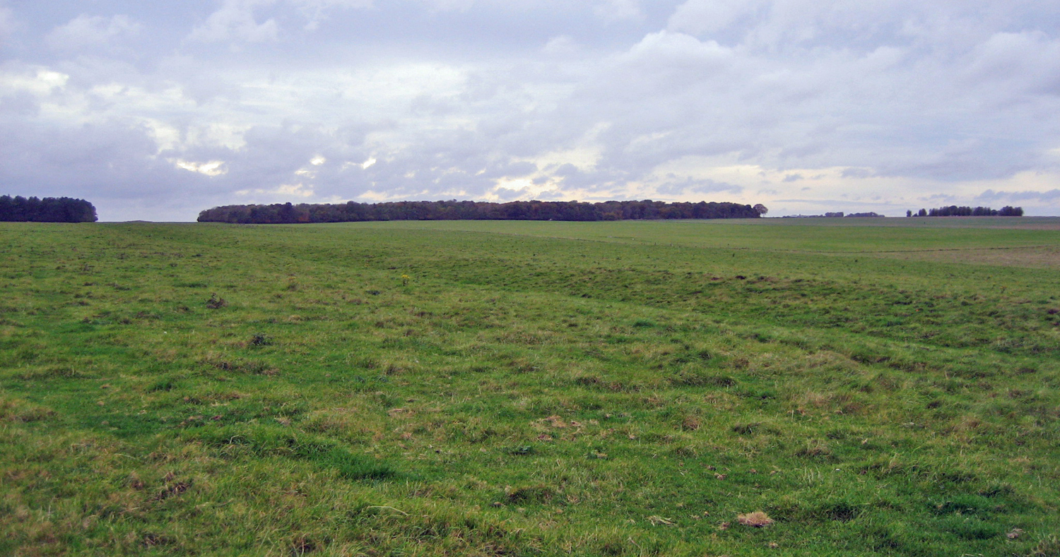
The Stonehenge Cursus (sometimes known as the Greater Cursus) is a large Neolithic cursus monument on Salisbury plain, near to Stonehenge in Wiltshire, England. It is roughly 3 kilometres (1.9 mi) long and between 100 metres (330 ft) and 150 metres (490 ft) wide. Excavations in 2007 dated the construction of the earthwork to between 3630 and 3375 BCE, several hundred years before the earliest phase of Stonehenge in 3000 BC. The cursus, along with adjacent barrows and the nearby 'Lesser Cursus' are part of the National Trust's Stonehenge Landscape property, and is within the Stonehenge and Avebury World Heritage Site.
Cursus comes from the Latin for 'racecourse'. Early antiquarians who first discovered cursuses believed them to be Roman racing tracks.
Radiocarbon dating of a red deer antler pick discovered at the bottom of the western terminal ditch suggests that the Stonehenge Cursus was first constructed between 3630 and 3375 BCE. It is just under 3 km long, and is roughly 100 m wide. Because of a slight difference in the alignment of its north and south ditches, it widens to a point nearly 150 m near its western end. It is roughly aligned east–west and is oriented toward the sunrise on the spring and autumn equinoxes. There is a (later) Bronze Age round barrow inside the western end of the enclosure, and a large Neolithic long barrow was constructed at its east terminal. The Stonehenge Riverside Project excavated the remains of the long barrow in 2008 to determine if the barrow predated, or was contemporary with the cursus itself. The ditches of the cursus are not uniform and vary in width and depth. The eastern ditch is fairly shallow, as is the southern ditch – being only 0.75 m deep and 1.8 m wide at the top. At the western terminal, the ditch is 2 m deep and 2.75 m wide.
Like most cursuses, its function is unclear, although it is believed to be ceremonial. The length of the cursus, running roughly east west, crosses a dry river valley known as Stonehenge Bottom. This may have been a winterbourne during the Neolithic era. If so, this would give it similar characteristics to other cursus, such as the Dorset Cursus, and it may be related to a ceremonial function. It has also been suggested that the Stonehenge Cursus acts as a boundary between areas of settlement and ceremonial activity. The cursus is also aligned on the equinox sunrise which rises over the eastern long barrow.
Two artificial pits have been found near the east and west ends of the cursuses. It has been found that lines of sunrise and sunset at midsummer through these pits are aligned with Stonehenge.
William Stukeley was the first antiquarian to identify and record the Stonehenge Cursus, although he incorrectly assumed it to be Roman in origin. In 1947 John FS Stone excavated a small area of the southern ditch toward the west end of the cursus. He discovered a small chipping of bluestone and an antler pick in a specially dug recess that dated from approximately 2500 BCE.
In 2007, the Stonehenge Riverside Project dug three trenches at the western end of the cursus, discovering the antler pick at the western terminus ditch. A trench in the northern ditch uncovered a sherd of pottery tentatively dated to the 4th millennium BCE. A trench at the southern ditch found evidence of recuts into the original ditch, c. 2500 BCE (when Stone's antler was deposited), and again between 2000 and 1500 BCE.
Just beyond the eastern terminal of the Cursus is a Neolithic long barrow, oriented north–south. It was noted by William Stukeley in 1723 and Richard Colt Hoare in 1810, and was excavated by John Thurnam in 1868, recovering an ox skull and some secondary inhumations. The barrow has since been levelled and is now underneath a bridleway running along King Barrow Ridge. The 2 m deep eastern ditch of the barrow was excavated once in the 1980s by Julian Richards and his team for the Stonehenge Environs Project, although they failed to find any dateable material. The Stonehenge Riverside Project excavated the ditch once more in 2008.
Hub AI
Stonehenge Cursus AI simulator
(@Stonehenge Cursus_simulator)
Stonehenge Cursus
The Stonehenge Cursus (sometimes known as the Greater Cursus) is a large Neolithic cursus monument on Salisbury plain, near to Stonehenge in Wiltshire, England. It is roughly 3 kilometres (1.9 mi) long and between 100 metres (330 ft) and 150 metres (490 ft) wide. Excavations in 2007 dated the construction of the earthwork to between 3630 and 3375 BCE, several hundred years before the earliest phase of Stonehenge in 3000 BC. The cursus, along with adjacent barrows and the nearby 'Lesser Cursus' are part of the National Trust's Stonehenge Landscape property, and is within the Stonehenge and Avebury World Heritage Site.
Cursus comes from the Latin for 'racecourse'. Early antiquarians who first discovered cursuses believed them to be Roman racing tracks.
Radiocarbon dating of a red deer antler pick discovered at the bottom of the western terminal ditch suggests that the Stonehenge Cursus was first constructed between 3630 and 3375 BCE. It is just under 3 km long, and is roughly 100 m wide. Because of a slight difference in the alignment of its north and south ditches, it widens to a point nearly 150 m near its western end. It is roughly aligned east–west and is oriented toward the sunrise on the spring and autumn equinoxes. There is a (later) Bronze Age round barrow inside the western end of the enclosure, and a large Neolithic long barrow was constructed at its east terminal. The Stonehenge Riverside Project excavated the remains of the long barrow in 2008 to determine if the barrow predated, or was contemporary with the cursus itself. The ditches of the cursus are not uniform and vary in width and depth. The eastern ditch is fairly shallow, as is the southern ditch – being only 0.75 m deep and 1.8 m wide at the top. At the western terminal, the ditch is 2 m deep and 2.75 m wide.
Like most cursuses, its function is unclear, although it is believed to be ceremonial. The length of the cursus, running roughly east west, crosses a dry river valley known as Stonehenge Bottom. This may have been a winterbourne during the Neolithic era. If so, this would give it similar characteristics to other cursus, such as the Dorset Cursus, and it may be related to a ceremonial function. It has also been suggested that the Stonehenge Cursus acts as a boundary between areas of settlement and ceremonial activity. The cursus is also aligned on the equinox sunrise which rises over the eastern long barrow.
Two artificial pits have been found near the east and west ends of the cursuses. It has been found that lines of sunrise and sunset at midsummer through these pits are aligned with Stonehenge.
William Stukeley was the first antiquarian to identify and record the Stonehenge Cursus, although he incorrectly assumed it to be Roman in origin. In 1947 John FS Stone excavated a small area of the southern ditch toward the west end of the cursus. He discovered a small chipping of bluestone and an antler pick in a specially dug recess that dated from approximately 2500 BCE.
In 2007, the Stonehenge Riverside Project dug three trenches at the western end of the cursus, discovering the antler pick at the western terminus ditch. A trench in the northern ditch uncovered a sherd of pottery tentatively dated to the 4th millennium BCE. A trench at the southern ditch found evidence of recuts into the original ditch, c. 2500 BCE (when Stone's antler was deposited), and again between 2000 and 1500 BCE.
Just beyond the eastern terminal of the Cursus is a Neolithic long barrow, oriented north–south. It was noted by William Stukeley in 1723 and Richard Colt Hoare in 1810, and was excavated by John Thurnam in 1868, recovering an ox skull and some secondary inhumations. The barrow has since been levelled and is now underneath a bridleway running along King Barrow Ridge. The 2 m deep eastern ditch of the barrow was excavated once in the 1980s by Julian Richards and his team for the Stonehenge Environs Project, although they failed to find any dateable material. The Stonehenge Riverside Project excavated the ditch once more in 2008.
Recent media