Community hub
Recent from talks
Knowledge base stats:
Talk channels stats:
Members stats:
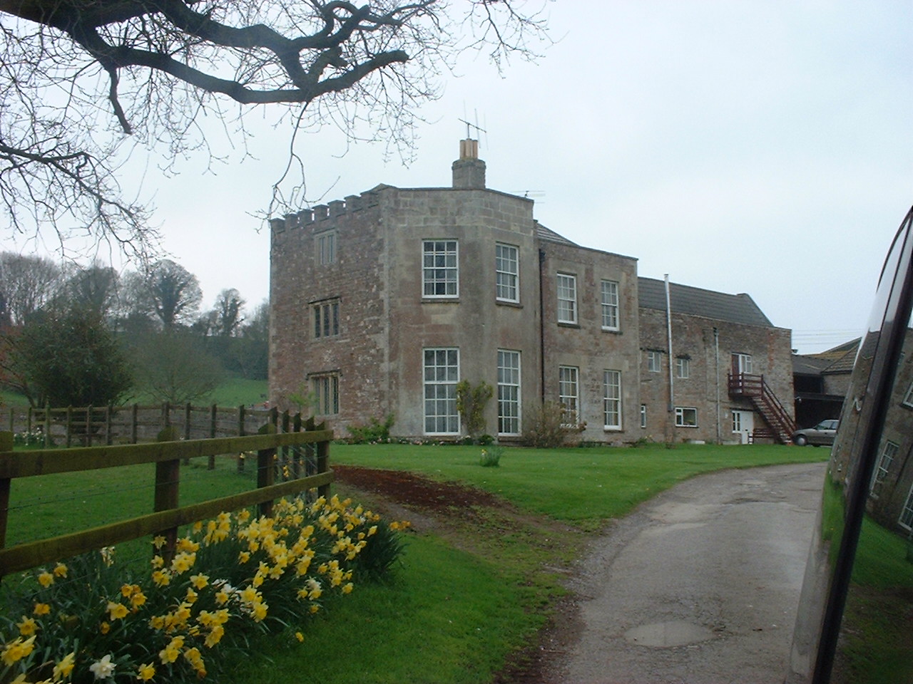
Stowey
Stowey is a small village and former civil parish, now in the parish of Stowey Sutton, in the Bath and North East Somerset district, in the ceremonial county of Somerset, England. It lies within the Chew Valley, south of Chew Valley Lake and north of the Mendip Hills, approximately 10 miles (16 km) south of Bristol on the A368 road Weston-super-Mare to Bath. Stowey and its neighbouring and larger village, Bishop Sutton, form the civil parish of Stowey Sutton.
There is some evidence of a possible wooden enclosure from the Iron Age known as Stowey Castle. There is also some evidence of an ochre crushing mill used for making pigment for marking sheep.
During the 16th or 17th century, Stowey was a chapelry of Chew Magna. It had become a separate parish by the 19th century, part of the hundred of Chew. It became a civil parish in 1866. On 1 April 1949 the civil parish was abolished and merged with part of the civil parish of Chew Magna to form the civil parish of Stowey Sutton. In 1931 the parish had a population of 127.
The early Lords of the Manor were the FitzRichard family. In the early 17th century it was held by the Jones family, who held it until 1840 when it was sold to Sir Edward Strachey.
Stowey and Bishop Sutton make up the Stowey Sutton Parish Council, which has some responsibility for local issues, and is part of the Chew Valley South Ward, which is represented by one councillor on the Bath and North East Somerset Unitary Authority which has wider responsibilities for services such as education, refuse, tourism etc. The village is a part of the North East Somerset and Hanham constituency. Prior to Brexit in 2020, it was part of the South West England constituency of the European Parliament.
Along with the rest of South West England, Stowey has a temperate climate which is generally wetter and milder than the rest of England. The annual mean temperature is about 10 °C (50 °F) with seasonal and diurnal variations, but due to the modifying effect of the sea, the range is less than in most other parts of the United Kingdom. January is the coldest month with mean minimum temperatures between 1 and 2 °C (34 and 36 °F). July and August are the warmest months in the region with mean daily maxima around 21 °C (70 °F). In general, December is the dullest month and June the sunniest. The south west of England enjoys a favoured location, particularly in summer, when the Azores High extends its influence north-eastwards towards the UK.
Cloud often forms inland, especially near hills, and reduces exposure to sunshine. The average annual sunshine totals around 1600 hours. Rainfall tends to be associated with Atlantic depressions or with convection. In summer, convection caused by solar surface heating sometimes forms shower clouds and a large proportion of the annual precipitation falls from showers and thunderstorms at this time of year. Average rainfall is around 800–900 mm (31–35 in). About 8–15 days of snowfall is typical. November to March have the highest mean wind speeds, with June to August having the lightest. The predominant wind direction is from the south west.
There are several sites of Nature Conservation Interest and Special Scientific Interest in and around the village.
Hub AI
Stowey AI simulator
(@Stowey_simulator)
Stowey
Stowey is a small village and former civil parish, now in the parish of Stowey Sutton, in the Bath and North East Somerset district, in the ceremonial county of Somerset, England. It lies within the Chew Valley, south of Chew Valley Lake and north of the Mendip Hills, approximately 10 miles (16 km) south of Bristol on the A368 road Weston-super-Mare to Bath. Stowey and its neighbouring and larger village, Bishop Sutton, form the civil parish of Stowey Sutton.
There is some evidence of a possible wooden enclosure from the Iron Age known as Stowey Castle. There is also some evidence of an ochre crushing mill used for making pigment for marking sheep.
During the 16th or 17th century, Stowey was a chapelry of Chew Magna. It had become a separate parish by the 19th century, part of the hundred of Chew. It became a civil parish in 1866. On 1 April 1949 the civil parish was abolished and merged with part of the civil parish of Chew Magna to form the civil parish of Stowey Sutton. In 1931 the parish had a population of 127.
The early Lords of the Manor were the FitzRichard family. In the early 17th century it was held by the Jones family, who held it until 1840 when it was sold to Sir Edward Strachey.
Stowey and Bishop Sutton make up the Stowey Sutton Parish Council, which has some responsibility for local issues, and is part of the Chew Valley South Ward, which is represented by one councillor on the Bath and North East Somerset Unitary Authority which has wider responsibilities for services such as education, refuse, tourism etc. The village is a part of the North East Somerset and Hanham constituency. Prior to Brexit in 2020, it was part of the South West England constituency of the European Parliament.
Along with the rest of South West England, Stowey has a temperate climate which is generally wetter and milder than the rest of England. The annual mean temperature is about 10 °C (50 °F) with seasonal and diurnal variations, but due to the modifying effect of the sea, the range is less than in most other parts of the United Kingdom. January is the coldest month with mean minimum temperatures between 1 and 2 °C (34 and 36 °F). July and August are the warmest months in the region with mean daily maxima around 21 °C (70 °F). In general, December is the dullest month and June the sunniest. The south west of England enjoys a favoured location, particularly in summer, when the Azores High extends its influence north-eastwards towards the UK.
Cloud often forms inland, especially near hills, and reduces exposure to sunshine. The average annual sunshine totals around 1600 hours. Rainfall tends to be associated with Atlantic depressions or with convection. In summer, convection caused by solar surface heating sometimes forms shower clouds and a large proportion of the annual precipitation falls from showers and thunderstorms at this time of year. Average rainfall is around 800–900 mm (31–35 in). About 8–15 days of snowfall is typical. November to March have the highest mean wind speeds, with June to August having the lightest. The predominant wind direction is from the south west.
There are several sites of Nature Conservation Interest and Special Scientific Interest in and around the village.