This article needs additional citations for verification. (February 2021) |

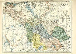
Tullyhaw (Irish: Teallach Eathach, which means 'the Territory of Eochaidh', an ancestor of the McGoverns, who lived c. 650 AD) is a Barony in County Cavan in Ireland. The area has been in constant occupation since pre-4000 BC. Located in the northwest of the county, it has been referred to as Cavan's panhandle.[1][2] Tullyhaw was originally a túath within West Bréifne. It was later absorbed into East Bréifne in the sixteenth century.[3]
In 1579, East Bréifne, then part of Connacht, was made a shire. The shire was named County Cavan, being named after Cavan (Irish: An Cabhán), the area's main town. The administration remained in the control of the local Irish dynasty and subject to the Brehon and Canon Law.
In 1584, Sir John Perrot formed the shire into a county in Ulster. It was subdivided into seven baronies:[4]
The last one, Tullyhaw, encompassed the mountains bordering on O'Rourke's country, and was left subject to the ancient tenures and exactions of their Irish lord.[4]
This article related to the geography of County Cavan, Ireland is a stub. You can help Wikipedia by expanding it. |