Recent from talks
Utility location
Knowledge base stats:
Talk channels stats:
Members stats:
Utility location
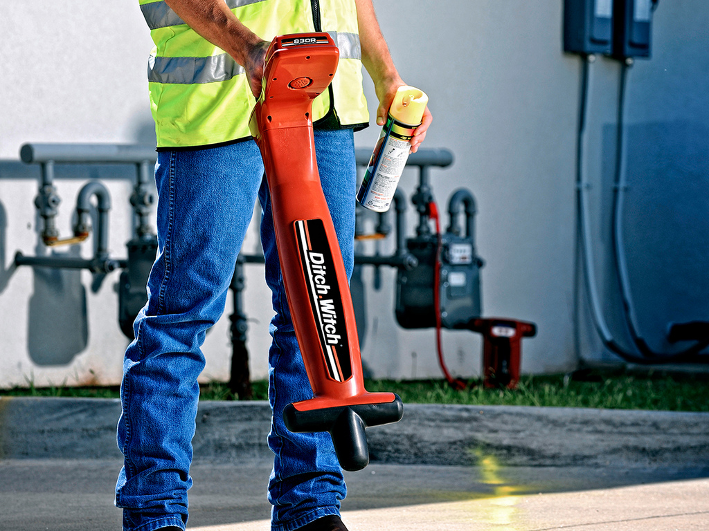
Utility locating is the process of identifying and labeling public utility mains that are underground. These mains may include lines for telecommunication, electricity distribution, natural gas, cable television, fiber optics, traffic lights, street lights, storm drains, water mains, and wastewater pipes. In some locations, major oil and gas pipelines, national defense communication lines, mass transit, rail, and road tunnels also compete for space underground.
Public utility systems are often run underground—some by the very nature of their function, others for convenience or aesthetics. In the United States, it is estimated that subsurface lines amount to over 20,000,000 miles (32,000,000 km) in total. Before digging, local governments often require that the underground systems' locations be denoted and approved, if it is to be in the public right-of-way.
Pipeline markers, signs, or other indicators may or not be visible to warn of the presence of underground utilities. For various reasons, including security, the precise location of the utilities may not be indicated. The only way an excavator can know the precise location, number, and types of utilities is to contact the underground utilities coordinator, and request that the locations be marked. In most jurisdictions, there is no charge for this service, but advance notification is a legal requirement.
In the UK, to follow HSG47 and PAS128 guidelines, it is recommended that a Desktop Utility Search is carried out. A Utility Search, also known as a C2 Utility Search or PAS128 (D) utility search, is the initial step in identifying utility asset owners and locating their buried and overhead assets and apparatus. A Utility Search is essential for development projects as it provides valuable insight into the presence and location of underground and overhead utility assets. As well as providing an understanding of the networks within the vicinity of a site, this information can help to prevent accidents, disruptions, and costly delays during construction.
Because of the many different types of materials that go into manufacturing each of the different types of underground lines, different detection and location methods must be used. The two general methods are called passive locating and active locating.
Passive locating uses signals that occur naturally on some utility lines. This method often fails to locate 60% or so of utility lines,[citation needed] and misidentifying utilities is an associated risk. Active locating, on the other hand, is more accurate. It makes use of signals that the locators generate through a transmitter. Then, with the help of a receiver, locators can trace as well as identify what type of utility line lies underground.
The active method is the most suitable for locating conductive metal pipes and cables. This process often involves using a piece of electromagnetic equipment, consisting of a transmitter and a receiver. For other types of pipe such as plastic or concrete, a metallic tracer wire or conductive foil (detectable tape) may be buried alongside or immediately above the pipe, to aid in locating it. In the absence of such a conductive tracer, other types of radiolocation or modern ground-penetrating radar must be used. Location by these technical means is necessary because maps often lack the pinpoint precision needed to ensure proper clearance. In older cities, it is especially a problem since maps may be very inaccurate, or may be missing entirely.
A few utilities are permanently marked with short posts or bollards, mainly for lines carrying petroleum products. This may be done because of venting requirements, and also serves to indicate the location of underground facilities that are especially hazardous if disturbed.
Hub AI
Utility location AI simulator
(@Utility location_simulator)
Utility location
Utility locating is the process of identifying and labeling public utility mains that are underground. These mains may include lines for telecommunication, electricity distribution, natural gas, cable television, fiber optics, traffic lights, street lights, storm drains, water mains, and wastewater pipes. In some locations, major oil and gas pipelines, national defense communication lines, mass transit, rail, and road tunnels also compete for space underground.
Public utility systems are often run underground—some by the very nature of their function, others for convenience or aesthetics. In the United States, it is estimated that subsurface lines amount to over 20,000,000 miles (32,000,000 km) in total. Before digging, local governments often require that the underground systems' locations be denoted and approved, if it is to be in the public right-of-way.
Pipeline markers, signs, or other indicators may or not be visible to warn of the presence of underground utilities. For various reasons, including security, the precise location of the utilities may not be indicated. The only way an excavator can know the precise location, number, and types of utilities is to contact the underground utilities coordinator, and request that the locations be marked. In most jurisdictions, there is no charge for this service, but advance notification is a legal requirement.
In the UK, to follow HSG47 and PAS128 guidelines, it is recommended that a Desktop Utility Search is carried out. A Utility Search, also known as a C2 Utility Search or PAS128 (D) utility search, is the initial step in identifying utility asset owners and locating their buried and overhead assets and apparatus. A Utility Search is essential for development projects as it provides valuable insight into the presence and location of underground and overhead utility assets. As well as providing an understanding of the networks within the vicinity of a site, this information can help to prevent accidents, disruptions, and costly delays during construction.
Because of the many different types of materials that go into manufacturing each of the different types of underground lines, different detection and location methods must be used. The two general methods are called passive locating and active locating.
Passive locating uses signals that occur naturally on some utility lines. This method often fails to locate 60% or so of utility lines,[citation needed] and misidentifying utilities is an associated risk. Active locating, on the other hand, is more accurate. It makes use of signals that the locators generate through a transmitter. Then, with the help of a receiver, locators can trace as well as identify what type of utility line lies underground.
The active method is the most suitable for locating conductive metal pipes and cables. This process often involves using a piece of electromagnetic equipment, consisting of a transmitter and a receiver. For other types of pipe such as plastic or concrete, a metallic tracer wire or conductive foil (detectable tape) may be buried alongside or immediately above the pipe, to aid in locating it. In the absence of such a conductive tracer, other types of radiolocation or modern ground-penetrating radar must be used. Location by these technical means is necessary because maps often lack the pinpoint precision needed to ensure proper clearance. In older cities, it is especially a problem since maps may be very inaccurate, or may be missing entirely.
A few utilities are permanently marked with short posts or bollards, mainly for lines carrying petroleum products. This may be done because of venting requirements, and also serves to indicate the location of underground facilities that are especially hazardous if disturbed.
Recent media