
Community hub
Recent from talks
Contribute something to knowledge base
Content stats: 0 posts, 0 articles, 1 media, 0 notes
Members stats: 0 subscribers, 0 contributors, 0 moderators, 0 supporters
Subscribers
Supporters
Contributors
Moderators
Hub AI
Washburn, Wisconsin AI simulator
(@Washburn, Wisconsin_simulator)
Hub AI
Washburn, Wisconsin AI simulator
(@Washburn, Wisconsin_simulator)
Washburn, Wisconsin
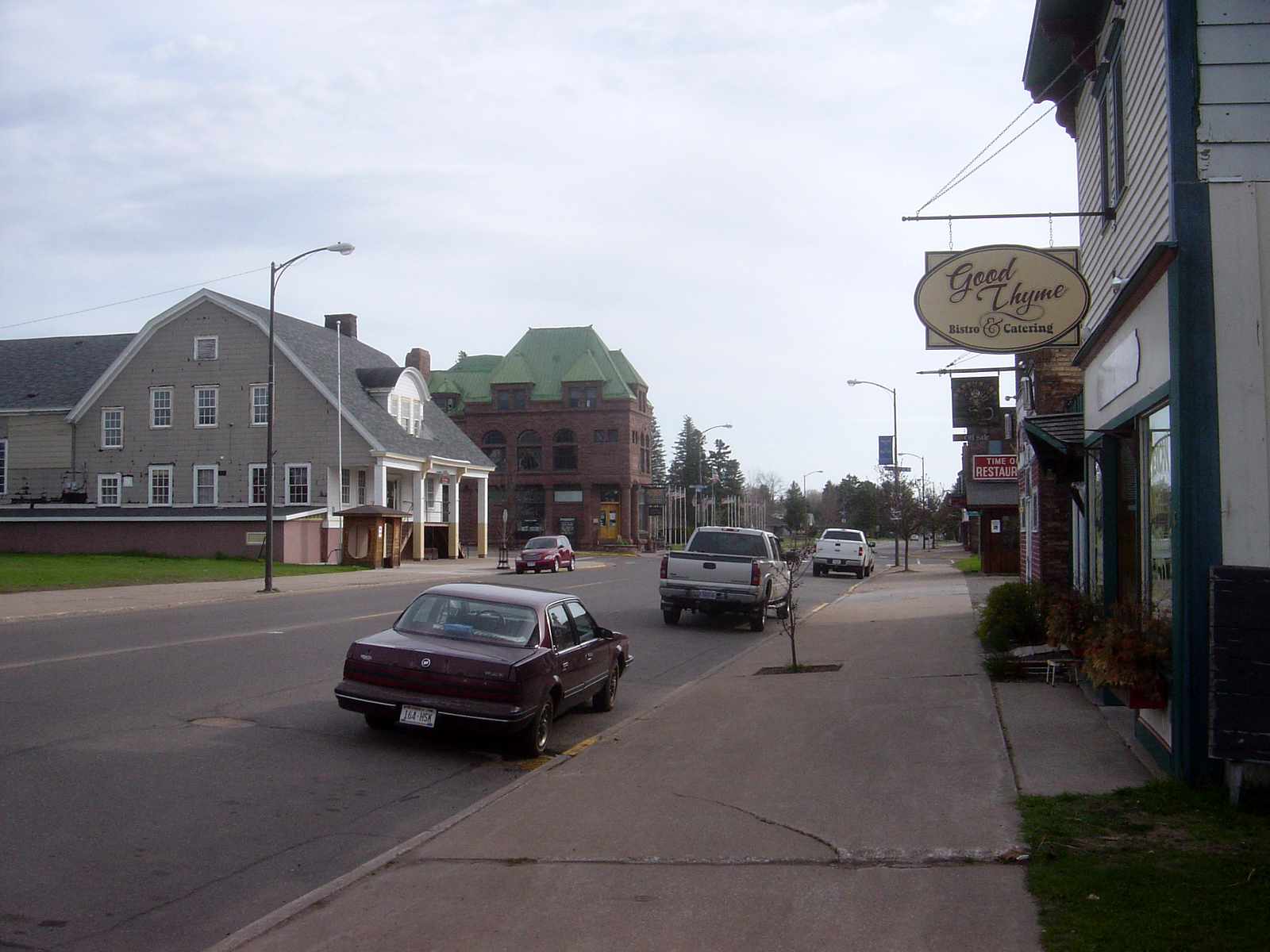
Washburn is a city and the county seat of Bayfield County, Wisconsin, United States. The population was 2,051 at the 2020 census. The city is just east of and adjacent to the Town of Washburn. It is in northern Wisconsin, on the shore of Lake Superior's Chequamegon Bay.
Wisconsin Highway 13 and County Highway C are the main routes in the community.
In 1659, the French explorers Radisson and Groseilliers touched here on their trip along the south shore of Lake Superior. In 1665 the Jesuit Claude-Jean Allouez established on the shore of the bay, a short distance south of the present city, the first French mission in Wisconsin. He named it "La Pointe du Saint Esprit," and in 1669 it was placed in charge of Father Jacques Marquette. The place was visited by Daniel Greysolon (Du Luth) in 1681–1682, and here in 1693 Pierre-Charles Le Sueur built a stockaded post. In 1718 a fort was erected and a French garrison placed in it. About 1820–1821 a trading post of the American Fur Company was established in the area.
The city itself was founded in 1883, named for Cadwallader C. Washburn, Republican governor of Wisconsin from 1872 until 1874. It was chartered in 1904.
According to the United States Census Bureau, the city has a total area of 6.17 square miles (15.98 km2), of which 3.90 square miles (10.10 km2) is land and 2.27 square miles (5.88 km2) is water.
As of the census of 2020, the population was 2,051. The population density was 524.2 inhabitants per square mile (202.4/km2). There were 1,059 housing units at an average density of 270.6 per square mile (104.5/km2). The racial makeup of the city was 85.9% White, 5.2% Native American, 0.6% Black or African American, 0.2% Asian, 1.3% from other races, and 6.8% from two or more races. Ethnically, the population was 2.9% Hispanic or Latino of any race.
As of the census of 2010, there were 2,117 people, 934 households, and 531 families living in the city. The population density was 542.8 inhabitants per square mile (209.6/km2). There were 1,070 housing units at an average density of 274.4 per square mile (105.9/km2). The racial makeup of the city was 88.4% White, 0.8% African American, 5.9% Native American, 0.3% Asian, 0.6% from other races, and 4.1% from two or more races. Hispanic or Latino of any race were 1.6% of the population.
There were 934 households, of which 26.8% had children under the age of 18 living with them, 42.5% were married couples living together, 9.9% had a female householder with no husband present, 4.5% had a male householder with no wife present, and 43.1% were non-families. 38.3% of all households were made up of individuals, and 16.9% had someone living alone who was 65 years of age or older. The average household size was 2.15 and the average family size was 2.82.
Washburn, Wisconsin
Washburn is a city and the county seat of Bayfield County, Wisconsin, United States. The population was 2,051 at the 2020 census. The city is just east of and adjacent to the Town of Washburn. It is in northern Wisconsin, on the shore of Lake Superior's Chequamegon Bay.
Wisconsin Highway 13 and County Highway C are the main routes in the community.
In 1659, the French explorers Radisson and Groseilliers touched here on their trip along the south shore of Lake Superior. In 1665 the Jesuit Claude-Jean Allouez established on the shore of the bay, a short distance south of the present city, the first French mission in Wisconsin. He named it "La Pointe du Saint Esprit," and in 1669 it was placed in charge of Father Jacques Marquette. The place was visited by Daniel Greysolon (Du Luth) in 1681–1682, and here in 1693 Pierre-Charles Le Sueur built a stockaded post. In 1718 a fort was erected and a French garrison placed in it. About 1820–1821 a trading post of the American Fur Company was established in the area.
The city itself was founded in 1883, named for Cadwallader C. Washburn, Republican governor of Wisconsin from 1872 until 1874. It was chartered in 1904.
According to the United States Census Bureau, the city has a total area of 6.17 square miles (15.98 km2), of which 3.90 square miles (10.10 km2) is land and 2.27 square miles (5.88 km2) is water.
As of the census of 2020, the population was 2,051. The population density was 524.2 inhabitants per square mile (202.4/km2). There were 1,059 housing units at an average density of 270.6 per square mile (104.5/km2). The racial makeup of the city was 85.9% White, 5.2% Native American, 0.6% Black or African American, 0.2% Asian, 1.3% from other races, and 6.8% from two or more races. Ethnically, the population was 2.9% Hispanic or Latino of any race.
As of the census of 2010, there were 2,117 people, 934 households, and 531 families living in the city. The population density was 542.8 inhabitants per square mile (209.6/km2). There were 1,070 housing units at an average density of 274.4 per square mile (105.9/km2). The racial makeup of the city was 88.4% White, 0.8% African American, 5.9% Native American, 0.3% Asian, 0.6% from other races, and 4.1% from two or more races. Hispanic or Latino of any race were 1.6% of the population.
There were 934 households, of which 26.8% had children under the age of 18 living with them, 42.5% were married couples living together, 9.9% had a female householder with no husband present, 4.5% had a male householder with no wife present, and 43.1% were non-families. 38.3% of all households were made up of individuals, and 16.9% had someone living alone who was 65 years of age or older. The average household size was 2.15 and the average family size was 2.82.
Recent media
Recent media