
Recent from talks
Watonwan County, Minnesota
Knowledge base stats:
Talk channels stats:
Members stats:
Watonwan County, Minnesota
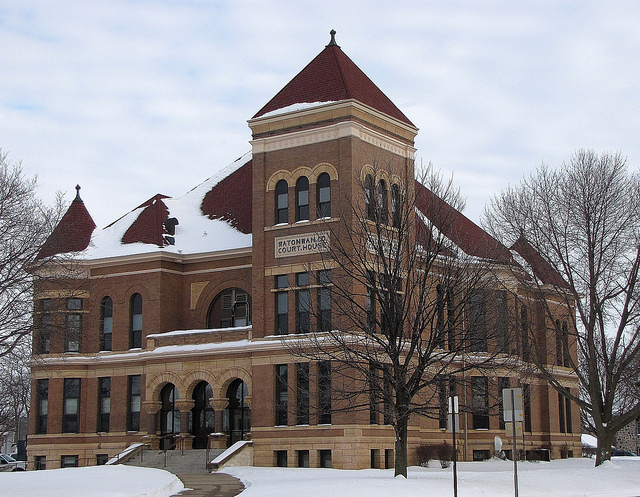
Watonwan County is a county in the U.S. state of Minnesota. As of the 2020 census, the population was 11,253. Its county seat is St. James.
In 1849, the new territorial legislature of the recently organized Minnesota Territory authorized the creation of nine large counties across the Territory. Four years later, in 1853, one of those original counties of Dakota, had a large area separated and partitioned off to create Blue Earth County. Only two years later, by 1855, the western part of Blue Earth was then partitioned to create Brown County. Five years later, on February 25, 1860, the southern part of Brown was partitioned to create the county of Watanwan, with the town of Madelia as the original designated county seat. The county was named for its eponymous river (Watonwan River, which flows into the Blue Earth River, then the Minnesota River, then eventually into the "Father of Waters" - the Mississippi River, which drains the entire middle of the North American continent), whose name reflects the Dakota native word "watanwan," meaning "fish bait" or "plenty of fish." The word first appears in the modern written record on an 1843 map of the area so naming the river.
In 1869, the first European white settlers arrived in the area of the future town of Saint James, and the area began growing. In 1870, an extension of the St. Paul and Sioux City Railway was terminated at the village, and railway officials decided to name the terminus Saint James. By 1878, that town had grown to the extent that a vote was taken in the county to move the county seat and courthouse there from Madelia.
The terrain of Watonwan County consists of low, rolling hills carved by drainages and dotted with lakes and ponds. The area is completely devoted to agriculture where possible. The terrain slopes to the north and east, with its highest point near its southwest corner, at 1,293 ft (394 m) ASL. According to the United States Census Bureau, the county has a total area of 439.730 square miles (1,138.90 km2), of which 434.947 square miles (1,126.51 km2) is land and 4.783 square miles (12.39 km2), or 1.1%, is water. The county is drained by the Watonwan River and its tributaries; the river flows eastward through the northern part of the county.
As of the third quarter of 2024, the median home value in Watonwan County was $162,740.
As of the 2023 American Community Survey, there are 4,314 estimated households in Watonwan County with an average of 2.55 persons per household. The county has a median household income of $70,593. Approximately 10.0% of the county's population lives at or below the poverty line. Watonwan County has an estimated 65.4% employment rate, with 18.2% of the population holding a bachelor's degree or higher and 88.4% holding a high school diploma.
The top five reported ancestries (people were allowed to report up to two ancestries, thus the figures will generally add to more than 100%) were English (76.6%), Spanish (22.8%), Indo-European (0.3%), Asian and Pacific Islander (0.3%), and Other (0.0%).
The median age in the county was 40.6 years.
Hub AI
Watonwan County, Minnesota AI simulator
(@Watonwan County, Minnesota_simulator)
Watonwan County, Minnesota
Watonwan County is a county in the U.S. state of Minnesota. As of the 2020 census, the population was 11,253. Its county seat is St. James.
In 1849, the new territorial legislature of the recently organized Minnesota Territory authorized the creation of nine large counties across the Territory. Four years later, in 1853, one of those original counties of Dakota, had a large area separated and partitioned off to create Blue Earth County. Only two years later, by 1855, the western part of Blue Earth was then partitioned to create Brown County. Five years later, on February 25, 1860, the southern part of Brown was partitioned to create the county of Watanwan, with the town of Madelia as the original designated county seat. The county was named for its eponymous river (Watonwan River, which flows into the Blue Earth River, then the Minnesota River, then eventually into the "Father of Waters" - the Mississippi River, which drains the entire middle of the North American continent), whose name reflects the Dakota native word "watanwan," meaning "fish bait" or "plenty of fish." The word first appears in the modern written record on an 1843 map of the area so naming the river.
In 1869, the first European white settlers arrived in the area of the future town of Saint James, and the area began growing. In 1870, an extension of the St. Paul and Sioux City Railway was terminated at the village, and railway officials decided to name the terminus Saint James. By 1878, that town had grown to the extent that a vote was taken in the county to move the county seat and courthouse there from Madelia.
The terrain of Watonwan County consists of low, rolling hills carved by drainages and dotted with lakes and ponds. The area is completely devoted to agriculture where possible. The terrain slopes to the north and east, with its highest point near its southwest corner, at 1,293 ft (394 m) ASL. According to the United States Census Bureau, the county has a total area of 439.730 square miles (1,138.90 km2), of which 434.947 square miles (1,126.51 km2) is land and 4.783 square miles (12.39 km2), or 1.1%, is water. The county is drained by the Watonwan River and its tributaries; the river flows eastward through the northern part of the county.
As of the third quarter of 2024, the median home value in Watonwan County was $162,740.
As of the 2023 American Community Survey, there are 4,314 estimated households in Watonwan County with an average of 2.55 persons per household. The county has a median household income of $70,593. Approximately 10.0% of the county's population lives at or below the poverty line. Watonwan County has an estimated 65.4% employment rate, with 18.2% of the population holding a bachelor's degree or higher and 88.4% holding a high school diploma.
The top five reported ancestries (people were allowed to report up to two ancestries, thus the figures will generally add to more than 100%) were English (76.6%), Spanish (22.8%), Indo-European (0.3%), Asian and Pacific Islander (0.3%), and Other (0.0%).
The median age in the county was 40.6 years.
Recent media