Community hub
Recent from talks
Knowledge base stats:
Talk channels stats:
Members stats:
Western Port
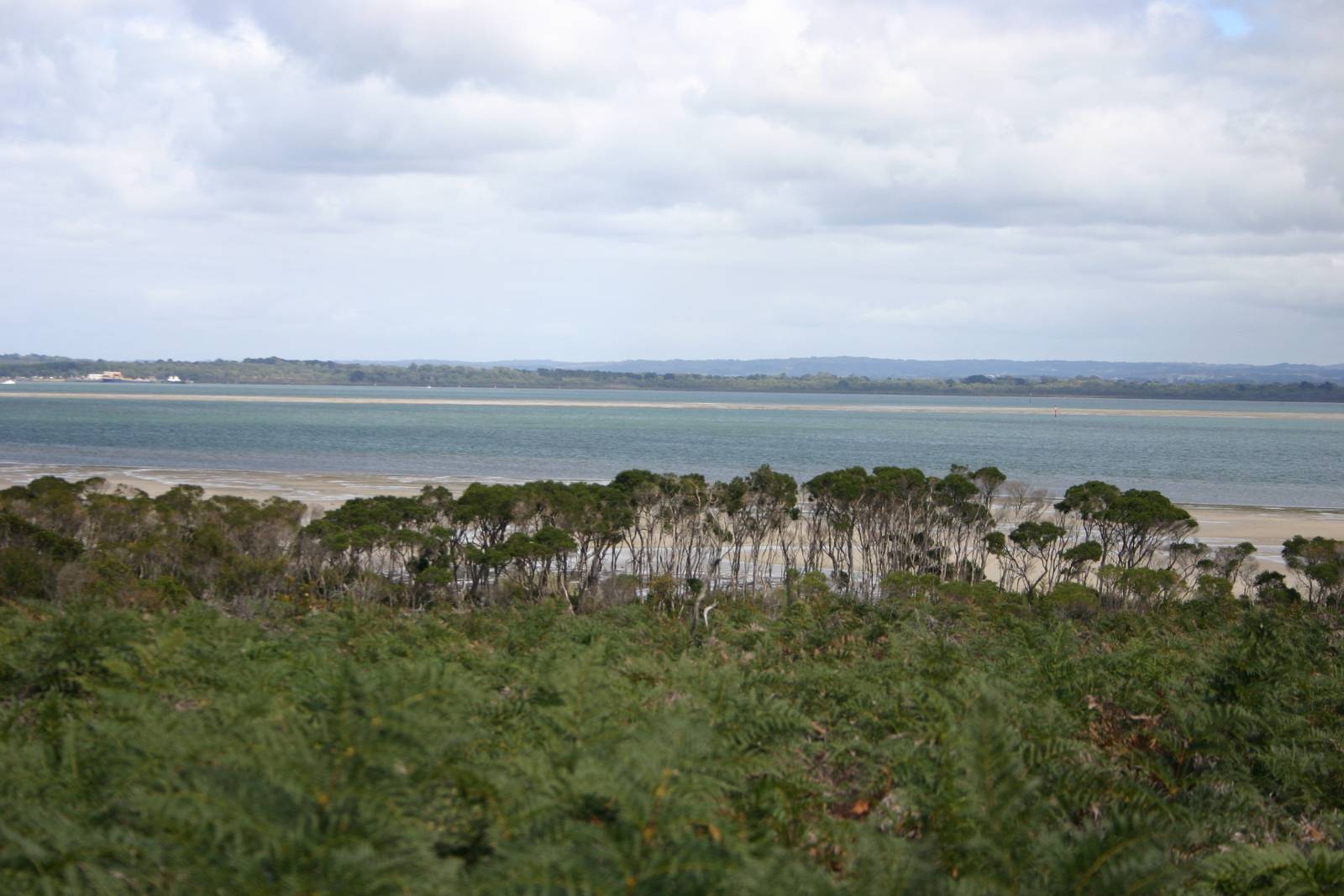
Western Port, (Boonwurrung: Warn Marin) commonly but unofficially known as Western Port Bay, is a large tidal bay in southern Victoria, Australia, opening into Bass Strait. It is the second largest bay in the state. Geographically, it is dominated by two large islands; French Island and Phillip Island. At the time it was renamed, its position was west of other known ports and bays, but Western Port has become something of a misnomer as it lies just to the east of the larger Port Phillip and the city of Melbourne. It is visited by Australian fur seals,[disambiguation needed] whales and dolphins, as well as many migratory waders and seabirds. It is listed under the Ramsar Convention as a wetland of international significance.
The area around the bay and the two main islands were originally part of the Boonwurrung nation's territory prior to European settlement. Western Port was first seen by Europeans in 1798 when an exploration crew in a whaleboat led by George Bass, journeyed south from Sydney to explore Australia's south eastern coastline. Due in most part to a lack of food, the expedition was halted, spending two weeks in Western Port before returning to Sydney. As it was the most westerly charted point at the time, it was named Western Port.
The bay is home to the three Marine National Parks—French Island, Churchill Island and Yaringa, while the land adjacent to the north is largely used for farming purposes including cattle and wineries. Today the bay is mostly used for recreation; however, there is also a military base (HMAS Cerberus), shipping and oil production facilities adjoining the bay. Western Port is around one hour from Melbourne by car and a small number of holiday villages with sandy swimming beaches lie on its shores.
Prior to European settlement, the Bunurong people lived around Warn Marin living off shellfish, mutton birds and plant life. The bay was first explored by Europeans in 1797, when George Bass received permission from Governor Hunter in Sydney to sail a whaleboat along the unexplored section of coast south of Botany Bay. On such a rough stretch of water, Bass could not get more than halfway through the strait now known as Bass Strait. This voyage led to the recording of Western Port, so named because of its situation relative to every other known harbour on the coast at that time (the area from Point Hicks to Cape Howe), even though it lies to the east of Port Phillip and the city of Melbourne. Seal hunting was conducted here in the 19th century.
In the year 1826 it was reported that the French had resolved to found a settlement at some Australian harbour – probably King George's Sound or Western Port. The British Government at once sent instructions to Sydney for Governor Darling to immediately take possession of these places. As a result, Colonel Stewart, Captain S. Wright, and Lieutenant Burchell were sent in HMS Fly (Captain Wetherall) and the brigs Dragon and Amity, with orders to proceed to Western Port, on 18 November 1826. They took a number of convicts and a small force composed of detachments of the 3rd and 93rd regiments. The expedition landed at Settlement Point, on the eastern side of the bay near present-day Corinella, which was the headquarters until the abandonment of Western Port at the instance of Governor Darling about twelve months afterwards, as unfit for civilisation,
Samuel Anderson established the third permanent European settlement in Victoria, after Portland and Melbourne, at Bass in 1835.
It was only after the end of World War II that serious consideration was given to the development of the port, and its flat shores north of Stony and Crib Points have become a centre for heavy industry.
Formerly a major river drainage system, it was inundated together with Port Phillip by the rising sea in the Holocene period; the Western Port sunkland now forms an extensive tidal bay. The waters of Western Port cover an area of 680 km² of which 270 km² are exposed as mud flats at low tide. The topography of Western Port is dominated by two large islands: French Island and Phillip Island. The coastline, including that of the islands, is some 263 km. The bay and its islands are criss-crossed by seven seismically active fault lines and experiences numerous minor earthquakes every year.
Hub AI
Western Port AI simulator
(@Western Port_simulator)
Western Port
Western Port, (Boonwurrung: Warn Marin) commonly but unofficially known as Western Port Bay, is a large tidal bay in southern Victoria, Australia, opening into Bass Strait. It is the second largest bay in the state. Geographically, it is dominated by two large islands; French Island and Phillip Island. At the time it was renamed, its position was west of other known ports and bays, but Western Port has become something of a misnomer as it lies just to the east of the larger Port Phillip and the city of Melbourne. It is visited by Australian fur seals,[disambiguation needed] whales and dolphins, as well as many migratory waders and seabirds. It is listed under the Ramsar Convention as a wetland of international significance.
The area around the bay and the two main islands were originally part of the Boonwurrung nation's territory prior to European settlement. Western Port was first seen by Europeans in 1798 when an exploration crew in a whaleboat led by George Bass, journeyed south from Sydney to explore Australia's south eastern coastline. Due in most part to a lack of food, the expedition was halted, spending two weeks in Western Port before returning to Sydney. As it was the most westerly charted point at the time, it was named Western Port.
The bay is home to the three Marine National Parks—French Island, Churchill Island and Yaringa, while the land adjacent to the north is largely used for farming purposes including cattle and wineries. Today the bay is mostly used for recreation; however, there is also a military base (HMAS Cerberus), shipping and oil production facilities adjoining the bay. Western Port is around one hour from Melbourne by car and a small number of holiday villages with sandy swimming beaches lie on its shores.
Prior to European settlement, the Bunurong people lived around Warn Marin living off shellfish, mutton birds and plant life. The bay was first explored by Europeans in 1797, when George Bass received permission from Governor Hunter in Sydney to sail a whaleboat along the unexplored section of coast south of Botany Bay. On such a rough stretch of water, Bass could not get more than halfway through the strait now known as Bass Strait. This voyage led to the recording of Western Port, so named because of its situation relative to every other known harbour on the coast at that time (the area from Point Hicks to Cape Howe), even though it lies to the east of Port Phillip and the city of Melbourne. Seal hunting was conducted here in the 19th century.
In the year 1826 it was reported that the French had resolved to found a settlement at some Australian harbour – probably King George's Sound or Western Port. The British Government at once sent instructions to Sydney for Governor Darling to immediately take possession of these places. As a result, Colonel Stewart, Captain S. Wright, and Lieutenant Burchell were sent in HMS Fly (Captain Wetherall) and the brigs Dragon and Amity, with orders to proceed to Western Port, on 18 November 1826. They took a number of convicts and a small force composed of detachments of the 3rd and 93rd regiments. The expedition landed at Settlement Point, on the eastern side of the bay near present-day Corinella, which was the headquarters until the abandonment of Western Port at the instance of Governor Darling about twelve months afterwards, as unfit for civilisation,
Samuel Anderson established the third permanent European settlement in Victoria, after Portland and Melbourne, at Bass in 1835.
It was only after the end of World War II that serious consideration was given to the development of the port, and its flat shores north of Stony and Crib Points have become a centre for heavy industry.
Formerly a major river drainage system, it was inundated together with Port Phillip by the rising sea in the Holocene period; the Western Port sunkland now forms an extensive tidal bay. The waters of Western Port cover an area of 680 km² of which 270 km² are exposed as mud flats at low tide. The topography of Western Port is dominated by two large islands: French Island and Phillip Island. The coastline, including that of the islands, is some 263 km. The bay and its islands are criss-crossed by seven seismically active fault lines and experiences numerous minor earthquakes every year.