
Community hub
Recent from talks
Contribute something to knowledge base
Content stats: 0 posts, 0 articles, 1 media, 0 notes
Members stats: 0 subscribers, 0 contributors, 0 moderators, 0 supporters
Subscribers
Supporters
Contributors
Moderators
Hub AI
Worsbrough AI simulator
(@Worsbrough_simulator)
Hub AI
Worsbrough AI simulator
(@Worsbrough_simulator)
Worsbrough
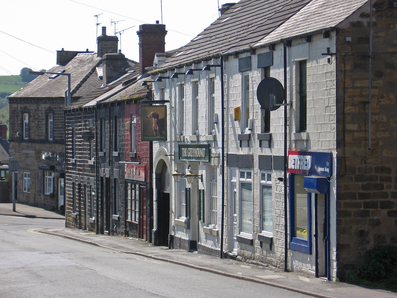
Worsbrough is a district 2 to 3 miles south of Barnsley in the metropolitan borough of Barnsley, South Yorkshire, England. Before 1974, Worsbrough had its own urban district council in the West Riding of Yorkshire. Much of Worsbrough is now part of Barnsley Metropolitan Borough Council's, Worsbrough Ward, although certain parts of the historic Worsbrough district, such as Birdwell, Rockley and Blacker Hill, currently lie within neighbouring council wards.
The Worsbrough district included three parishes; St James's originally included the suburbs of Worsbrough Bridge and Ward Green. St Thomas's included Worsbrough Dale, Swaithe and Bank End. St Mary's included Worsbrough Village, Birdwell, Blacker Hill, Worsbrough Park and Rockley.
Worsbrough Common estate is a suburb of the Barnsley town centre area. It takes its name from the old common above Highstone Lane. Although it takes its name from the old Worsbrough common, most of the modern Worsbro Common council estate was never part of the Worsbrough Urban District or Parish, but part of the County Borough of Barnsley. Furthermore, approximately one third of the common ground and fields used to build the Kendray council estate was on land within the Worsbrough Urban District, which was later swallowed up by the County Borough of Barnsley after the estate was constructed.
Stainborough C.P. was formerly a sub division of the Worsbrough Urban District.
The River Dove flows through Worsbrough and the reservoir before joining the River Dearne . The A61 traverses this large valley, before passing through Birdwell and junction 36 of the M1, in the direction of Sheffield.
A railway line, the Worsbrough Branch line, linked to the former Woodhead Line, passed along the valley. It is now part of the Trans-Pennine Trail.
The Worsbrough Branch railway line was primarily a coal freight line and started at Aldham from Wath and ended at West Silkstone Junction, where it joined the Barnsley-Penistone line.
The Worsbrough Bank, sometimes referred to as the Worsbrough Incline, was a steep bank on the Worsbrough Branch of the Great Central Railway (GCR) freight-only line from Wath to Penistone, climbing for 7 miles (11 km), with a stretch of 3 miles (4.8 km) at a nominal gradient of 1 in 40 (2.5%). Sections of this incline also suffered from colliery subsidence, making it infamously difficult to restart a stalled train on these severe sections. The main traffic on the line was loaded trains carrying coal from the southern Yorkshire coalfields to Lancashire via the Woodhead Tunnel.
Worsbrough
Worsbrough is a district 2 to 3 miles south of Barnsley in the metropolitan borough of Barnsley, South Yorkshire, England. Before 1974, Worsbrough had its own urban district council in the West Riding of Yorkshire. Much of Worsbrough is now part of Barnsley Metropolitan Borough Council's, Worsbrough Ward, although certain parts of the historic Worsbrough district, such as Birdwell, Rockley and Blacker Hill, currently lie within neighbouring council wards.
The Worsbrough district included three parishes; St James's originally included the suburbs of Worsbrough Bridge and Ward Green. St Thomas's included Worsbrough Dale, Swaithe and Bank End. St Mary's included Worsbrough Village, Birdwell, Blacker Hill, Worsbrough Park and Rockley.
Worsbrough Common estate is a suburb of the Barnsley town centre area. It takes its name from the old common above Highstone Lane. Although it takes its name from the old Worsbrough common, most of the modern Worsbro Common council estate was never part of the Worsbrough Urban District or Parish, but part of the County Borough of Barnsley. Furthermore, approximately one third of the common ground and fields used to build the Kendray council estate was on land within the Worsbrough Urban District, which was later swallowed up by the County Borough of Barnsley after the estate was constructed.
Stainborough C.P. was formerly a sub division of the Worsbrough Urban District.
The River Dove flows through Worsbrough and the reservoir before joining the River Dearne . The A61 traverses this large valley, before passing through Birdwell and junction 36 of the M1, in the direction of Sheffield.
A railway line, the Worsbrough Branch line, linked to the former Woodhead Line, passed along the valley. It is now part of the Trans-Pennine Trail.
The Worsbrough Branch railway line was primarily a coal freight line and started at Aldham from Wath and ended at West Silkstone Junction, where it joined the Barnsley-Penistone line.
The Worsbrough Bank, sometimes referred to as the Worsbrough Incline, was a steep bank on the Worsbrough Branch of the Great Central Railway (GCR) freight-only line from Wath to Penistone, climbing for 7 miles (11 km), with a stretch of 3 miles (4.8 km) at a nominal gradient of 1 in 40 (2.5%). Sections of this incline also suffered from colliery subsidence, making it infamously difficult to restart a stalled train on these severe sections. The main traffic on the line was loaded trains carrying coal from the southern Yorkshire coalfields to Lancashire via the Woodhead Tunnel.
Recent media
Recent media