
Community hub
Recent from talks
Contribute something
Nothing was collected or created yet.
Guelma Province
View on WikipediaGuelma Province (Arabic: ولاية قالمة) is a province (wilaya) in eastern Algeria. Its namesake is its seat and most populous municipality: Guelma.
Key Information

.svg)
History
[edit]Its civilians suffered heavy casualties during the 1945 Sétif massacre by the French Army.[2] The province itself was established in 1974 but before that, it was part of Annaba Province.
In 1984 El Taref Province and Souk Ahras Province were carved out of its territory.
Demographics
[edit]It has 556,673 inhabitants as of 2024, one of the lower populations in the country, which gives it 39 seats in the APW, the province's assembly. The population density is 105 inhabitants per square kilometre (272/sq mi). Of these, 54.4% live in urban areas and 87% have access to safe drinking water, lower than the national average of 89%. [1] Archived 2007-09-11 at the Wayback Machine. Of the active population of the province, 23.3% work in agriculture, 17.9% in construction, 9.9% in industry, and 48.9% in the services sector. 21.1% of the population is unemployed.[2][permanent dead link]]
Geography
[edit]The territory of the province (4,101 km2 (1,583 sq mi)) is mainly composed of arable land (about 49%) or 1,890 km2 (730 sq mi), of which about 100 km2 (39 sq mi) is irrigated, and the rest is rainfed. In the area surrounding Guelma, around 130 km2 (50 sq mi) is irrigable, 110 km2 (42 sq mi) in the area between Oued Zenati and Tamlouka, and 20 km2 (8 sq mi) around Bouchegouf. Forests cover about 31% of the total area, which equals 0.9 km2 (0 sq mi), composed mainly of Aleppo Pine, Algerian Oak and Cork Oak. Areas dedicated for future industrial development, called activity zones in Algeria cover 2 km2 (1 sq mi).[3][permanent dead link]]
Administrative divisions
[edit]The province is divided into 10 districts (daïras), which are further divided into 34 communes or municipalities.[3]
Districts
[edit]Communes
[edit]- Aïn Ben Beida
- Houari Boumediene
- Aïn Larbi
- Aïn Makhlouf
- Aïn Reggada
- Aïn Sandel
- Belkheir
- Ben Djarah
- Beni Mezline
- Bordj Sabat
- Bou Hachana
- Bou Hamdane
- Bouati Mahmoud
- Boughouf
- Boumahra Ahmed
- Dahouara
- Djeballah Khemissi
- El Fedjoudj
- Guellat Bou Dbaa
- Guelma
- Hammam Debagh
- Hammam Nbail
- Héliopolis
- Kheraza
- Medjez Amar
- Medjez Sfa
- Nechmaya
- Oued Cheham
- Oued Fragha
- Oued Zenati
- Ras El Agba
- Roknia
- Salaoua Announa
- Tamlouka
Notable residents
[edit]- Houari Boumédienne, President of Algeria
- Saint Possidius, bishop of Calama (Guelma) (5th century)
See also
[edit]- Khamissa — Ancient Roman ruins in province.
References
[edit]- ^ Office National des Statistiques, Recensement General de la Population et de l’Habitat 2008 Archived 2008-07-24 at the Wayback Machine Preliminary results of the 2008 population census. Accessed on 2008-07-02.
- ^ "Remembering the massacre of 45,000 Algerians – Middle East Monitor". Archived from the original on 2024-04-25. Retrieved 2024-04-25.
- ^ Journal Officiel de la Republique Algerienne, No. 41, Page 1307. 4 September 1991.
External links
[edit]- Official Tourism Office of Guelma Province website — (in Arabic); (in German); (in English); (in French)
|  | |
| International | |
|---|---|
| National | |
| Geographic | |
| Other | |
Guelma Province
View on GrokipediaGeography
Physical geography and location
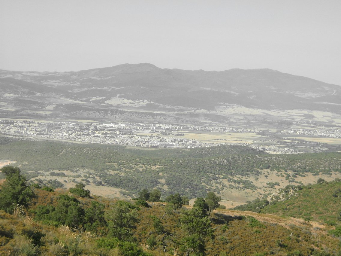
Guelma Province is situated in northeastern Algeria, bordering Tunisia to the east, with coordinates approximately between 36°10' and 36°50' north latitude and 7°10' and 8°10' east longitude. It covers an area of 3,686 square kilometers, making it one of the smaller provinces in the country, and is part of the Constantine Department historically.[2] The province lies within the Tell Atlas mountain range, featuring a mix of fertile plains, hills, and elevated plateaus that transition into semi-arid steppes toward the south. Its topography includes the Guelma Plain in the north, known for agricultural productivity, flanked by the Boudjarrah Mountains to the west and the Tébessa Mountains extending from the east. The province's location positions it at the crossroads of Mediterranean influences and inland arid zones, with the Seybouse River providing key hydrological features that support irrigation and valleys. Elevations range from about 200 meters in the northern plains to over 1,000 meters in the southern highlands, contributing to varied microclimates and soil types, including alluvial deposits suitable for viticulture and cereals. Guelma's strategic placement near the Algerian-Tunisian border has historically facilitated trade routes, with proximity to the Mediterranean Sea roughly 70 kilometers north influencing its accessibility via roads connecting to Annaba and Constantine.Climate and natural resources
Guelma Province exhibits a Mediterranean climate with sub-humid conditions in the central and northern regions transitioning to semi-arid in the south. Winters are mild and rainy, while summers are hot and dry. The average annual temperature stands at 17.3 °C, with extremes ranging from 4 °C during winter lows to over 35 °C in summer highs.[3] Precipitation varies regionally, averaging 654 mm annually at the Guelma station, 627 mm at Aïn Larbi, and 526 mm at Medjez Amar, generally between 400-500 mm in southern areas and up to nearly 1,000 mm in the north. About 57% of rainfall occurs during the wet season from October to May. The hottest month is August, with average highs of 93 °F (34 °C) and lows of 68 °F (20 °C), while January sees the coldest conditions, with highs of 58 °F (14 °C) and lows of 40 °F (4 °C).[3][4] Additional climatic features include 36.2 sirocco days per year, which can impact agriculture; 11 frost days annually at Guelma and 33.5 at Aïn Larbi; 2.2 hail days at Guelma; and occasional snow on higher peaks, with 12.7 snow days at Aïn Larbi. These patterns support agricultural and pastoral activities but pose risks from dry winds and variable wetness.[3] Natural resources in the province center on water, forests, and geothermal features rather than extractive minerals. Forested and wooded lands cover 117,584.67 hectares, including sites like the Beni Salah National Forest, contributing to biodiversity and recreation. Over 1,040 natural springs exist, many thermal or mineral, with high flow rates, temperatures, and quality that enable balneotherapy, tourism, and water supply. Wetlands in Guelma support regional biodiversity conservation, providing ecosystem services such as water regulation amid Algeria's 2,375 total wetlands (2,056 natural).[5][6][7][8]History
Ancient and Roman periods
The region of present-day Guelma Province formed part of the ancient Berber kingdom of Numidia, characterized by tribal confederations and pastoral economies prior to extensive Roman influence. The urban center at Calama (modern Guelma) corresponds to the ancient site of Suthul, which Roman legions under Aulus Postumius besieged in 110 BC amid the Jugurthine War against King Jugurtha, as recorded by the historian Sallust.[9] This event marked early Roman military penetration into the area, though Numidia retained semi-autonomy as a client kingdom under rulers like Juba I until its full subjugation. After Julius Caesar's defeat of Juba I at the Battle of Thapsus in 46 BC, eastern Numidia—including Calama—was annexed as the Roman province of Africa Nova, later restructured into the province of Numidia by Emperor Hadrian around 123–129 AD.[10] Calama developed as a prosperous Roman municipium, elevated to colonia status, supporting agriculture, trade, and infrastructure such as a large theater seating thousands, thermal baths with hypocaust systems, and aqueducts.[11][12] Archaeological evidence from these structures indicates integration into imperial networks, with local Berber elites adopting Roman customs while maintaining indigenous elements. In the late Roman period, Calama fell under Numidia Cirtensis, a subdivision emphasizing administrative and military control.[13] The city transitioned to Christianity by the 4th century, becoming the episcopal see of Possidius, bishop from circa 397 AD and biographer of Saint Augustine, who corresponded with him on theological matters.[14] Religious strife peaked in 408 AD when Donatist clergy in Calama halted a pagan procession, an incident Augustine addressed in his letters, reflecting schisms between Nicene and dissident factions amid declining imperial authority.[15]Medieval Islamic and Ottoman eras
During the late 7th century, the region of modern Guelma Province fell to the Arab-Muslim armies during the Umayyad conquest of Ifriqiya, culminating in the defeat of Byzantine forces by 698 CE under Musa ibn Nusayr, following initial raids by Uqba ibn Nafi starting in 647 CE.[16] The prior urban center of Calama, heavily damaged by Vandal incursions in 484 CE and partially rebuilt under Byzantine rule after 533 CE, experienced accelerated decline as formal settlement shifted to rural patterns amid Berber resistance, including the revolt led by the Berber queen Dihya (Kahina) in the 680s, and gradual Islamization of local populations.[17] In the subsequent medieval Islamic period (8th–15th centuries), the Guelma area, part of eastern Algeria's Constantinois region, came under successive dynasties that facilitated further Arab-Berber cultural synthesis and agricultural continuity in fertile valleys. Rustamid Ibadi influence briefly extended from central Algeria in the 8th–9th centuries, followed by Aghlabid control from Kairouan (800–909 CE), which promoted irrigation and trade networks. Fatimid rule (909–973 CE) introduced Shi'a Ismaili elements before Sunni Zirid and Hammadid Berber dynasties dominated northeastern Algeria from the 11th century, with the Hammadids maintaining a capital at the Qal'a of Beni Hammad until their fall to Almohads in 1152 CE; these regimes relied on tribal levies and pastoral economies, with Guelma's terrain supporting olive and grain production amid sparse documentation of local events. Almoravid and Almohad expansions (late 11th–13th centuries) enforced orthodox Malikite Islam, suppressing residual Kharijite sects, while the region later aligned with Hafsid Tunisia in the east until Zayyanid pressures from the west.[18] Under Ottoman suzerainty from 1518 CE, when Aruj Barbarossa placed Algiers under Istanbul's protection, the Guelma region integrated into the Regency of Algiers as part of the eastern territories governed from Constantine, formalized as the Beylik of Constantine around 1567 CE. Administration involved Turkish beys overseeing Arab and Berber tribes through aghas and qaid chiefs, with taxation focused on agrarian output—wheat, barley, olives, and livestock—via the timar system and corsair-linked trade routes to Annaba. The area saw limited Hanafi Islamic scholarship and Sufi zawiyas, but persistent tribal autonomy, including Zenata and Chaoui groups, led to occasional revolts against central exactions; the ancient Calama site remained largely unpopulated as an urban entity, with settlement concentrated in douars (villages) vulnerable to nomadic incursions and lacking major fortifications until French incursions in the 1830s.[16][19]French colonial period and independence war
The French conquest of the Guelma region, part of eastern Algeria, followed the capture of Constantine on October 13, 1837, which facilitated the subjugation of surrounding areas including Guelma by the early 1840s through military campaigns against local resistance.[20] Colonial administration integrated Guelma into the Constantine department, promoting European settler agriculture focused on grains, olives, and vineyards, which involved land expropriations from indigenous Arab and Berber communities, reducing native land ownership to under 10% in fertile zones by the early 20th century.[21] This economic restructuring exacerbated socioeconomic disparities, with European colons (pieds-noirs) comprising about 10-15% of the local population by 1900, controlling key resources while indigenous Algerians faced taxation and marginalization.[22] Tensions intensified after World War I, fueled by unmet reform promises and nationalist stirrings from groups like the Étoile Nord-Africaine, but erupted dramatically on May 8, 1945—Victory in Europe Day—when approximately 1,500 Parti du Peuple Algérien (PPA) supporters in Guelma held a peaceful demonstration waving the Algerian flag, resulting in one demonstrator killed and five wounded by police under orders from the local sous-préfet.[20] Retaliatory violence followed, with 12 Europeans killed in the Guelma area on May 9-10 amid insurrections; French authorities and settler militias then unleashed massacres, killing an estimated 1,500 to 2,000 Muslims by late May, primarily civilians including traders, craftsmen, and tenant farmers targeted from pre-compiled lists of nationalists and union members, with bodies often dumped in mass graves or lime kilns.[20] Casualty figures remain disputed, with French official estimates low (around 1,000 total for Sétif-Guelma-Kherrata) contrasted by Algerian claims exceeding 45,000, while independent analyses converge on 3,000-6,000 deaths overall, highlighting colonial repression's role in alienating the population.[23] [24] These events radicalized Algerian nationalists, contributing directly to the Front de Libération Nationale (FLN)'s launch of the independence war on November 1, 1954, with Guelma—within FLN Wilaya IV (Constantine)—becoming a hotspot for guerrilla operations due to its proximity to Tunisia-based supply lines.[25] FLN ambushes and sabotage targeted French infrastructure, prompting counterinsurgency measures including the construction of the Morice Line electrified barrier along the Tunisian border in 1957 to curb infiltrations, which reduced cross-border movements but intensified local reprisals and forced relocations of rural populations into regroupement camps.[26] French forces, bolstered by units like the Foreign Legion, conducted sweeps in the Guelma maquis, resulting in hundreds of combat deaths; by 1959, the region saw heightened FLN recruitment among Berber and Arab communities disillusioned by prior massacres.[27] The war's final phase involved escalating violence from both sides, including FLN internal purges and French use of torture documented in military reports, with Guelma witnessing clashes until the March 18, 1962, Évian Accords ceasefire.[28] Independence was declared on July 5, 1962, triggering the exodus of over 90% of Guelma's European settlers (approximately 20,000 individuals) amid OAS bombings and FLN seizures, leaving behind abandoned estates and a power vacuum filled by provisional government seizures.[22] The Algerian War of Independence resulted in an estimated 300,000–400,000 Algerian deaths nationwide from combat, reprisals, and famine, underscoring the war's causal roots in unresolved colonial grievances like the 1945 events.Post-independence era and civil strife
Following Algeria's independence on July 5, 1962, the region encompassing modern Guelma Province experienced the exodus of European settlers, whose departure facilitated the nationalization of colonial-era properties and lands previously under French control. The wilaya of Guelma was formally established in 1974 through a territorial reorganization that separated it from Annaba Wilaya, encompassing daïras such as Souk Ahras, Sedrata, Bouchegouf, Oued Zenati, and others initially under its administration.[29] In 1984, further administrative divisions carved out El Taref and Souk Ahras provinces from Guelma's territory, reducing its scope while emphasizing local governance in agricultural and rural development.[30] Post-independence policies under the socialist-oriented government included agrarian reforms aimed at redistributing land from former colonial estates to state-managed cooperatives and smallholders, impacting Guelma's fertile plains suited for grain, olives, and livestock production; however, implementation challenges such as mismanagement and low productivity persisted nationwide, with limited province-specific data available. Urban and infrastructural growth accelerated modestly in the 1970s and 1980s, driven by state investment in housing and roads, though economic reliance on agriculture exposed the area to fluctuations in national planning priorities. The Algerian Civil War (1991–2002), often termed the "black decade" due to its estimated 150,000–200,000 deaths from insurgent attacks, government reprisals, and massacres, affected Guelma Province amid widespread national instability triggered by the military's cancellation of 1991 elections won by the Islamist Islamic Salvation Front (FIS). While rural eastern regions like Guelma faced sporadic security threats from groups such as the Armed Islamic Group (GIA), which conducted ambushes and bombings across Algeria, no major documented massacres or battles occurred in the province comparable to those in central areas like Relizane or Blida; local impacts included heightened military presence and economic disruption from curfews and displacement, contributing to a broader climate of fear that influenced literature and social memory in the region.[31] By the late 1990s, government counterinsurgency efforts, including amnesties and the formation of self-defense militias, helped stabilize the area, aligning with the national decline in violence by 2002.Administrative divisions
Districts
Guelma Province is divided into 10 districts (daïras), serving as intermediate administrative units between the province and its 34 communes. Each district is headed by a sub-prefect (wali adjoint) appointed by the central government and oversees local implementation of policies, infrastructure maintenance, and coordination of communal services. This structure, established under Algeria's 1974 territorial reorganization and refined in subsequent reforms, ensures decentralized administration while maintaining national oversight.[32][29] The districts, named after their principal communes (chef-lieux de daïra), are:- Aïn Makhlouf
- Bouchegouf
- Guelaât Bou Sbaâ
- Guelma (provincial capital)
- Hammam Debagh
- Hammam N'Bail
- Héliopolis
- Houari Boumédiène (Aïn Hessania)
- Khezarra
- Oued Zenati
Communes
Guelma Province is subdivided into 34 communes, the smallest administrative units in Algeria responsible for local governance, public services, and municipal affairs.[34] These communes vary in population and size, with Guelma commune serving as the provincial capital and largest urban center, while others are rural or semi-urban. They handle tasks such as urban planning, waste management, and basic infrastructure maintenance under oversight from the provincial and national levels. The communes are grouped into 10 daïras for intermediate administration. The following lists the communes by daïra, based on official delineations:[35]- Aïn Hessainia daïra: Houari Boumediene, Medjez Amar, Ras El Agba, Sellaoua Announa
- Aïn Makhlouf daïra: Aïn Larbi, Aïn Makhlouf, Tamlouka
- Bouchegouf daïra: Aïn Ben Beida, Bouchegouf, Medjez Sfa, Oued Ferragha
- Guelaat Bou Sbaa daïra: Belkheir, Beni Mezline, Boumahra Ahmed, Djeballah Khemissi, Guelaat Bou Sbaa, Nechmaya
- Guelma daïra: Bendjarah, Guelma
- Hammam Debagh daïra: Bou Hamdane, Hammam Debagh, Roknia
- Hammam N'bails daïra: Dahouara, Hammam N'bail, Oued Cheham
- Héliopolis daïra: Bouati Mahmoud, El Fedjou dj, Héliopolis
- Khezaras daïra: Aïn Sandel, Bou Hachana, Khezaras
- Oued Zenati daïra: Aïn Regada, Bordj Sabath, Oued Zenati
Demographics
Population trends and statistics
As of the 2008 Algerian census conducted by the Office National des Statistiques (ONS), Guelma Province had a total population of 482,430 residents, marking an increase from 430,000 in the 1998 census and reflecting an annual growth rate of 1.2% over that decade.[37] This growth rate was modestly below the national average, attributable to factors such as rural-to-urban migration patterns and varying fertility rates in eastern Algerian wilayas. The province's population density stood at 131 inhabitants per km² in 2008, based on an area of 3,686 km².[37][2]| Census Year | Total Population | Annual Growth Rate (prior decade) |
|---|---|---|
| 1998 | 430,000 | - |
| 2008 | 482,430 | 1.2% |