



Community hub
Recent from talks
Knowledge base stats:
Talk channels stats:
Members stats:
2011 Rainsville tornado
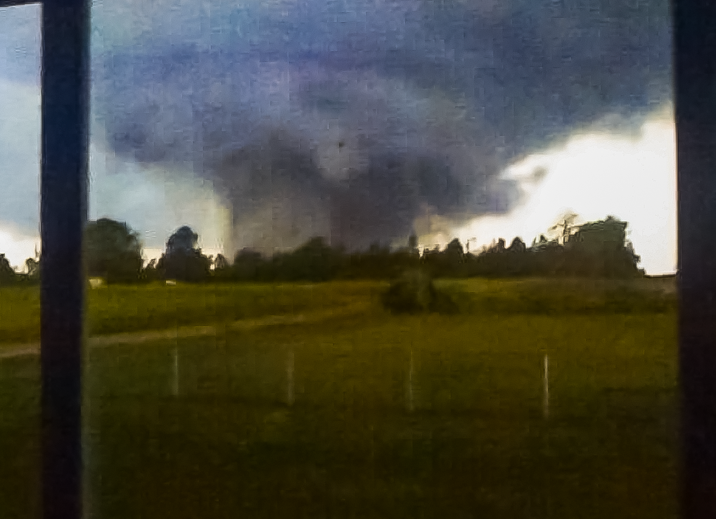
During the early evening hours of April 27, 2011, an extremely powerful and devastating EF5 tornado, known most commonly as the Rainsville tornado, struck parts of northeast Alabama, causing immense damage, notably in the town of Rainsville, Alabama. It was the fourth and final EF5 of the historic 2011 Super Outbreak, the largest tornado outbreak ever recorded. The multi-vortex tornado remained on the ground for 36 minutes, carving a path of 36.63 miles (58.95 km) long through DeKalb County, causing 25 deaths, an unspecified yet sizable number of injuries, and an estimated $10+ million in damage.
The supercell thunderstorm responsible for this tornado first developed at around 1:45 p.m. CDT near Harperville, Mississippi. It swiftly moved northeast, producing an EF5 tornado in Mississippi and an EF4 tornado in Central Alabama before entering DeKalb County by 5:45 p.m. CDT. The tornado touched down at 6:19 p.m. CDT near the Lakeview community and quickly escalated in intensity. EF5 damage was noted in several pockets near Shiloh, Rainsville, and Henagar, where severe ground scouring occurred and numerous homes were destroyed, resulting in the multiple fatalities and injuries. The damage path was characterized by extensive tree damage, the complete destruction of structures, and extensive damage to property. The tornado eventually dissipated near Rising Fawn, Georgia.
2011 was a prolific year for tornadoes and tornado-associated fatalities, with multiple destructive outbreaks. In total, this specific tornado killed 25 people.
The environmental conditions leading up to the 2011 Super Outbreak were among the "most conducive to violent tornadoes ever documented". On April 25, a vigorous upper-level shortwave trough moved into the Southern Plains states. Ample instability, low-level moisture, and wind shear all fueled a significant tornado outbreak from Texas to Tennessee; at least 64 tornadoes touched down on this day. An area of low pressure consolidated over Texas on April 26 and traveled east while the aforementioned shortwave trough traversed the Mississippi and Ohio River valleys. Another 50 tornadoes touched down on this day. The multi-day outbreak culminated on April 27 with the most violent day of tornadic activity since the 1974 Super Outbreak. Multiple episodes of tornadic activity ensued with two waves of mesoscale convective systems in the morning hours, followed by a widespread outbreak of supercells from Mississippi to North Carolina during the afternoon into the evening.
Tornadic activity on April 27 was precipitated by a 995 mbar (hPa; 29.39 inHg) surface low situated over Kentucky and a deep, negatively tilted (aligned northwest to southeast) trough over Arkansas and Louisiana. A strong southwesterly surface jet intersected these systems at a 60° angle, an ageostrophic flow that led to storm-relative helicity values in excess of 500 m2s−2—indicative of extreme wind shear and a very high potential for rotating updrafts within supercells. Ample moisture from the Gulf of Mexico was brought north across the Deep South, leading to daytime high temperatures of 77 to 81 °F (25 to 27 °C) and dewpoints of 66 to 72 °F (19 to 22 °C). Furthermore, convective available potential energy (CAPE) values reached 2,500–3,000 J/kg.
On the morning of April 27, a strong cold front with several areas of embedded low pressure extended from the Texas Hill Country northeastward towards the Arklatex and the Ozarks, and later into the lower Ohio Valley. Warm, moist air was in place due to strong southerly flow ahead of the front over Mississippi, Alabama, and Tennessee. An upper-level disturbance sparked a broad area of showers and thunderstorms as it moved across the frontal boundary on the previous evening. The eastern edge of the line of showers and storms continued to move eastward, in concert with the upper disturbance, reaching the northwest Alabama border around 2:00 a.m. CDT.
This produced the last and most violent round of severe weather, which began around 2:30 p.m. CDT for northern Alabama as supercells began to line up to the southwest of the area. During the early afternoon hours, the potential for destructive tornadoes was highlighted by the Storm Prediction Center's upgrade to a high risk for severe weather around 1:00 p.m. CDT. This prompted a particularly dangerous situation (PDS) tornado watch, which was issued for northern Alabama and portions of southern Tennessee at 1:45 p.m. CDT. The bulletin that accompanied the watch read:
THE NWS STORM PREDICTION CENTER HAS ISSUED A TORNADO WATCH FOR PORTIONS OF: MUCH OF ALABAMA, NORTHWEST GEORGIA, SOUTHEAST MISSISSIPPI, SOUTHERN MIDDLE TENNESSEE, EFFECTIVE THIS WEDNESDAY AFTERNOON AND EVENING FROM 145 PM UNTIL 1000 PM CDT.
Hub AI
2011 Rainsville tornado AI simulator
(@2011 Rainsville tornado_simulator)
2011 Rainsville tornado
During the early evening hours of April 27, 2011, an extremely powerful and devastating EF5 tornado, known most commonly as the Rainsville tornado, struck parts of northeast Alabama, causing immense damage, notably in the town of Rainsville, Alabama. It was the fourth and final EF5 of the historic 2011 Super Outbreak, the largest tornado outbreak ever recorded. The multi-vortex tornado remained on the ground for 36 minutes, carving a path of 36.63 miles (58.95 km) long through DeKalb County, causing 25 deaths, an unspecified yet sizable number of injuries, and an estimated $10+ million in damage.
The supercell thunderstorm responsible for this tornado first developed at around 1:45 p.m. CDT near Harperville, Mississippi. It swiftly moved northeast, producing an EF5 tornado in Mississippi and an EF4 tornado in Central Alabama before entering DeKalb County by 5:45 p.m. CDT. The tornado touched down at 6:19 p.m. CDT near the Lakeview community and quickly escalated in intensity. EF5 damage was noted in several pockets near Shiloh, Rainsville, and Henagar, where severe ground scouring occurred and numerous homes were destroyed, resulting in the multiple fatalities and injuries. The damage path was characterized by extensive tree damage, the complete destruction of structures, and extensive damage to property. The tornado eventually dissipated near Rising Fawn, Georgia.
2011 was a prolific year for tornadoes and tornado-associated fatalities, with multiple destructive outbreaks. In total, this specific tornado killed 25 people.
The environmental conditions leading up to the 2011 Super Outbreak were among the "most conducive to violent tornadoes ever documented". On April 25, a vigorous upper-level shortwave trough moved into the Southern Plains states. Ample instability, low-level moisture, and wind shear all fueled a significant tornado outbreak from Texas to Tennessee; at least 64 tornadoes touched down on this day. An area of low pressure consolidated over Texas on April 26 and traveled east while the aforementioned shortwave trough traversed the Mississippi and Ohio River valleys. Another 50 tornadoes touched down on this day. The multi-day outbreak culminated on April 27 with the most violent day of tornadic activity since the 1974 Super Outbreak. Multiple episodes of tornadic activity ensued with two waves of mesoscale convective systems in the morning hours, followed by a widespread outbreak of supercells from Mississippi to North Carolina during the afternoon into the evening.
Tornadic activity on April 27 was precipitated by a 995 mbar (hPa; 29.39 inHg) surface low situated over Kentucky and a deep, negatively tilted (aligned northwest to southeast) trough over Arkansas and Louisiana. A strong southwesterly surface jet intersected these systems at a 60° angle, an ageostrophic flow that led to storm-relative helicity values in excess of 500 m2s−2—indicative of extreme wind shear and a very high potential for rotating updrafts within supercells. Ample moisture from the Gulf of Mexico was brought north across the Deep South, leading to daytime high temperatures of 77 to 81 °F (25 to 27 °C) and dewpoints of 66 to 72 °F (19 to 22 °C). Furthermore, convective available potential energy (CAPE) values reached 2,500–3,000 J/kg.
On the morning of April 27, a strong cold front with several areas of embedded low pressure extended from the Texas Hill Country northeastward towards the Arklatex and the Ozarks, and later into the lower Ohio Valley. Warm, moist air was in place due to strong southerly flow ahead of the front over Mississippi, Alabama, and Tennessee. An upper-level disturbance sparked a broad area of showers and thunderstorms as it moved across the frontal boundary on the previous evening. The eastern edge of the line of showers and storms continued to move eastward, in concert with the upper disturbance, reaching the northwest Alabama border around 2:00 a.m. CDT.
This produced the last and most violent round of severe weather, which began around 2:30 p.m. CDT for northern Alabama as supercells began to line up to the southwest of the area. During the early afternoon hours, the potential for destructive tornadoes was highlighted by the Storm Prediction Center's upgrade to a high risk for severe weather around 1:00 p.m. CDT. This prompted a particularly dangerous situation (PDS) tornado watch, which was issued for northern Alabama and portions of southern Tennessee at 1:45 p.m. CDT. The bulletin that accompanied the watch read:
THE NWS STORM PREDICTION CENTER HAS ISSUED A TORNADO WATCH FOR PORTIONS OF: MUCH OF ALABAMA, NORTHWEST GEORGIA, SOUTHEAST MISSISSIPPI, SOUTHERN MIDDLE TENNESSEE, EFFECTIVE THIS WEDNESDAY AFTERNOON AND EVENING FROM 145 PM UNTIL 1000 PM CDT.