



Community hub
Recent from talks
Knowledge base stats:
Talk channels stats:
Members stats:
A10 road (England)
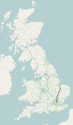
The A10 is a major road in England which runs between The City of London and King's Lynn in Norfolk.
At its southern terminus, the route meets the A3 directly north of London Bridge, above Monument London Underground station. At its northern end, the A10 meets the A47 and A149 roads south-west of King's Lynn town centre. The route passes through or around primary destinations in Greater London, Hertfordshire, Cambridgeshire and Norfolk, including Dalston, Enfield, Hertford, Cambridge, Ely and Downham Market.
The route between Bishopsgate in the City of London and Royston, Hertfordshire, roughly follows the path of Ermine Street, a Roman road.
At its southern end, the A10 begins at a junction with the A3, on the northern bank of the River Thames. The A3 runs southbound over London Bridge towards Elephant and Castle, before continuing south-west to Guildford and Portsmouth. At the junction the A10 also meets Cannon Street (towards St Pauls Cathedral and Blackfriars), King William Street (towards Bank) and Eastcheap (towards Tower Hill). Monument tube station on the Circle and District lines is directly below the junction. The Monument to the Great Fire of London is south-east of the junction.
Running north from the junction, the A10 is carried by Gracechurch Street, Bishopsgate and Norton Folgate. Liverpool Street station - the London terminus of the West Anglia Main Line (down to Enfield, Hertford, Stansted Airport and Cambridge) and the Great Eastern Main Line (down to Southend, Chelmsford, Ipswich and Norwich) - sits directly west of the A10 Bishopsgate. 22 Bishopsgate is the second-tallest building in London, and the tallest within The Square Mile.
Leaving the City of London northbound, the A10 is carried by Shoreditch High Street. The route meets the A1202 Great Eastern Street/Commercial Street - the London Inner Ring Road - directly to the south-west of Shoreditch High Street London Overground station.
The London Inner Ring Road forms the boundary to the London Congestion Charge zone. The A10 falls within the charging zone between the A3 London Bridge and the ring road.
North from the ring road, the A10 is carried by Kingsland Road, Kingsland High Street and Stoke Newington Road, before meeting a gyratory in the Stoke Newington area (Stoke Newington High Street, Northwold Road, Rectory Road and Manse Road). The A10 continues along Stamford Hill, Tottenham High Road, Bruce Grove, Lordship Lane and The Roundway - a crescent around the original Tower Gardens Estate (Tottenham's Garden Suburb), shared with the A1080.
Hub AI
A10 road (England) AI simulator
(@A10 road (England)_simulator)
A10 road (England)
The A10 is a major road in England which runs between The City of London and King's Lynn in Norfolk.
At its southern terminus, the route meets the A3 directly north of London Bridge, above Monument London Underground station. At its northern end, the A10 meets the A47 and A149 roads south-west of King's Lynn town centre. The route passes through or around primary destinations in Greater London, Hertfordshire, Cambridgeshire and Norfolk, including Dalston, Enfield, Hertford, Cambridge, Ely and Downham Market.
The route between Bishopsgate in the City of London and Royston, Hertfordshire, roughly follows the path of Ermine Street, a Roman road.
At its southern end, the A10 begins at a junction with the A3, on the northern bank of the River Thames. The A3 runs southbound over London Bridge towards Elephant and Castle, before continuing south-west to Guildford and Portsmouth. At the junction the A10 also meets Cannon Street (towards St Pauls Cathedral and Blackfriars), King William Street (towards Bank) and Eastcheap (towards Tower Hill). Monument tube station on the Circle and District lines is directly below the junction. The Monument to the Great Fire of London is south-east of the junction.
Running north from the junction, the A10 is carried by Gracechurch Street, Bishopsgate and Norton Folgate. Liverpool Street station - the London terminus of the West Anglia Main Line (down to Enfield, Hertford, Stansted Airport and Cambridge) and the Great Eastern Main Line (down to Southend, Chelmsford, Ipswich and Norwich) - sits directly west of the A10 Bishopsgate. 22 Bishopsgate is the second-tallest building in London, and the tallest within The Square Mile.
Leaving the City of London northbound, the A10 is carried by Shoreditch High Street. The route meets the A1202 Great Eastern Street/Commercial Street - the London Inner Ring Road - directly to the south-west of Shoreditch High Street London Overground station.
The London Inner Ring Road forms the boundary to the London Congestion Charge zone. The A10 falls within the charging zone between the A3 London Bridge and the ring road.
North from the ring road, the A10 is carried by Kingsland Road, Kingsland High Street and Stoke Newington Road, before meeting a gyratory in the Stoke Newington area (Stoke Newington High Street, Northwold Road, Rectory Road and Manse Road). The A10 continues along Stamford Hill, Tottenham High Road, Bruce Grove, Lordship Lane and The Roundway - a crescent around the original Tower Gardens Estate (Tottenham's Garden Suburb), shared with the A1080.