
Community hub
Recent from talks
Contribute something
Nothing was collected or created yet.
A658 road
View on Wikipedia
This article needs additional citations for verification. (March 2022) |
 | |
|---|---|
 | |
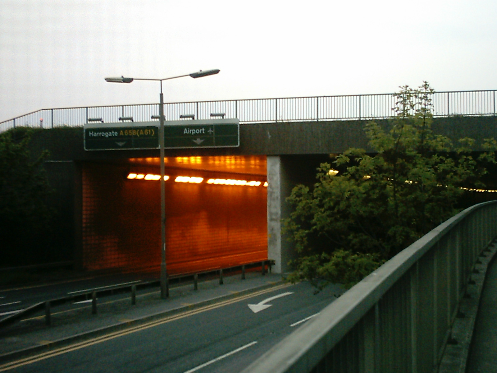
 The A658 dual carriageway plus a pedestrian walkway runs under the main runway at Leeds Bradford International Airport | |
| Major junctions | |
| East end | Knaresborough |
| West end | Bradford |
| Location | |
| Country | United Kingdom |
| Constituent country | England |
| Road network | |
The A658 is a road in Yorkshire, England.
Route
[edit]It runs from Bradford, West Yorkshire (53°47′42″N 1°44′55″W / 53.7949°N 1.7487°W), to Knaresborough, North Yorkshire (54°00′23″N 1°25′58″W / 54.0065°N 1.4327°W), passing along the way Leeds Bradford International Airport, where it runs through a tunnel directly under the main runway. The road starts near to the cathedral in Bradford, crossing the A650 almost immediately as it heads north westwards from the city.[1] The A658 originally terminated south of the village of Pannal at the junction with the A61,[2] but was extended when the south Harrogate and Knaresborough bypass was built and the road now ends east of Knaresborough where it meets the A59.
Places along the A658
[edit]References
[edit]- ^ Bradford, Brighouse, Halifax, Keighley. Sevenoaks: Geographers' A-Z Map Co. 2004. p. 5. ISBN 1843482088.
- ^ "SE35 – B// (includes: Follifoot; Goldsborough; Harrogate; Knaresborough; Knaresb... – Ordnance Survey 1:25,000 maps of Great Britain, 1945-1969". maps.nls.uk. Retrieved 1 March 2022.
Located at SE303504
- ^ a b Witherow, John, ed. (29 July 2013). "'Unbelievably stupid' driver ignored accident cordon". The Times. No. 70949. London. p. 16.
External links
[edit]A roads in Zone 6 of the Great Britain road numbering scheme | ||
|---|---|---|