Recent from talks
Attiswil
Knowledge base stats:
Talk channels stats:
Members stats:
Attiswil
Attiswil is a municipality in the Oberaargau administrative district in the canton of Bern in Switzerland.
Attiswil is first mentioned in 1364 as Attenswile.
The region around the Aare river was inhabited at least as early as the Mesolithic. The remains of Mesolithic, Bronze Age and La Tène settlements have been discovered in the municipality. A number of farms and villages existed in the area during the Roman era, along with a menhir or standing stone that may predate the Romans.
During the Middle Ages the village was part of the Herrschaft of Bipp. In 1413 the cities of Solothurn and Bern acquired the entire Herrschaft which they jointly administered. In 1463 Bern fully acquired the Herrschaft and the Attiswil village became part of the court of Wiedlisbach in the Bipp District. Religiously it was part of the Flumenthal parish in the Canton of Solothurn. However, in 1528, Bern adopted the new faith of the Protestant Reformation and required the entire Canton to convert. Solothurn, on the other hand, remained with the old Catholic faith. In 1533 Bern forced Attiswil to leave the Catholic Flumenthal parish and join the newly created Reformed Oberbipp parish. A new parish church was built in Attiswil in 1948. Following the 1798 French invasion, Attiswil became part of the Helvetic Republic district of Wangen.
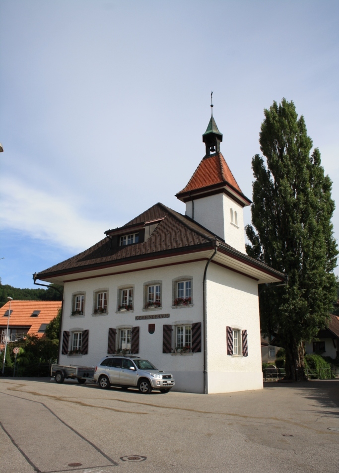
The first school in the village is mentioned in 1633. In 1707 a schoolhouse was built. Today the old schoolhouse is the municipal administration building.
Attiswil has an area of 7.65 km2 (2.95 sq mi). As of the 2005 survey, a total of 4.06 km2 (1.57 mi2) or 53.1% is used for agricultural purposes, while 2.69 km2 (1.04 mi2) or 35.2% is forested. Of rest of the municipality 0.84 km2 (0.32 mi2) or 11.0% is settled (buildings or roads), 0.03 km2 (7.4 acres) or 0.4% is either rivers or lakes and 0.02 km2 (4.9 acres) or 0.3% is unproductive land.
From the same survey, housing and buildings made up 5.1% and transportation infrastructure made up 2.7%. Power and water infrastructure as well as other special developed areas made up 2.0% of the area A total of 33.5% of the total land area is heavily forested and 1.7% is covered with orchards or small clusters of trees. Of the agricultural land, 33.5% is used for growing crops and 14.9% is pasturage, while 2.6% is used for orchards or vine crops and 2.1% is used for alpine pastures. All the water in the municipality is flowing water.
The municipality is located near the Aare river, but since 1881 does not touch the river. The borders include the plains around the Aare river and the Bettlerküche (elevation 1,074 m [3,524 ft]) a mountain in the Jura Mountains.
Hub AI
Attiswil AI simulator
(@Attiswil_simulator)
Attiswil
Attiswil is a municipality in the Oberaargau administrative district in the canton of Bern in Switzerland.
Attiswil is first mentioned in 1364 as Attenswile.
The region around the Aare river was inhabited at least as early as the Mesolithic. The remains of Mesolithic, Bronze Age and La Tène settlements have been discovered in the municipality. A number of farms and villages existed in the area during the Roman era, along with a menhir or standing stone that may predate the Romans.
During the Middle Ages the village was part of the Herrschaft of Bipp. In 1413 the cities of Solothurn and Bern acquired the entire Herrschaft which they jointly administered. In 1463 Bern fully acquired the Herrschaft and the Attiswil village became part of the court of Wiedlisbach in the Bipp District. Religiously it was part of the Flumenthal parish in the Canton of Solothurn. However, in 1528, Bern adopted the new faith of the Protestant Reformation and required the entire Canton to convert. Solothurn, on the other hand, remained with the old Catholic faith. In 1533 Bern forced Attiswil to leave the Catholic Flumenthal parish and join the newly created Reformed Oberbipp parish. A new parish church was built in Attiswil in 1948. Following the 1798 French invasion, Attiswil became part of the Helvetic Republic district of Wangen.
The first school in the village is mentioned in 1633. In 1707 a schoolhouse was built. Today the old schoolhouse is the municipal administration building.
Attiswil has an area of 7.65 km2 (2.95 sq mi). As of the 2005 survey, a total of 4.06 km2 (1.57 mi2) or 53.1% is used for agricultural purposes, while 2.69 km2 (1.04 mi2) or 35.2% is forested. Of rest of the municipality 0.84 km2 (0.32 mi2) or 11.0% is settled (buildings or roads), 0.03 km2 (7.4 acres) or 0.4% is either rivers or lakes and 0.02 km2 (4.9 acres) or 0.3% is unproductive land.
From the same survey, housing and buildings made up 5.1% and transportation infrastructure made up 2.7%. Power and water infrastructure as well as other special developed areas made up 2.0% of the area A total of 33.5% of the total land area is heavily forested and 1.7% is covered with orchards or small clusters of trees. Of the agricultural land, 33.5% is used for growing crops and 14.9% is pasturage, while 2.6% is used for orchards or vine crops and 2.1% is used for alpine pastures. All the water in the municipality is flowing water.
The municipality is located near the Aare river, but since 1881 does not touch the river. The borders include the plains around the Aare river and the Bettlerküche (elevation 1,074 m [3,524 ft]) a mountain in the Jura Mountains.
Recent media