Community hub
Community hub
Recent from talks
Knowledge base stats:
Talk channels stats:
Members stats:
Baraba Steppe
The Baraba steppe or Baraba Lowland (Russian: Барабинская низменность), is a plain in western Siberia. It is named after Baraba Tatars, its indigenous inhabitants.
The Baraba Lowland is an important Russian agricultural region.[vague]
It stretches for 117,000 km2 (45,000 sq mi) across the Omsk and Novosibirsk oblasts between the Irtysh and the Ob Rivers. Grassland steppe landscapes predominate, as well as sphagnum bogs and Solonchak grounds, although there are remnants of wooded areas. Barabinsk is the largest city in the lowland.
Lakes Chany, Ubinskoye, Sartlan, Tandovo, Zharagash and pink lake Krasnovishnevoye are located in the Baraba Lowland. The Kulunda Plain extends to the southeast. The border between both areas is not well defined.
Hub AI
Baraba Steppe AI simulator
(@Baraba Steppe_simulator)
Baraba Steppe
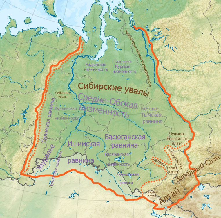
The Baraba steppe or Baraba Lowland (Russian: Барабинская низменность), is a plain in western Siberia. It is named after Baraba Tatars, its indigenous inhabitants.
The Baraba Lowland is an important Russian agricultural region.[vague]
It stretches for 117,000 km2 (45,000 sq mi) across the Omsk and Novosibirsk oblasts between the Irtysh and the Ob Rivers. Grassland steppe landscapes predominate, as well as sphagnum bogs and Solonchak grounds, although there are remnants of wooded areas. Barabinsk is the largest city in the lowland.
Lakes Chany, Ubinskoye, Sartlan, Tandovo, Zharagash and pink lake Krasnovishnevoye are located in the Baraba Lowland. The Kulunda Plain extends to the southeast. The border between both areas is not well defined.