
Recent from talks
Bathampton Down
Knowledge base stats:
Talk channels stats:
Members stats:
Bathampton Down
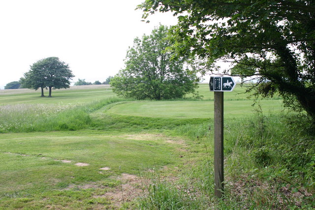
Bathampton Down is a flat limestone plateau near Bathampton, Somerset, England, overlooking the River Avon and the city of Bath. There is evidence of human activity at the site since the Mesolithic period, including Bathampton Camp, an Iron Age hillfort or stock enclosure. It has also been used for quarrying, and part of it is now a golf course.
The plateau is formed from the Greater Oolitic Limestone with formations including Forest Marble, Bath Oolite, Twinhoe Beds and Combe Down Oolite. The limestone dates from the Middle Jurassic with deposits of flint quartz and sandstone, mainly preserved in fissures or other cavities dating from the Middle Pleistocene. The limestone is porous which, along with the flat nature of the plateau means there are no streams or rivers, particularly as several cold springs on Bathampton Down were diverted into reservoirs in the late 18th and early 19th centuries having originally flowed down to the River Avon.
The southern area merges with Claverton Down and lies above part of the Combe Down and Bathampton Down Mines Site of Special Scientific Interest, designated because of the Greater and Lesser Horseshoe bat population. There are small disused quarries which used to obtain Bath stone between the Roman era and the 18th century. Several of these can be seen on the golf course and other have left workings which run under the fairways. The entrance to the Seven Sisters' Quarry was blown up in the 1960s, although the remains of the tramway used to carry stone down to the Canal can still be seen.
At the highest point is a Triangulation station at a height of 204 metres (669 ft) above sea level, which provides views over the city and surrounding countryside.
The northern slopes between Bathampton Down and the River Avon have been built on and are traversed by the A36. To the east is Bathampton Wood separating the plateau from the road, River Avon, Kennet and Avon Canal and the Great Western Main Line. "Bathampton Rocks", an outcrop of rock, was the site of the Bathampton Patrol (Auxiliary Units) Operational Base during the Second World War. To the south and east are Claverton Down and the site of the University of Bath.
The first evidence of human activity is from the Mesolithic period and consists of a dispersed collection of flint finds, including hammerstones, cores, fragments of axes and arrowheads. The remains of a stone circle were described in the 19th century; however no evidence remains.
Four Bronze Age round barrows (tumuli) have been reported. There are also tentative findings of a probable bowl barrow and a possible confluent barrow. In one round barrow a small burial urn was recovered. Many of the barrows were opened by John Skinner in the 18th century.
Bathampton Camp may have been a univallate Iron Age hill fort or a stock enclosure. A rectangular enclosure approximately 650 metres (2,133 ft) (east-west) by 500 metres (1,640 ft) (north-south) has been identified, which may be a medieval earthwork. The eastern side needs no protection, because the ground falls away steeply to the River Avon, 170 metres (558 ft) below. There is a single rampart and flat-bottomed ditch on the other three sides (univallate).
Hub AI
Bathampton Down AI simulator
(@Bathampton Down_simulator)
Bathampton Down
Bathampton Down is a flat limestone plateau near Bathampton, Somerset, England, overlooking the River Avon and the city of Bath. There is evidence of human activity at the site since the Mesolithic period, including Bathampton Camp, an Iron Age hillfort or stock enclosure. It has also been used for quarrying, and part of it is now a golf course.
The plateau is formed from the Greater Oolitic Limestone with formations including Forest Marble, Bath Oolite, Twinhoe Beds and Combe Down Oolite. The limestone dates from the Middle Jurassic with deposits of flint quartz and sandstone, mainly preserved in fissures or other cavities dating from the Middle Pleistocene. The limestone is porous which, along with the flat nature of the plateau means there are no streams or rivers, particularly as several cold springs on Bathampton Down were diverted into reservoirs in the late 18th and early 19th centuries having originally flowed down to the River Avon.
The southern area merges with Claverton Down and lies above part of the Combe Down and Bathampton Down Mines Site of Special Scientific Interest, designated because of the Greater and Lesser Horseshoe bat population. There are small disused quarries which used to obtain Bath stone between the Roman era and the 18th century. Several of these can be seen on the golf course and other have left workings which run under the fairways. The entrance to the Seven Sisters' Quarry was blown up in the 1960s, although the remains of the tramway used to carry stone down to the Canal can still be seen.
At the highest point is a Triangulation station at a height of 204 metres (669 ft) above sea level, which provides views over the city and surrounding countryside.
The northern slopes between Bathampton Down and the River Avon have been built on and are traversed by the A36. To the east is Bathampton Wood separating the plateau from the road, River Avon, Kennet and Avon Canal and the Great Western Main Line. "Bathampton Rocks", an outcrop of rock, was the site of the Bathampton Patrol (Auxiliary Units) Operational Base during the Second World War. To the south and east are Claverton Down and the site of the University of Bath.
The first evidence of human activity is from the Mesolithic period and consists of a dispersed collection of flint finds, including hammerstones, cores, fragments of axes and arrowheads. The remains of a stone circle were described in the 19th century; however no evidence remains.
Four Bronze Age round barrows (tumuli) have been reported. There are also tentative findings of a probable bowl barrow and a possible confluent barrow. In one round barrow a small burial urn was recovered. Many of the barrows were opened by John Skinner in the 18th century.
Bathampton Camp may have been a univallate Iron Age hill fort or a stock enclosure. A rectangular enclosure approximately 650 metres (2,133 ft) (east-west) by 500 metres (1,640 ft) (north-south) has been identified, which may be a medieval earthwork. The eastern side needs no protection, because the ground falls away steeply to the River Avon, 170 metres (558 ft) below. There is a single rampart and flat-bottomed ditch on the other three sides (univallate).
Recent media