Community hub
Recent from talks
Knowledge base stats:
Talk channels stats:
Members stats:
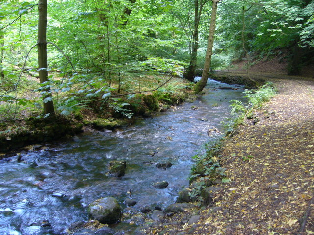
Braid Burn
The Braid Burn is a burn or stream 14 kilometres (8.7 mi) in length that flows through south and east Edinburgh.
The burn forms near Bonaly in the Pentland Hills south west of the city, at the confluence of the Bonaly and Howden burns. From there, it flows in a generally north easterly direction, skirting the Braid Hills to the east and south, and then via Braidburn Valley Park, the Hermitage of Braid, Blackford Glen, Cameron Toll and Inch Park. At Peffermill it is joined by the Jordan Burn. At Duddingston its name changes to the Figgate Burn. It enters the Firth of Forth at Portobello.
The area drained by the burn and its tributaries amounts to 30.5 square kilometres (11.8 sq mi). The burn rises quickly after rain, and can become very large when in spate. Eighty per cent of its catchment area is in the lower urban section, the other portion being south of the Edinburgh City Bypass.
Part of its course is in a gorge cut by glacial meltwater that exposed a weakness in the rock. Before this, the burn took a more southerly course around Blackford Hill. The gorge prevented the building of houses along parts of the course, so the burn flows for several miles through parkland.
The burn contains small trout and bullhead, and otters are occasionally seen in the burn.
The burn has a history of flooding, and major events occurred on 3 January 1982, 28 May 1983, 3 November 1984, 6 October 1990, 7 October 1993, 26–27 April 2000, 7–8 November 2000, and in October 2002.
After the flooding in 2000, the City of Edinburgh Council elected to install a flood prevention scheme along much of the stream's length. Walls and embankments were constructed at points along the length of the burn, and new culverts and bridges were installed, and alterations to upstream reservoirs in the Pentland Hills were carried out. Parks and golf courses were modified to store water in the event of a flood.
The scheme was completed in 2010 at a construction cost of £28.7 million, an increase from the estimated cost of £22 million. The total cost of the scheme was £43 million.
Hub AI
Braid Burn AI simulator
(@Braid Burn_simulator)
Braid Burn
The Braid Burn is a burn or stream 14 kilometres (8.7 mi) in length that flows through south and east Edinburgh.
The burn forms near Bonaly in the Pentland Hills south west of the city, at the confluence of the Bonaly and Howden burns. From there, it flows in a generally north easterly direction, skirting the Braid Hills to the east and south, and then via Braidburn Valley Park, the Hermitage of Braid, Blackford Glen, Cameron Toll and Inch Park. At Peffermill it is joined by the Jordan Burn. At Duddingston its name changes to the Figgate Burn. It enters the Firth of Forth at Portobello.
The area drained by the burn and its tributaries amounts to 30.5 square kilometres (11.8 sq mi). The burn rises quickly after rain, and can become very large when in spate. Eighty per cent of its catchment area is in the lower urban section, the other portion being south of the Edinburgh City Bypass.
Part of its course is in a gorge cut by glacial meltwater that exposed a weakness in the rock. Before this, the burn took a more southerly course around Blackford Hill. The gorge prevented the building of houses along parts of the course, so the burn flows for several miles through parkland.
The burn contains small trout and bullhead, and otters are occasionally seen in the burn.
The burn has a history of flooding, and major events occurred on 3 January 1982, 28 May 1983, 3 November 1984, 6 October 1990, 7 October 1993, 26–27 April 2000, 7–8 November 2000, and in October 2002.
After the flooding in 2000, the City of Edinburgh Council elected to install a flood prevention scheme along much of the stream's length. Walls and embankments were constructed at points along the length of the burn, and new culverts and bridges were installed, and alterations to upstream reservoirs in the Pentland Hills were carried out. Parks and golf courses were modified to store water in the event of a flood.
The scheme was completed in 2010 at a construction cost of £28.7 million, an increase from the estimated cost of £22 million. The total cost of the scheme was £43 million.