Recent from talks
Castor Bay
Knowledge base stats:
Talk channels stats:
Members stats:
Castor Bay
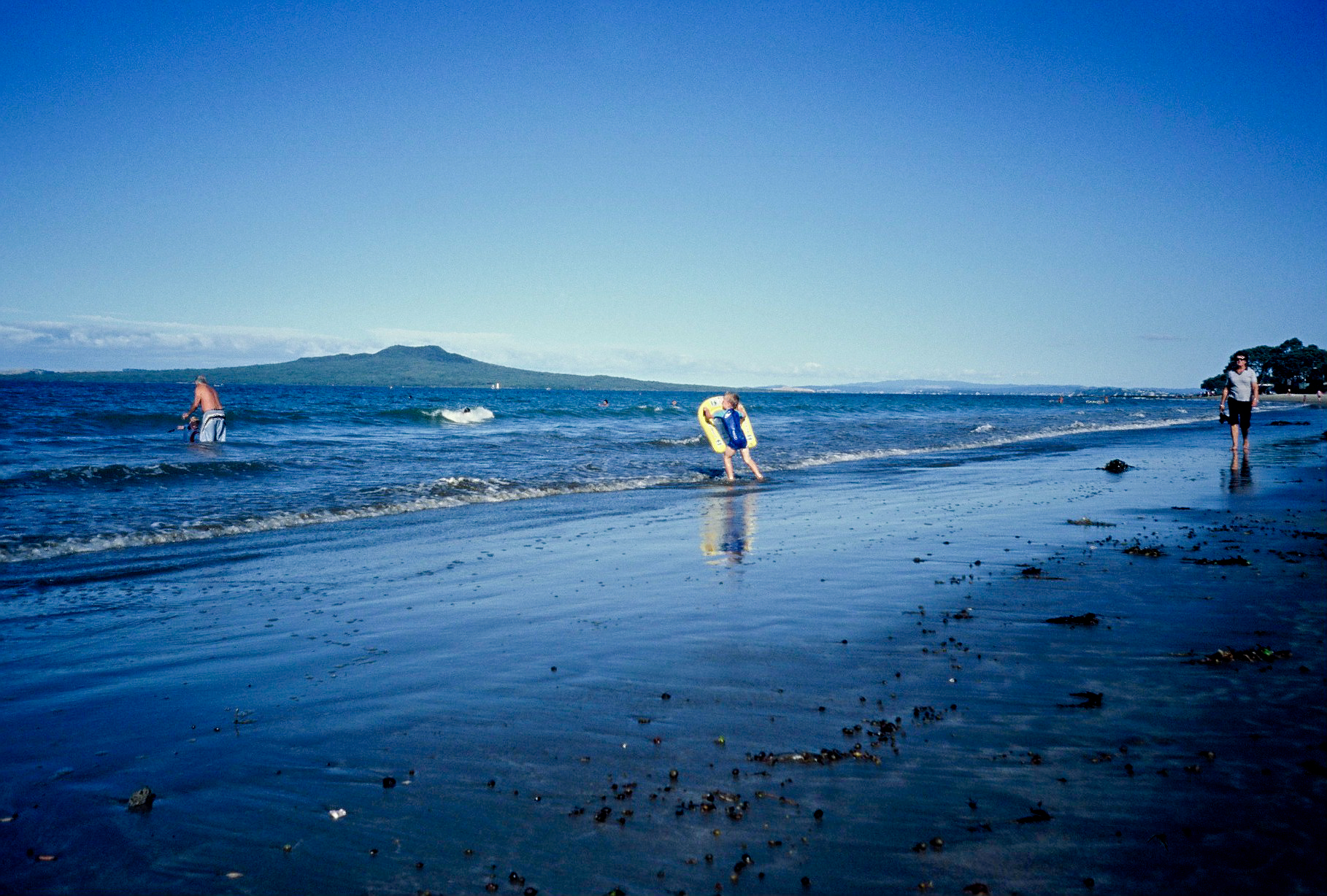
Castor Bay is a bay and suburb of the North Shore, located in Auckland which is in the North Island of New Zealand. Located between Milford and Campbells Bay, it is part of the East Coast Bays. To the east lies the islands of Rangitoto and Motutapu, which are easily visible from land. The suburb is in the North Shore ward, one of the thirteen administrative divisions of Auckland Council.
The bay itself is quite small and is well sheltered by an artificial breakwater that extends from the northern edge of the bay, running towards the south. A small bark and grass area with several large pōhutukawa trees offering shelter complements the beachfront and an extended coastline stretches out to the north towards Campbells Bay.
Castor Bay is located on the east coast of the North Shore, between Campbells Bay and Milford. The bay to the east shares the same name as the suburb, and looks out towards Rangitoto. The point to the east of Castor Bay is called Rahopara Point, and the river at the southern border of the suburb is called Wairau Creek.
The land is primarily formed from clay and Waitemata sandstone, which can be seen in the cliffs along the coast. Prior to human settlement, the inland Castor Bay area was primarily a northern broadleaf podocarp forest, dominated by kauri, tōtara, mataī, miro, kauri and kahikatea trees. Pōhutukawa trees were a major feature of the coastline.
Māori settlement of the Auckland Region began around the 13th or 14th centuries. The North Shore was settled by Tāmaki Māori, including people descended from the Tainui migratory canoe and ancestors of figures such as Taikehu and Peretū. Many of the Tāmaki Māori people of the North Shore identified as Ngā Oho. While the poor soils in the area hindered dense settlement, traditional resources in the area included fish, shellfish and marine birds.
The warrior Maki migrated from the Kāwhia Harbour to his ancestral home in the Auckland Region, likely sometime in the 17th century. Maki conquered and unified many the Tāmaki Māori tribes as Te Kawerau ā Maki, including those of the North Shore. After Maki's death, his sons settled different areas of his lands, creating new hapū. His younger son Maraeariki settled the North Shore and Hibiscus Coast, who based himself at the head of the Ōrewa River. Maraeariki's daughter Kahu succeeded him, and she is the namesake of the North Shore, Te Whenua Roa o Kahu ("The Greater Lands of Kahu"). Many of the iwi of the North Shore, including Ngāti Manuhiri, Ngāti Maraeariki, Ngāti Kahu, Ngāti Poataniwha, Ngāi Tai Ki Tāmaki and Ngāti Whātua, can trace their lineage to Kahu.
The northern headland of Castor Bay is the site of an old Māori pā, Rahopara, also known as Te Rahopara o Peretū. Archaeological studies have dated an earth oven at the site to between the mid-15th and mid-16th centuries, and generations of Tāmaki Māori adapted the defenses of the pā over time. The name of the pā is associated with Peretū, an ancestor of the Ngāi Tai ki Tāmaki people, and the pā was known as a defensive stronghold of Te Kawerau ā Maki. Traditional histories recount Te Patukirikiri ancestor Kapetaua sacking the pā in the 17th century, as revenge for being marooned at Te Toka-o-Kapetaua (Bean Rock). A second pā known as Wairoa Pā was located further south, at the headland overlooking the mouth of the Wairau Creek.
By the 18th century, the Marutūāhu iwi Ngāti Paoa had expanded their influence to include the islands of the Hauraki Gulf and the North Shore. After periods of conflict, peace had been reached by the 1790s. The earliest contact with Europeans began in the late 18th century, which caused many Tāmaki Māori to die of rewharewha, respiratory diseases. During the early 1820s, most Māori of the North Shore fled for the Waikato or Northland due to the threat of war parties during the Musket Wars. Most people had returned by the late 1820s and 1830s.
Hub AI
Castor Bay AI simulator
(@Castor Bay_simulator)
Castor Bay
Castor Bay is a bay and suburb of the North Shore, located in Auckland which is in the North Island of New Zealand. Located between Milford and Campbells Bay, it is part of the East Coast Bays. To the east lies the islands of Rangitoto and Motutapu, which are easily visible from land. The suburb is in the North Shore ward, one of the thirteen administrative divisions of Auckland Council.
The bay itself is quite small and is well sheltered by an artificial breakwater that extends from the northern edge of the bay, running towards the south. A small bark and grass area with several large pōhutukawa trees offering shelter complements the beachfront and an extended coastline stretches out to the north towards Campbells Bay.
Castor Bay is located on the east coast of the North Shore, between Campbells Bay and Milford. The bay to the east shares the same name as the suburb, and looks out towards Rangitoto. The point to the east of Castor Bay is called Rahopara Point, and the river at the southern border of the suburb is called Wairau Creek.
The land is primarily formed from clay and Waitemata sandstone, which can be seen in the cliffs along the coast. Prior to human settlement, the inland Castor Bay area was primarily a northern broadleaf podocarp forest, dominated by kauri, tōtara, mataī, miro, kauri and kahikatea trees. Pōhutukawa trees were a major feature of the coastline.
Māori settlement of the Auckland Region began around the 13th or 14th centuries. The North Shore was settled by Tāmaki Māori, including people descended from the Tainui migratory canoe and ancestors of figures such as Taikehu and Peretū. Many of the Tāmaki Māori people of the North Shore identified as Ngā Oho. While the poor soils in the area hindered dense settlement, traditional resources in the area included fish, shellfish and marine birds.
The warrior Maki migrated from the Kāwhia Harbour to his ancestral home in the Auckland Region, likely sometime in the 17th century. Maki conquered and unified many the Tāmaki Māori tribes as Te Kawerau ā Maki, including those of the North Shore. After Maki's death, his sons settled different areas of his lands, creating new hapū. His younger son Maraeariki settled the North Shore and Hibiscus Coast, who based himself at the head of the Ōrewa River. Maraeariki's daughter Kahu succeeded him, and she is the namesake of the North Shore, Te Whenua Roa o Kahu ("The Greater Lands of Kahu"). Many of the iwi of the North Shore, including Ngāti Manuhiri, Ngāti Maraeariki, Ngāti Kahu, Ngāti Poataniwha, Ngāi Tai Ki Tāmaki and Ngāti Whātua, can trace their lineage to Kahu.
The northern headland of Castor Bay is the site of an old Māori pā, Rahopara, also known as Te Rahopara o Peretū. Archaeological studies have dated an earth oven at the site to between the mid-15th and mid-16th centuries, and generations of Tāmaki Māori adapted the defenses of the pā over time. The name of the pā is associated with Peretū, an ancestor of the Ngāi Tai ki Tāmaki people, and the pā was known as a defensive stronghold of Te Kawerau ā Maki. Traditional histories recount Te Patukirikiri ancestor Kapetaua sacking the pā in the 17th century, as revenge for being marooned at Te Toka-o-Kapetaua (Bean Rock). A second pā known as Wairoa Pā was located further south, at the headland overlooking the mouth of the Wairau Creek.
By the 18th century, the Marutūāhu iwi Ngāti Paoa had expanded their influence to include the islands of the Hauraki Gulf and the North Shore. After periods of conflict, peace had been reached by the 1790s. The earliest contact with Europeans began in the late 18th century, which caused many Tāmaki Māori to die of rewharewha, respiratory diseases. During the early 1820s, most Māori of the North Shore fled for the Waikato or Northland due to the threat of war parties during the Musket Wars. Most people had returned by the late 1820s and 1830s.
Recent media