Recent from talks
Cauca Department
Knowledge base stats:
Talk channels stats:
Members stats:
Cauca Department
Cauca Department (Spanish pronunciation: [ˈkawka], Spanish: Departamento del Cauca) is a department of Southwestern Colombia. Located in the southwestern part of the country, facing the Pacific Ocean to the west, the Valle del Cauca Department to the north, Tolima Department to the northeast, Huila Department to the east, and Nariño Department to the south. Putumayo and Caqueta Departments border the southeast portion of Cauca Department as well. It covers a total area of 29,308 km2 (11,316 sq mi), the 13th largest in Colombia. Its capital is the city of Popayán. The offshore island of Malpelo belongs to the department. It is located in the southwest of the country, mainly in the Andean and Pacific regions (between 0°58′54″N and 3°19′04″N latitude, 75°47′36″W and 77°57′05″W longitude) plus a tiny part (Piamonte) in the Amazonian region. The area makes up 2.56% of the country.
Cauca Department is divided into 42 municipalities, 99 districts, 474 police posts and numerous villages and populated places. The municipalities are grouped into 27 circles and 29 notaries: a circle-based registration in Popayán and eight sectional offices based in Bolívar, Caloto, Puerto Tejada, Santander de Quilichao, Patia, Guapi and Silvia, makes up the judicial district of Popayán. This district possesses 8 judicial circuit seats in Popayán, Bolívar, Caloto, Guapi, Patia, Puerto Tejada, Santander de Quilichao and Silvia. The department makes up the constituency of Cauca.
The relief of the territory of the department of Cauca belongs to the Andean system at the macro level seven distinguishing morphological units:
The Pacific Plate comprises two sectors, firstly the alluvial coastal belt or platform characterized by low, swampy, mangrove forest with many rivers estuaries subject to the ebb and flow of tides, the remainder is a plain or hills comprising the western slopes of the western cordillera.
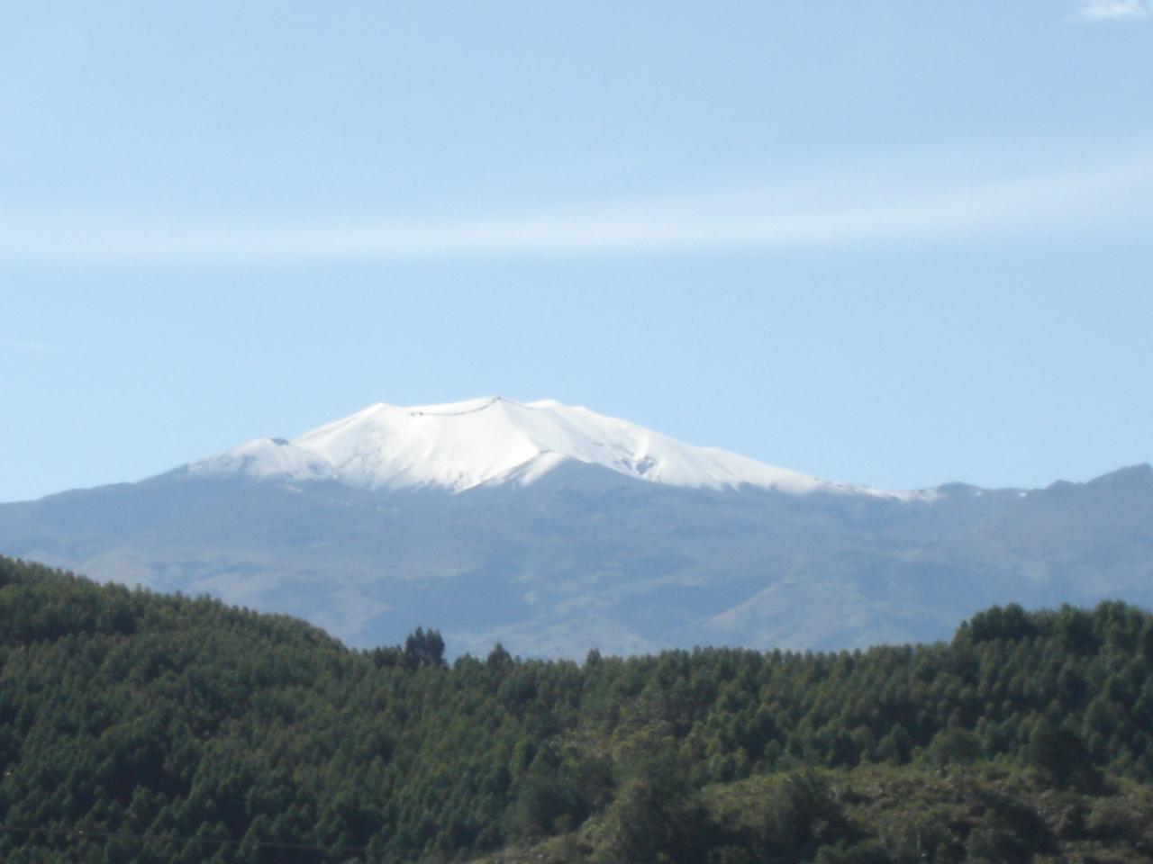
The western cordillera in Cauca extends from southwest to northeast. Among the most important landmarks are the blade of Napí, the hills of Guaduas, Munchique, and Naya, and the Cauca River Valley. The central mountain range crosses the department from south to north; relevant landmarks include Sotará Colcano, Petacas Nevado del Huila, and the departmental boundary.
The highlands of Popayán, sandwiched between the Western and Central Cordilleras, is seen as a landmark within the plateau of the hill of La Tetilla. Among the most representative landmarks of the Colombian Massif, shared with the department of Huila, are the Páramo del Buey, the volcanoes of Cutanga and Puracé, the peak of Paletará, and the Sierra Nevada of Coconucos. Patia Valley, where the Patia River runs north–south and framed by the Central and Western mountain ranges, extends into Nariño Department. The Amazonian salient corresponds to the so-called Bota Caucana, through which flows the Japurá River.
The Colombian Massif, also called the Nudo de Almaguer, is a mountainous section of Andean natural region formed by the convergence of two major mountain ranges, the Central and the Eastern cordilleras. The massif extends through the departments of Cauca, Huila, and Nariño. Towards the south, the Colombian Massif is continued by the Pasto Massif and towards the north it diverges forming the Central and Eastern Andes. The Colombian Massif is a strategic national and international level, given its significance for water production, biodiversity and ecosystems, an area that represents a special conformation of the regions with more potential for development in Colombia.
Cauca Department can be divided into the following hydrographic regions:
Hub AI
Cauca Department AI simulator
(@Cauca Department_simulator)
Cauca Department
Cauca Department (Spanish pronunciation: [ˈkawka], Spanish: Departamento del Cauca) is a department of Southwestern Colombia. Located in the southwestern part of the country, facing the Pacific Ocean to the west, the Valle del Cauca Department to the north, Tolima Department to the northeast, Huila Department to the east, and Nariño Department to the south. Putumayo and Caqueta Departments border the southeast portion of Cauca Department as well. It covers a total area of 29,308 km2 (11,316 sq mi), the 13th largest in Colombia. Its capital is the city of Popayán. The offshore island of Malpelo belongs to the department. It is located in the southwest of the country, mainly in the Andean and Pacific regions (between 0°58′54″N and 3°19′04″N latitude, 75°47′36″W and 77°57′05″W longitude) plus a tiny part (Piamonte) in the Amazonian region. The area makes up 2.56% of the country.
Cauca Department is divided into 42 municipalities, 99 districts, 474 police posts and numerous villages and populated places. The municipalities are grouped into 27 circles and 29 notaries: a circle-based registration in Popayán and eight sectional offices based in Bolívar, Caloto, Puerto Tejada, Santander de Quilichao, Patia, Guapi and Silvia, makes up the judicial district of Popayán. This district possesses 8 judicial circuit seats in Popayán, Bolívar, Caloto, Guapi, Patia, Puerto Tejada, Santander de Quilichao and Silvia. The department makes up the constituency of Cauca.
The relief of the territory of the department of Cauca belongs to the Andean system at the macro level seven distinguishing morphological units:
The Pacific Plate comprises two sectors, firstly the alluvial coastal belt or platform characterized by low, swampy, mangrove forest with many rivers estuaries subject to the ebb and flow of tides, the remainder is a plain or hills comprising the western slopes of the western cordillera.
The western cordillera in Cauca extends from southwest to northeast. Among the most important landmarks are the blade of Napí, the hills of Guaduas, Munchique, and Naya, and the Cauca River Valley. The central mountain range crosses the department from south to north; relevant landmarks include Sotará Colcano, Petacas Nevado del Huila, and the departmental boundary.
The highlands of Popayán, sandwiched between the Western and Central Cordilleras, is seen as a landmark within the plateau of the hill of La Tetilla. Among the most representative landmarks of the Colombian Massif, shared with the department of Huila, are the Páramo del Buey, the volcanoes of Cutanga and Puracé, the peak of Paletará, and the Sierra Nevada of Coconucos. Patia Valley, where the Patia River runs north–south and framed by the Central and Western mountain ranges, extends into Nariño Department. The Amazonian salient corresponds to the so-called Bota Caucana, through which flows the Japurá River.
The Colombian Massif, also called the Nudo de Almaguer, is a mountainous section of Andean natural region formed by the convergence of two major mountain ranges, the Central and the Eastern cordilleras. The massif extends through the departments of Cauca, Huila, and Nariño. Towards the south, the Colombian Massif is continued by the Pasto Massif and towards the north it diverges forming the Central and Eastern Andes. The Colombian Massif is a strategic national and international level, given its significance for water production, biodiversity and ecosystems, an area that represents a special conformation of the regions with more potential for development in Colombia.
Cauca Department can be divided into the following hydrographic regions:
Recent media