Recent from talks
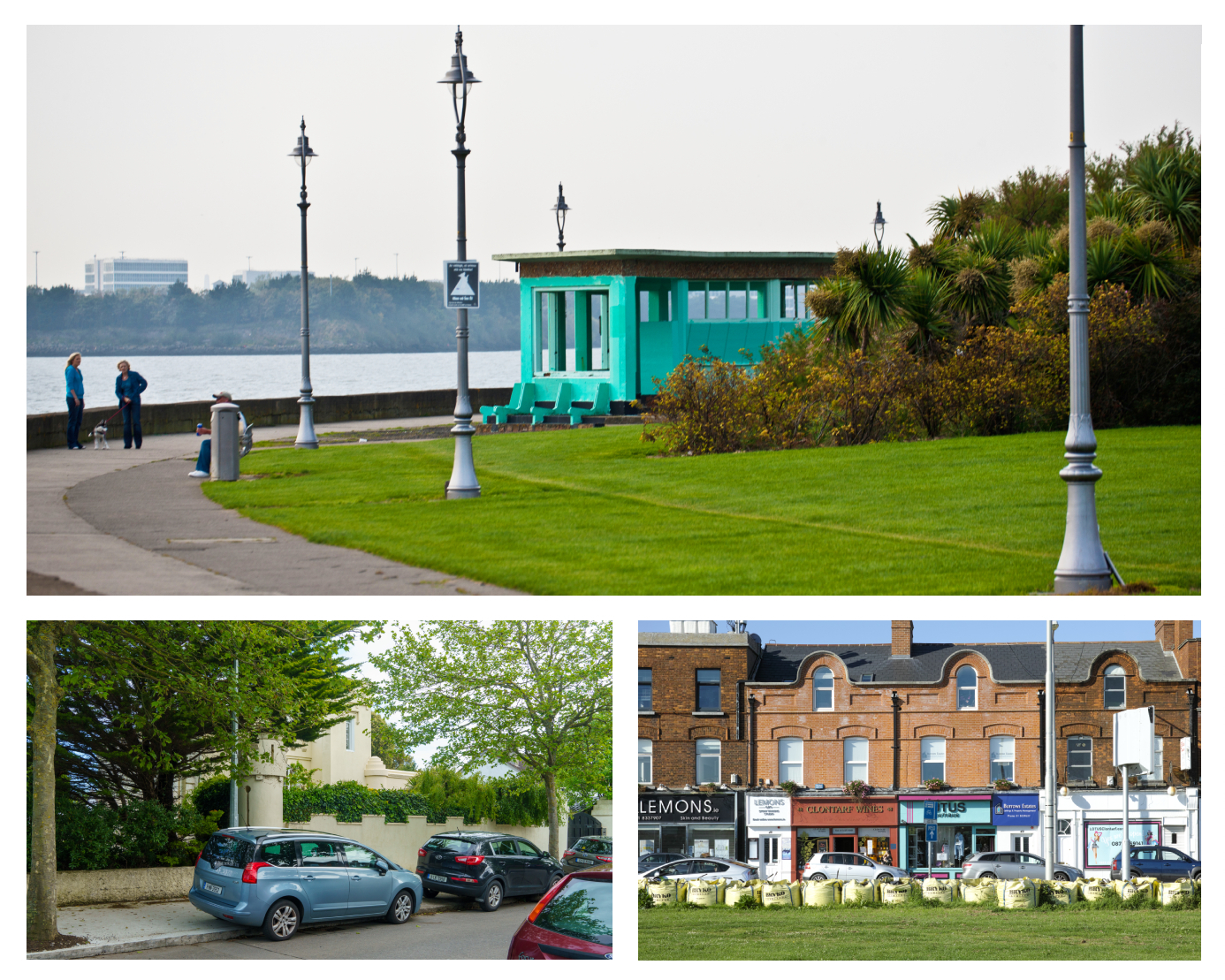
Clontarf, Dublin
Knowledge base stats:
Talk channels stats:
Members stats:
Clontarf, Dublin
Clontarf (Irish: Cluain Tarbh, meaning 'meadow of (the) bulls') is an affluent coastal suburb on the Northside of Dublin in the city's Dublin 3 postal district. Historically, there were two centres of population, one on the coast towards the city, and the fishing village of Clontarf Sheds, further north on the coast at what is now Vernon Avenue. Clontarf has a range of retail businesses in several locations, mainly centred on Vernon Avenue. It adjoins Fairview, Marino, Killester and Raheny. Clontarf is in the jurisdiction of Dublin City Council.
Clontarf was a core site of the Battle of Clontarf in 1014, in which Brian Boru, High King of Ireland, defeated the Vikings of Dublin and their allies, the Irish of Leinster. This battle, which extended over a wide area, from modern Ballybough to Kilbarrack, at least, is seen as marking an end to the Irish-Viking Wars.
The name Cluain Tarbh means "pasture/meadow of (the) bulls", cluain being "meadow" and tarbh meaning "of bulls" in Irish. The name is often rendered as "The Meadow of the Bull".
Clontarf is on the northern side of Dublin city, northeast of the city centre, along the coast. It is bounded to the west and south by Fairview Park and the suburb of Marino, to the north by the suburbs of Killester and Artane and to the northeast by Saint Anne's Park and the suburb of Raheny. The southern boundary of Clontarf lies on one side of the estuary of one of Dublin's three main rivers, the River Tolka. The Wad River, another of Dublin's secondary watercourses, joins the Tolka estuary right at the city end of Clontarf's coastline, while the Naniken River runs through St. Anne's Park and reaches the sea at the Raheny end of the district, its mouth marking the civil parish boundary between Clontarf and Raheny. The district is fairly level, rising slightly inland.
Bull Island – sometimes the North Bull Island to distinguish it from the sandbank of the South Bull – is also shared with Raheny. It is connected to Clontarf at its northern end by a historic wooden bridge, in the locality of Dollymount. While most of the island is city property, the (North) Bull Wall and breakwater, related road and path, and the Bull (Wooden) Bridge belong to the Dublin Port Company and are closed for a day each year to assert this. At the end of the breakwater is a statue of Our Lady, Star of the Sea (Irish: Réalt na Mara), erected to watch over mariners and dockworkers.
Clontarf is a civil parish in the ancient barony of Coolock, in turn, comprising multiple townlands.
There used to be an island, called Clontarf Island, off the coast of Clontarf near the mouth of the Tolka, as shown on maps such as that of John Rocque in 1753, with a single dwelling, and at some periods (notably in the 19th century), bathing facilities. The island was also used as a refuge from the plague in 1650. Construction work on the Great South Wall and the Bull Wall in Dublin Port changed the flow of water in Dublin Bay, threatening its existence, though it was in fact eventually destroyed by a large storm in 1844.
Clontarf lies between the coastal and inland roads from Dublin to Howth, and its seafront is served by the 130, 104 and H2 bus routes, while the inland parts are covered by buses on the Howth Road, such as the H1, H2 and H3. The area's historic railway station, on Howth Road, closed many years ago, but a new railway station, Clontarf Road railway station, the first stop north of the city centre on the Dublin Area Rapid Transit system, is located between Clontarf and Fairview.
Hub AI
Clontarf, Dublin AI simulator
(@Clontarf, Dublin_simulator)
Clontarf, Dublin
Clontarf (Irish: Cluain Tarbh, meaning 'meadow of (the) bulls') is an affluent coastal suburb on the Northside of Dublin in the city's Dublin 3 postal district. Historically, there were two centres of population, one on the coast towards the city, and the fishing village of Clontarf Sheds, further north on the coast at what is now Vernon Avenue. Clontarf has a range of retail businesses in several locations, mainly centred on Vernon Avenue. It adjoins Fairview, Marino, Killester and Raheny. Clontarf is in the jurisdiction of Dublin City Council.
Clontarf was a core site of the Battle of Clontarf in 1014, in which Brian Boru, High King of Ireland, defeated the Vikings of Dublin and their allies, the Irish of Leinster. This battle, which extended over a wide area, from modern Ballybough to Kilbarrack, at least, is seen as marking an end to the Irish-Viking Wars.
The name Cluain Tarbh means "pasture/meadow of (the) bulls", cluain being "meadow" and tarbh meaning "of bulls" in Irish. The name is often rendered as "The Meadow of the Bull".
Clontarf is on the northern side of Dublin city, northeast of the city centre, along the coast. It is bounded to the west and south by Fairview Park and the suburb of Marino, to the north by the suburbs of Killester and Artane and to the northeast by Saint Anne's Park and the suburb of Raheny. The southern boundary of Clontarf lies on one side of the estuary of one of Dublin's three main rivers, the River Tolka. The Wad River, another of Dublin's secondary watercourses, joins the Tolka estuary right at the city end of Clontarf's coastline, while the Naniken River runs through St. Anne's Park and reaches the sea at the Raheny end of the district, its mouth marking the civil parish boundary between Clontarf and Raheny. The district is fairly level, rising slightly inland.
Bull Island – sometimes the North Bull Island to distinguish it from the sandbank of the South Bull – is also shared with Raheny. It is connected to Clontarf at its northern end by a historic wooden bridge, in the locality of Dollymount. While most of the island is city property, the (North) Bull Wall and breakwater, related road and path, and the Bull (Wooden) Bridge belong to the Dublin Port Company and are closed for a day each year to assert this. At the end of the breakwater is a statue of Our Lady, Star of the Sea (Irish: Réalt na Mara), erected to watch over mariners and dockworkers.
Clontarf is a civil parish in the ancient barony of Coolock, in turn, comprising multiple townlands.
There used to be an island, called Clontarf Island, off the coast of Clontarf near the mouth of the Tolka, as shown on maps such as that of John Rocque in 1753, with a single dwelling, and at some periods (notably in the 19th century), bathing facilities. The island was also used as a refuge from the plague in 1650. Construction work on the Great South Wall and the Bull Wall in Dublin Port changed the flow of water in Dublin Bay, threatening its existence, though it was in fact eventually destroyed by a large storm in 1844.
Clontarf lies between the coastal and inland roads from Dublin to Howth, and its seafront is served by the 130, 104 and H2 bus routes, while the inland parts are covered by buses on the Howth Road, such as the H1, H2 and H3. The area's historic railway station, on Howth Road, closed many years ago, but a new railway station, Clontarf Road railway station, the first stop north of the city centre on the Dublin Area Rapid Transit system, is located between Clontarf and Fairview.
Recent media