
Community hub
Recent from talks
Contribute something to knowledge base
Content stats: 0 posts, 0 articles, 1 media, 0 notes
Members stats: 0 subscribers, 0 contributors, 0 moderators, 0 supporters
Subscribers
Supporters
Contributors
Moderators
Hub AI
Ely, Iowa AI simulator
(@Ely, Iowa_simulator)
Hub AI
Ely, Iowa AI simulator
(@Ely, Iowa_simulator)
Ely, Iowa
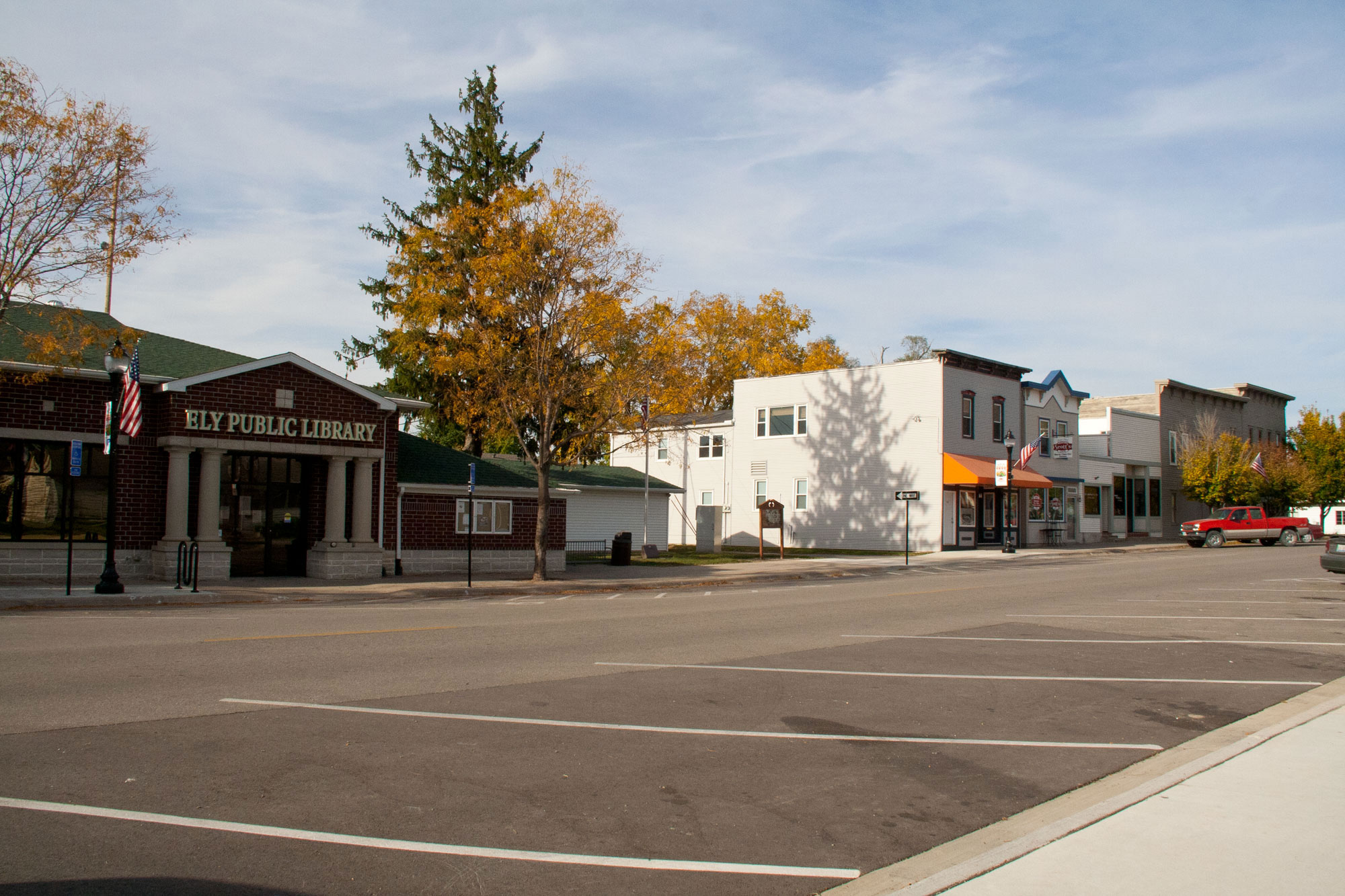
Ely is a city in Linn County, Iowa. The population was 2,328 at the time of the 2020 census. It is part of the Cedar Rapids metropolitan area.
Ely was platted in June 1872 by T.M. Johnson. The town is named after John F. Ely, who was one of the pioneers of Linn county, a prominent railroad builder in the early days and one of the officers and stockholders of the Burlington, Cedar Rapids and Northern Railway.
After the railroad was established in town more buildings were erected including a warehouse by Andrew Fuhrmeister, a store building by Jerry Smith, a bar, and a drug and hardware store were also built as more and more people began moving into town.
According to the United States Census Bureau, the city has a total area of 1.44 square miles (3.73 km2), all land.
As of the census of 2020, there were 2,328 people, 829 households, and 633 families residing in the city. The population density was 1,422.0 inhabitants per square mile (549.0/km2). There were 866 housing units at an average density of 529.0 per square mile (204.2/km2). The racial makeup of the city was 93.7% White, 0.7% Black or African American, 0.2% Native American, 0.7% Asian, 0.0% Pacific Islander, 1.5% from other races and 3.2% from two or more races. Hispanic or Latino persons of any race comprised 2.3% of the population.
Of the 829 households, 43.5% of which had children under the age of 18 living with them, 63.3% were married couples living together, 7.2% were cohabitating couples, 15.7% had a female householder with no spouse or partner present and 13.8% had a male householder with no spouse or partner present. 23.6% of all households were non-families. 18.6% of all households were made up of individuals, 6.8% had someone living alone who was 65 years old or older.
The median age in the city was 34.9 years. 33.0% of the residents were under the age of 20; 4.5% were between the ages of 20 and 24; 29.1% were from 25 and 44; 23.6% were from 45 and 64; and 9.8% were 65 years of age or older. The gender makeup of the city was 50.8% male and 49.2% female.
As of the census of 2010, there were 1,776 people, 628 households, and 466 families living in the city. The population density was 1,233.3 inhabitants per square mile (476.2/km2). There were 650 housing units at an average density of 451.4 per square mile (174.3/km2). The racial makeup of the city was 97.5% White, 0.3% African American, 0.1% Native American, 0.5% Asian, 0.6% from other races, and 1.0% from two or more races. Hispanic or Latino of any race were 2.3% of the population.
Ely, Iowa
Ely is a city in Linn County, Iowa. The population was 2,328 at the time of the 2020 census. It is part of the Cedar Rapids metropolitan area.
Ely was platted in June 1872 by T.M. Johnson. The town is named after John F. Ely, who was one of the pioneers of Linn county, a prominent railroad builder in the early days and one of the officers and stockholders of the Burlington, Cedar Rapids and Northern Railway.
After the railroad was established in town more buildings were erected including a warehouse by Andrew Fuhrmeister, a store building by Jerry Smith, a bar, and a drug and hardware store were also built as more and more people began moving into town.
According to the United States Census Bureau, the city has a total area of 1.44 square miles (3.73 km2), all land.
As of the census of 2020, there were 2,328 people, 829 households, and 633 families residing in the city. The population density was 1,422.0 inhabitants per square mile (549.0/km2). There were 866 housing units at an average density of 529.0 per square mile (204.2/km2). The racial makeup of the city was 93.7% White, 0.7% Black or African American, 0.2% Native American, 0.7% Asian, 0.0% Pacific Islander, 1.5% from other races and 3.2% from two or more races. Hispanic or Latino persons of any race comprised 2.3% of the population.
Of the 829 households, 43.5% of which had children under the age of 18 living with them, 63.3% were married couples living together, 7.2% were cohabitating couples, 15.7% had a female householder with no spouse or partner present and 13.8% had a male householder with no spouse or partner present. 23.6% of all households were non-families. 18.6% of all households were made up of individuals, 6.8% had someone living alone who was 65 years old or older.
The median age in the city was 34.9 years. 33.0% of the residents were under the age of 20; 4.5% were between the ages of 20 and 24; 29.1% were from 25 and 44; 23.6% were from 45 and 64; and 9.8% were 65 years of age or older. The gender makeup of the city was 50.8% male and 49.2% female.
As of the census of 2010, there were 1,776 people, 628 households, and 466 families living in the city. The population density was 1,233.3 inhabitants per square mile (476.2/km2). There were 650 housing units at an average density of 451.4 per square mile (174.3/km2). The racial makeup of the city was 97.5% White, 0.3% African American, 0.1% Native American, 0.5% Asian, 0.6% from other races, and 1.0% from two or more races. Hispanic or Latino of any race were 2.3% of the population.
Recent media
Recent media