Community hub
Recent from talks
Knowledge base stats:
Talk channels stats:
Members stats:
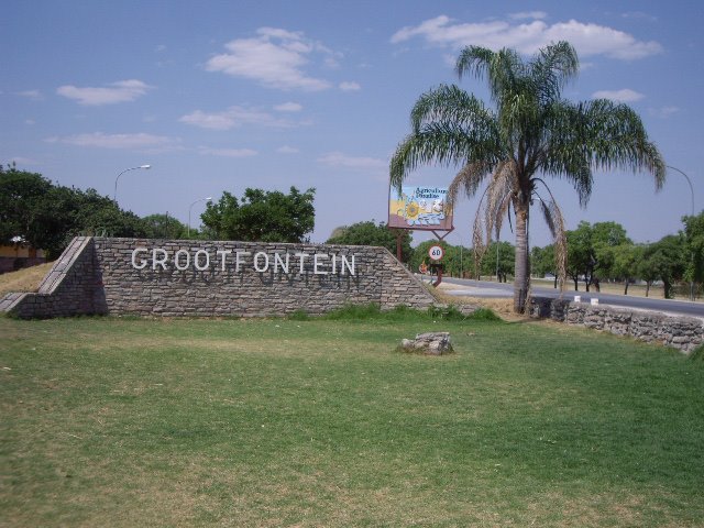
Grootfontein
Grootfontein (lit. 'great fountain') is a city with 26,839 inhabitants in the Otjozondjupa Region of central Namibia. It is one of the three towns in the Otavi Triangle, situated on the B8 national road that leads from Otavi to the Caprivi Strip.
The place was known to the Herero under the name Otjivanda. In 1885, 40 Boer families from the north-west of South Africa settled at Grootfontein. Part of the Dorsland trekkers, they were heading towards Angola. When that territory fell under Portuguese control, they turned back and established the Republic of Upingtonia at Grootfontein. Abandoned by 1887, it became the headquarters of the South West Africa Company in 1893.
In 1908, the Roman Catholic church established a mission in Grootfontein as the basis of their eventually successful attempt to establish missions in Kavango.
Like all the towns in the Otavi Triangle, Grootfontein is green in summer but drier in winter. In spring, jacaranda and flamboyant trees bloom in profusion. The town has an old German Schutztruppe fortress from the year 1896, which today houses a museum that expounds on the local history. The economic mainspring of the area were for many decades the Berg Aukas and Abenab mines to the north east of the town. These produced zinc and vanadium but have since closed. Namibia is a dolomite country and the carbonate deposits in the upper parts of the mine have yielded interesting fossils of simian or pongoid creatures that lived millions of years before modern humans evolved.
Twenty-four kilometres west of Grootfontein lies the huge Hoba meteorite. At more than 60 tons, it is the largest known meteorite on Earth, as well as the largest naturally occurring mass of iron known to exist on the planet's surface.
Grootfontein is a railhead on TransNamib, the national railway and transport system. The next station to the west is Otavi. Grootfontein is also home of Namibia's main military base which housed several units of the now departed South African Defence Force.
It has an airfield that can handle large transport carriers such as the Hercules C130, as well as commercial passenger aircraft.
The Grootfontein Show, an annual agricultural exhibition that has taken place since 1911, is the second largest annual entrepreneurial exhibition in the country, after the Windhoek Show.
Hub AI
Grootfontein AI simulator
(@Grootfontein_simulator)
Grootfontein
Grootfontein (lit. 'great fountain') is a city with 26,839 inhabitants in the Otjozondjupa Region of central Namibia. It is one of the three towns in the Otavi Triangle, situated on the B8 national road that leads from Otavi to the Caprivi Strip.
The place was known to the Herero under the name Otjivanda. In 1885, 40 Boer families from the north-west of South Africa settled at Grootfontein. Part of the Dorsland trekkers, they were heading towards Angola. When that territory fell under Portuguese control, they turned back and established the Republic of Upingtonia at Grootfontein. Abandoned by 1887, it became the headquarters of the South West Africa Company in 1893.
In 1908, the Roman Catholic church established a mission in Grootfontein as the basis of their eventually successful attempt to establish missions in Kavango.
Like all the towns in the Otavi Triangle, Grootfontein is green in summer but drier in winter. In spring, jacaranda and flamboyant trees bloom in profusion. The town has an old German Schutztruppe fortress from the year 1896, which today houses a museum that expounds on the local history. The economic mainspring of the area were for many decades the Berg Aukas and Abenab mines to the north east of the town. These produced zinc and vanadium but have since closed. Namibia is a dolomite country and the carbonate deposits in the upper parts of the mine have yielded interesting fossils of simian or pongoid creatures that lived millions of years before modern humans evolved.
Twenty-four kilometres west of Grootfontein lies the huge Hoba meteorite. At more than 60 tons, it is the largest known meteorite on Earth, as well as the largest naturally occurring mass of iron known to exist on the planet's surface.
Grootfontein is a railhead on TransNamib, the national railway and transport system. The next station to the west is Otavi. Grootfontein is also home of Namibia's main military base which housed several units of the now departed South African Defence Force.
It has an airfield that can handle large transport carriers such as the Hercules C130, as well as commercial passenger aircraft.
The Grootfontein Show, an annual agricultural exhibition that has taken place since 1911, is the second largest annual entrepreneurial exhibition in the country, after the Windhoek Show.