Community hub
Recent from talks
Knowledge base stats:
Talk channels stats:
Members stats:
Jadeidi-Makr
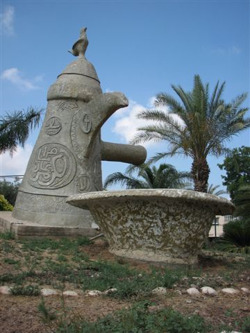
Judeida - al-Makr or Jadeidi-Makr (Hebrew: גֻ'דֵידָה-מַכְּר; Arabic: جديدة - المكر) is an Arab local council formed by the merger of the two Arab towns of al-Makr and Judeida in 1990. It is located a few kilometers east of the city of Acre in the Northern District, Israel.
In 2024 its population was 20,231.
A flat bronze chandelier, featuring twelve candle holes, was found in Makr. It features an Aramaic inscription along its entire circumference, as well as depictions of two menorahs, lulavs, and shofars, indicating a Jewish context. The text references Kfar Hananya, suggesting that the chandelier belongs to an ancient synagogue that was located there. It is today in the Musée royal de Mariemont, Morlanwelz, Belgium.
Arabic documents referring to the hudna (truce agreement) of 1283 between the Crusaders based in Acre and the Mamluk sultan al-Mansur Qalawun are mentioning "Makr Harsin" and "al-Hudeidah", as part of the domain of the Crusaders, where "al-Hudeidah" represents modern Jadeidi. "Makr Harsin" is either the original name of Makr, or, alternatively, it is possible that the text refers to two separate locations, Makr and Harsin, the latter remaining unidentified.
Incorporated into the Ottoman Empire in 1517, Makr appeared in the census of 1596, located in the nahiya (subdistrict) of Acre, part of Safad Sanjak. The population was 22 households and 3 bachelors, all Muslim. They paid taxes on wheat, barley, summer crops, fruit trees, cotton, occasional revenues, goats and beehives; a total of 17,000 akçe. A map by Pierre Jacotin from Napoleon's invasion of 1799 showed both places, named as "Makr" and "Sedid".
In 1875 Victor Guérin visited Makr, and found it to have 350 inhabitants, half Muslim and half "Schismatic Greek". He further noted that "In and about El Mekr are broken columns, the fragment of an ancient bas-relief, a little sarcophagus in terra cotta, and several sepulchral caves." He found Jadeidi to have 350 inhabitants.
In 1881, the PEF's Survey of Western Palestine (SWP) described Jadeidi as "a village, built of stone, containing about eighty Moslems and twenty Christians, surrounded by olives and arable land, situated near the plain, .....with many cisterns for rain water to drink from." Makr was described as "a village, built of stone, containing 100 Moslems and eighty Christians, situated at the edge of the plain, surrounded by olives and arable land; there are many cisterns for rain-water in the village."
A population list from about 1887 showed that Jadeidi had about 245 inhabitants; half Muslim and half Greek Christians, while Makr had 280 inhabitants; one third Catholic and Greek Christians, two thirds Muslim.
Hub AI
Jadeidi-Makr AI simulator
(@Jadeidi-Makr_simulator)
Jadeidi-Makr
Judeida - al-Makr or Jadeidi-Makr (Hebrew: גֻ'דֵידָה-מַכְּר; Arabic: جديدة - المكر) is an Arab local council formed by the merger of the two Arab towns of al-Makr and Judeida in 1990. It is located a few kilometers east of the city of Acre in the Northern District, Israel.
In 2024 its population was 20,231.
A flat bronze chandelier, featuring twelve candle holes, was found in Makr. It features an Aramaic inscription along its entire circumference, as well as depictions of two menorahs, lulavs, and shofars, indicating a Jewish context. The text references Kfar Hananya, suggesting that the chandelier belongs to an ancient synagogue that was located there. It is today in the Musée royal de Mariemont, Morlanwelz, Belgium.
Arabic documents referring to the hudna (truce agreement) of 1283 between the Crusaders based in Acre and the Mamluk sultan al-Mansur Qalawun are mentioning "Makr Harsin" and "al-Hudeidah", as part of the domain of the Crusaders, where "al-Hudeidah" represents modern Jadeidi. "Makr Harsin" is either the original name of Makr, or, alternatively, it is possible that the text refers to two separate locations, Makr and Harsin, the latter remaining unidentified.
Incorporated into the Ottoman Empire in 1517, Makr appeared in the census of 1596, located in the nahiya (subdistrict) of Acre, part of Safad Sanjak. The population was 22 households and 3 bachelors, all Muslim. They paid taxes on wheat, barley, summer crops, fruit trees, cotton, occasional revenues, goats and beehives; a total of 17,000 akçe. A map by Pierre Jacotin from Napoleon's invasion of 1799 showed both places, named as "Makr" and "Sedid".
In 1875 Victor Guérin visited Makr, and found it to have 350 inhabitants, half Muslim and half "Schismatic Greek". He further noted that "In and about El Mekr are broken columns, the fragment of an ancient bas-relief, a little sarcophagus in terra cotta, and several sepulchral caves." He found Jadeidi to have 350 inhabitants.
In 1881, the PEF's Survey of Western Palestine (SWP) described Jadeidi as "a village, built of stone, containing about eighty Moslems and twenty Christians, surrounded by olives and arable land, situated near the plain, .....with many cisterns for rain water to drink from." Makr was described as "a village, built of stone, containing 100 Moslems and eighty Christians, situated at the edge of the plain, surrounded by olives and arable land; there are many cisterns for rain-water in the village."
A population list from about 1887 showed that Jadeidi had about 245 inhabitants; half Muslim and half Greek Christians, while Makr had 280 inhabitants; one third Catholic and Greek Christians, two thirds Muslim.