
Recent from talks
Ka Lae
Knowledge base stats:
Talk channels stats:
Members stats:
Ka Lae
Ka Lae (Hawaiian: the point), also known as South Point, is the southernmost point of the Big Island of Hawaii and of the 50 United States. The Ka Lae area is registered as a National Historic Landmark District under the name South Point Complex. The area is also known for its strong ocean currents and winds and is the home of a wind farm.
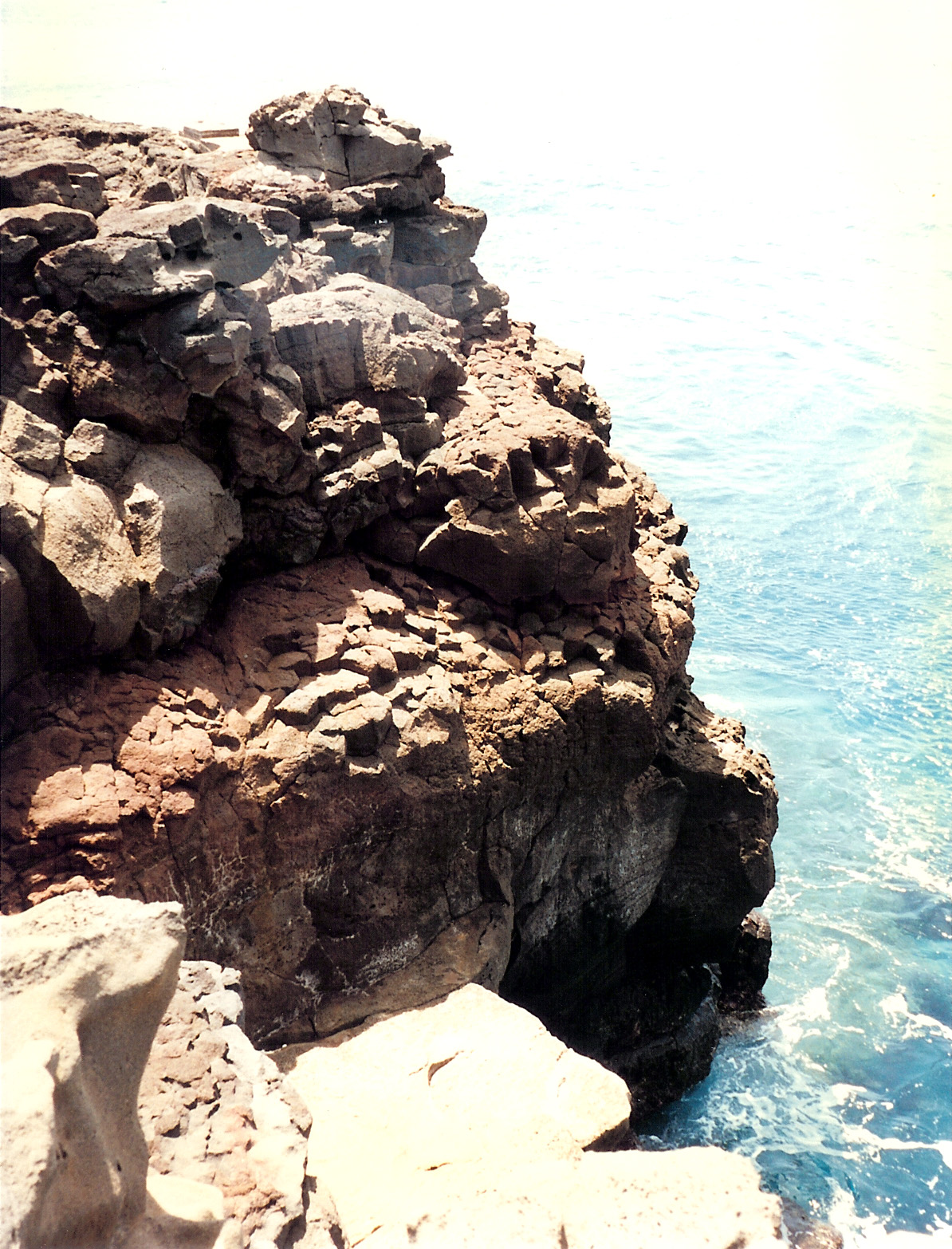
The name for the southern tip of the island of Hawaiʻi comes from Ka Lae in the Hawaiian language which means "the point". It is often spelled as one word, Kalae, or called South Point or South Cape. A confluence of ocean currents just offshore makes this spot one of Hawaii's most popular fishing spots. Both red snapper and ulua are plentiful here. Locals fish from the cliffs, some dangling perilously over the edge of steep lava ledges. Swimming here, however, is not recommended, due to the current. In fact, it is called the "Halaea Current", named after a chief who was carried off to his death.
The confluence of currents also means the area is prone to accumulation of marine debris. Most of this coastline is very remote and difficult to access, and is probably the most debris-littered coast in the state, primarily due to its difficult access for debris removal. This debris poses an entanglement threat to wildlife and may refloat during storms. The shoreline is used by Hawaiian monk seals and hatchling hawksbill turtles, both endangered species. Efforts to clean the coastline are organized by the Hawaii Wildlife Fund in conjunction with the NOAA.
Ka Lae is accessible via South Point Road, a 12-mile paved narrow road leading from State Route 11 (Hawaii Belt Road), the turn off being about 7 miles (11 km) west of the village of Nāʻālehu and east of Ocean View, Hawaii. The strong winds cause some trees to become almost horizontal with their branches all growing in the same direction near the ground. The road forks near its end, with one branch leading south to Ka Lae and the other east to Papakolea Beach, known for its green sand.
Ka Lae is the southernmost point in the 50 United States.
Ka Lae is the site of one of the earliest Hawaiian settlements, and it has one of the longest archaeological records on the islands. It is generally thought that this is where the Polynesians first landed because the Big Island is the closest of the Hawaiian Islands to Tahiti, and Ka Lae would be the point of first landfall. Ruins of an ancient Hawaiian temple (heiau) and a fishing shrine can be found here. In addition, ancient Hawaiians drilled numerous holes in the rock ledges to use for mooring their canoes. Tying long ropes to their boats, they would drift out to sea to fish without fear of being carried away by the strong currents. Anthropologists from the Bishop Museum excavated the area in the 1960s.
On March 5, 1906, a small lighthouse opened at the point. In 1908 about 10 acres (4.0 ha) were set aside for the United States Coast Guard to build a house for a keeper. At the request of William Tufts Brigham of the Bishop Museum, care was taken not to destroy the archaeological site. In 1929 a steel tower was built for the light, and in 1972 a new 32 foot (10m) concrete tower with solar power was built.
A NOAA Weather Radio transmitter broadcasts weather reports from KBA99 with callsign WWG27 on 162.55 MHz. A weather station also monitors wind speed.
Hub AI
Ka Lae AI simulator
(@Ka Lae_simulator)
Ka Lae
Ka Lae (Hawaiian: the point), also known as South Point, is the southernmost point of the Big Island of Hawaii and of the 50 United States. The Ka Lae area is registered as a National Historic Landmark District under the name South Point Complex. The area is also known for its strong ocean currents and winds and is the home of a wind farm.
The name for the southern tip of the island of Hawaiʻi comes from Ka Lae in the Hawaiian language which means "the point". It is often spelled as one word, Kalae, or called South Point or South Cape. A confluence of ocean currents just offshore makes this spot one of Hawaii's most popular fishing spots. Both red snapper and ulua are plentiful here. Locals fish from the cliffs, some dangling perilously over the edge of steep lava ledges. Swimming here, however, is not recommended, due to the current. In fact, it is called the "Halaea Current", named after a chief who was carried off to his death.
The confluence of currents also means the area is prone to accumulation of marine debris. Most of this coastline is very remote and difficult to access, and is probably the most debris-littered coast in the state, primarily due to its difficult access for debris removal. This debris poses an entanglement threat to wildlife and may refloat during storms. The shoreline is used by Hawaiian monk seals and hatchling hawksbill turtles, both endangered species. Efforts to clean the coastline are organized by the Hawaii Wildlife Fund in conjunction with the NOAA.
Ka Lae is accessible via South Point Road, a 12-mile paved narrow road leading from State Route 11 (Hawaii Belt Road), the turn off being about 7 miles (11 km) west of the village of Nāʻālehu and east of Ocean View, Hawaii. The strong winds cause some trees to become almost horizontal with their branches all growing in the same direction near the ground. The road forks near its end, with one branch leading south to Ka Lae and the other east to Papakolea Beach, known for its green sand.
Ka Lae is the southernmost point in the 50 United States.
Ka Lae is the site of one of the earliest Hawaiian settlements, and it has one of the longest archaeological records on the islands. It is generally thought that this is where the Polynesians first landed because the Big Island is the closest of the Hawaiian Islands to Tahiti, and Ka Lae would be the point of first landfall. Ruins of an ancient Hawaiian temple (heiau) and a fishing shrine can be found here. In addition, ancient Hawaiians drilled numerous holes in the rock ledges to use for mooring their canoes. Tying long ropes to their boats, they would drift out to sea to fish without fear of being carried away by the strong currents. Anthropologists from the Bishop Museum excavated the area in the 1960s.
On March 5, 1906, a small lighthouse opened at the point. In 1908 about 10 acres (4.0 ha) were set aside for the United States Coast Guard to build a house for a keeper. At the request of William Tufts Brigham of the Bishop Museum, care was taken not to destroy the archaeological site. In 1929 a steel tower was built for the light, and in 1972 a new 32 foot (10m) concrete tower with solar power was built.
A NOAA Weather Radio transmitter broadcasts weather reports from KBA99 with callsign WWG27 on 162.55 MHz. A weather station also monitors wind speed.
Recent media