
Community hub
Recent from talks
Contribute something
Nothing was collected or created yet.
Kamkalykol
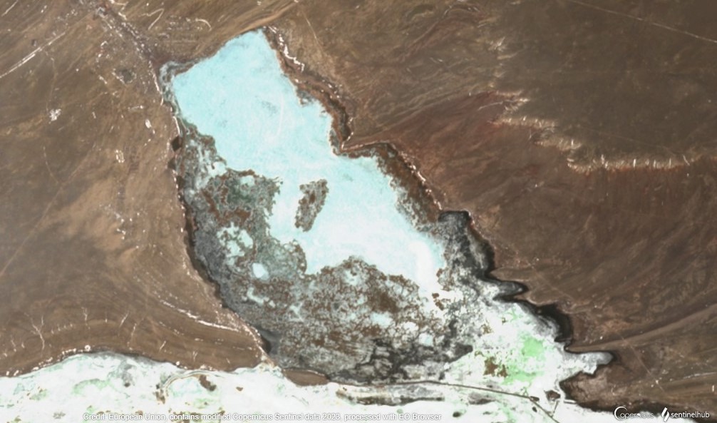
View on WikipediaKamkalykol (Kazakh: Қамқалыкөл) is a lake in the Moiynkum District, Jambyl Region, Kazakhstan.[1]
Key Information


The lake is located 30 kilometers (19 mi) to the ESE of Ulanbel village. The ruins of ghost town Kishi Kamkaly, abandoned in 2019, lie by the northern end of the lake. The lake water is used for watering livestock grazing in the surrounding area.[1][2][3]
Geography
[edit]Kamkalykol lies in the lower Shu river basin to the north of the river channel. Lake Karakol is located 9 kilometers (5.6 mi) to the northwest and lake Zhalanash 22 kilometers (14 mi) to the west. Kamkalykol stretches roughly from northwest to southeast for almost 5 kilometers (3.1 mi). To the south it is bound by the Shu floodplain.[3]
Kamkalykol freezes over in mid-November and thaws in March. On average the water level rises right after the melting of the snow in the spring and decreases in the summer.[1][2]
 |
Flora
[edit]The lake is swampy, especially in its southern part. There is abundant reed growth by the lakeshore and in shallow areas.[2]
See also
[edit]References
[edit]- ^ a b c "L-42 Topographic Chart (in Russian)". Retrieved 20 January 2023.
- ^ a b c ATAMEKEN: Geographical encyclopedia / General ed. B. O. Jacob. - Almaty "Kazakh Encyclopedia", 2011. - 648 pages. ISBN 9965-893-70-5
- ^ a b Google Earth
External links
[edit] Media related to Kamkalykol at Wikimedia Commons
- Подземные моря Уфы Ахмедсафина
- Chu-Talas, Kazakhstan
- Об утверждении перечня объектов государственного природно-заповедного фонда республиканского значения (On approval of the list of objects of the state natural reserve fund of republican significance)