
Community hub
0 subscribers8 pages, 0 posts
Recent from talks
All channels
Be the first to start a discussion here.
Be the first to start a discussion here.
Be the first to start a discussion here.
Be the first to start a discussion here.
Contribute something
Welcome to the community hub built to collect knowledge and have discussions related to Kaprun.
Nothing was collected or created yet.
Kaprun
View on Wikipediafrom Wikipedia
Not found
Kaprun
View on Grokipediafrom Grokipedia
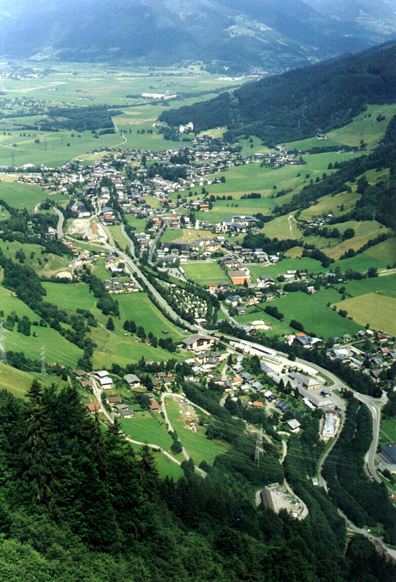
Kaprun is a municipality in the Zell am See District of the Austrian state of Salzburg, encompassing an area of 100.5 square kilometers at an elevation of 786 meters in the Kaprun Valley on the periphery of the Hohe Tauern National Park.[1] With a resident population of 3,130, it serves as a key hub in the Zell am See-Kaprun tourism region, renowned for its alpine landscapes and outdoor recreation opportunities.[2] The locality features prehistoric settlements dating to the Bronze Age and medieval structures such as the 12th-century Kaprun Castle, which functioned as a fortress and noble residence overlooking the valley.[3] Kaprun's economy centers on year-round tourism, particularly glacier skiing on the Kitzsteinhorn mountain, where lifts ascend to 3,000 meters, supported by 62.5 kilometers of pistes and reliable snow conditions from October to May.[4] Additionally, the Kaprun hydroelectric complex, among Europe's largest, generates peak electricity covering about 10% of Austria's demand through water power from high-alpine reservoirs, though its dams were initially built during World War II using forced labor before symbolizing post-war national reconstruction.[5][6][7] The municipality achieved tragic prominence in 2000 when a fire in the Gletscherbahn Kaprun 2 funicular tunnel claimed 155 lives, primarily skiers en route to the glacier, due to an overheated hydraulic component igniting in the unventilated ascent path.[8][9]
Kaprun exhibits a continental alpine climate, marked by pronounced seasonal variations, with cold, snowy winters and mild summers conducive to glacier preservation at higher elevations. Average annual temperatures hover around 4.5°C, with July means reaching approximately 10–12°C and January lows often below -5°C, supporting extensive snow cover from October through May.[15][16]
Precipitation is abundant, averaging 1,696–1,755 mm annually, primarily as snowfall in the mountainous terrain, which totals over 181 rainy or snowy days per year and sustains the Kitzsteinhorn glacier's year-round skiing capabilities.[15][17][18]
Environmentally, the area encompasses the Hohe Tauern National Park, hosting exceptional biodiversity including 3,500 plant species and 15,000 animal species amid glacial valleys and peaks exceeding 3,000 m. The Kitzsteinhorn glacier, a prominent feature, is experiencing retreat with thickness reductions exceeding 1 m per year, alongside rising permafrost and air temperatures documented since 2010 at the on-site Open-Air Laboratory, which has also noted a tenfold increase in rockfall incidents linked to thawing conditions.[19][20][21]
Geography
Location and Terrain
Kaprun is a municipality in the Zell am See District of Salzburg, Austria, within the Pinzgau region of the Eastern Alps. It occupies an area of 100.41 square kilometers and lies at coordinates 47°16′ N, 12°46′ E.[10] The main village center sits at an elevation of 786 meters above sea level, nestled in a valley flanked by steep mountain slopes.[11] The terrain is predominantly alpine, characterized by a transition from forested lower valleys to rugged high-altitude plateaus and glacial zones. Kaprun borders the Hohe Tauern National Park, with its northern flanks rising toward peaks like the Großes Wiesbachhorn at 3,564 meters and the Kitzsteinhorn massif, which features year-round glaciation.[12] This diverse topography includes gentle, tree-lined slopes near the village suitable for beginner skiing and hiking, escalating to steep, glaciated terrain above 2,000 meters that supports advanced mountaineering and extensive piste networks.[13] The surrounding landscape also encompasses alpine meadows, moraines, and reservoirs integrated into the natural contours, shaping a harsh yet accessible mountainous environment.[14]Climate and Environmental Features
Kaprun exhibits a continental alpine climate, marked by pronounced seasonal variations, with cold, snowy winters and mild summers conducive to glacier preservation at higher elevations. Average annual temperatures hover around 4.5°C, with July means reaching approximately 10–12°C and January lows often below -5°C, supporting extensive snow cover from October through May.[15][16]
Precipitation is abundant, averaging 1,696–1,755 mm annually, primarily as snowfall in the mountainous terrain, which totals over 181 rainy or snowy days per year and sustains the Kitzsteinhorn glacier's year-round skiing capabilities.[15][17][18]
Environmentally, the area encompasses the Hohe Tauern National Park, hosting exceptional biodiversity including 3,500 plant species and 15,000 animal species amid glacial valleys and peaks exceeding 3,000 m. The Kitzsteinhorn glacier, a prominent feature, is experiencing retreat with thickness reductions exceeding 1 m per year, alongside rising permafrost and air temperatures documented since 2010 at the on-site Open-Air Laboratory, which has also noted a tenfold increase in rockfall incidents linked to thawing conditions.[19][20][21]