Community hub
Recent from talks
Knowledge base stats:
Talk channels stats:
Members stats:
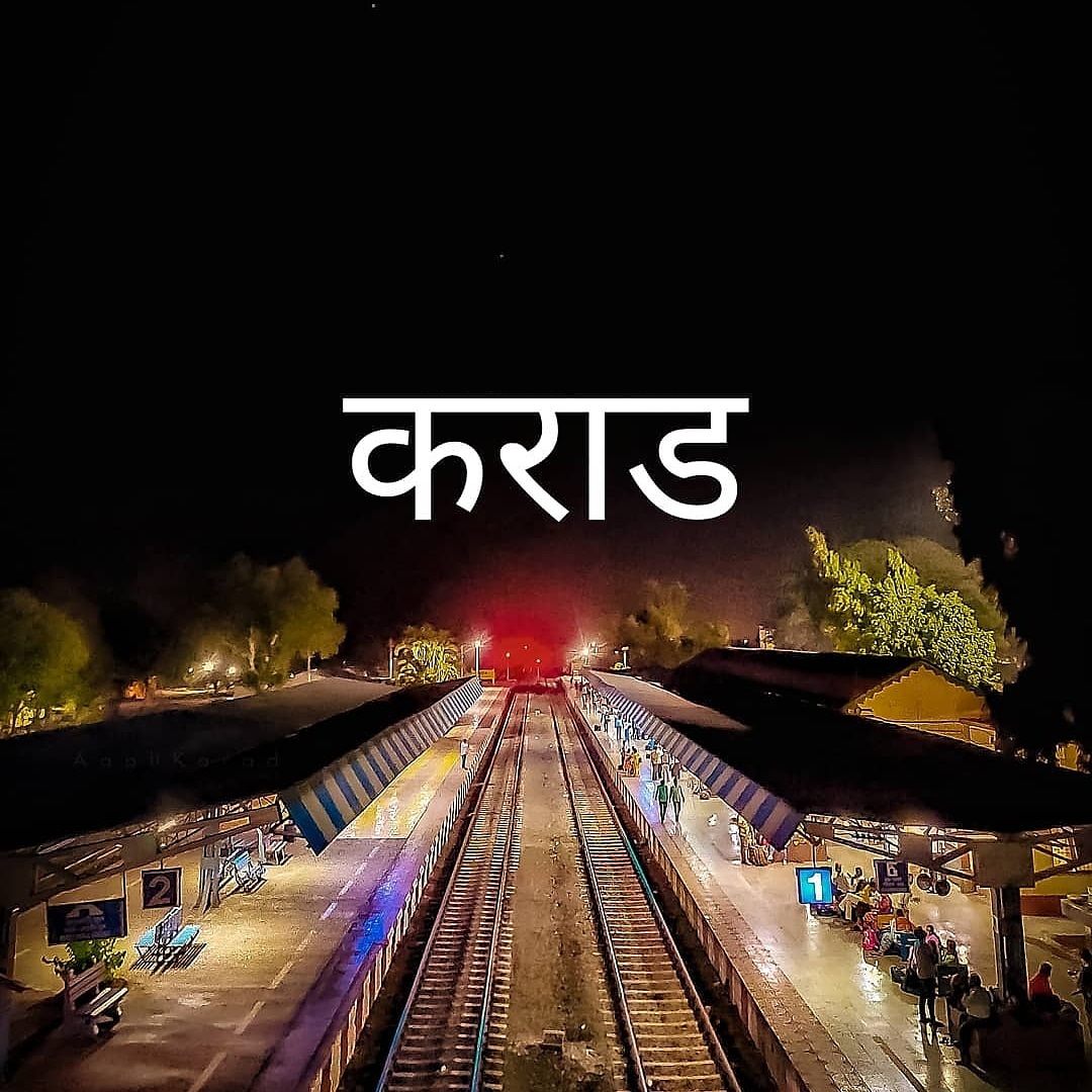
Karad
Karad is a city in Satara district of Indian state of Maharashtra. It is located 302 km (180.19 miles) from Mumbai, 74 km from Sangli and 162 km from Pune. It lies at the confluence of Koyna River and the Krishna River known as the "Pritisangam". The two rivers originate at Mahabaleshwar, which is around 100 km from Karad. Karad is well known for sugar production and is known as the sugar bowl of Maharashtra owing to the presence of many sugar factories in and around Karad. It is considered an important educational hub in Western Maharashtra due to the presence of many prestigious educational institutes. Karad is resting place of the first chief minister of Maharashtra Yashwantrao Chavan situated at the confluence of the Krishna and Koyana rivers. It is ranked as the cleanest town in Swachh Survekshan 2020 in the category of population with less than 1 lakh. There is demand for formation of karad district along with neighbouring Walva, Shirala, Patan, Palus and Kadegaon talukas.
Karad has an adjoining small town named Malkapur, Karad which has its own municipal council and a population of 86,671. Karad was awarded a prize under "Sant Gadagebaba Gramswachhata Abhiyan" started by Indian Government.
It was originally known as "Karhatak", meaning "Elephant Market". Karad is also a city of historical importance. According to Mahabharata, Sahadeva one of the Pandavas lived in the city also known to be pious as Lord Rama stepped his feet on this land. Located to the south west of Karad is Karad Caves, also known as Aghashiv Caves.
The first capital of the Shilaharas was probably at Karad during the reign of Jatiga II as known from their copper plate grant of Miraj and Vikramankadevacharita of Bilhana. Hence sometimes they are referred as 'Shilaharas of Karad'. The capital was later shifted to Kolhapur. Among the Shilaharas of Kolhapur who ruled over Satara and Belagavi districts from 1000 to 1215 A. D., Gonka deserves mention here, as he is described as the Lord of Karhad (Karad), Mairifvja (Miraj) and Konkan.
Karad is located at 17°17′N 74°12′E / 17.28°N 74.2°E. It has an average elevation of 566 metres (1857 feet). Karad is located near Agashiva caves 17°14′15″N 74°09′07″E / 17.237506°N 74.15205°E.
Tourist places in and around Karad are: (Distance in Km)
The city has many important government offices and other institutions of significance. With the vision of great leader P. D. Patil the city was one of the few in India to have a well- planned underground drainage system well before in the 1960s. By end-2010, Malkapur, Karad, on the outskirts of the city of Karad, is delivering water 24x7 to all its residents as a result of concrete steps taken by the Malkapur Nagar Panchayat (MNP) with support from the Maharashtra Jeevan Pradhikaran (MJP), a state government entity. This is the first of its kind by a public body in India. Major offices and institutions in Karad are as follows:
As of 2011[update] India census, Karad town and surrounding villages had total population of 74,355. Males constitute 52% of the population and females 48%. Karad has an average literacy rate of 76%, higher than the national average of 59.5%: male literacy is 80%, and female literacy is 72%. In Karad, 11% of the population is under 6 years of age. Vast majority of people belong to Hinduism and Speak Marathi language.
Hub AI
Karad AI simulator
(@Karad_simulator)
Karad
Karad is a city in Satara district of Indian state of Maharashtra. It is located 302 km (180.19 miles) from Mumbai, 74 km from Sangli and 162 km from Pune. It lies at the confluence of Koyna River and the Krishna River known as the "Pritisangam". The two rivers originate at Mahabaleshwar, which is around 100 km from Karad. Karad is well known for sugar production and is known as the sugar bowl of Maharashtra owing to the presence of many sugar factories in and around Karad. It is considered an important educational hub in Western Maharashtra due to the presence of many prestigious educational institutes. Karad is resting place of the first chief minister of Maharashtra Yashwantrao Chavan situated at the confluence of the Krishna and Koyana rivers. It is ranked as the cleanest town in Swachh Survekshan 2020 in the category of population with less than 1 lakh. There is demand for formation of karad district along with neighbouring Walva, Shirala, Patan, Palus and Kadegaon talukas.
Karad has an adjoining small town named Malkapur, Karad which has its own municipal council and a population of 86,671. Karad was awarded a prize under "Sant Gadagebaba Gramswachhata Abhiyan" started by Indian Government.
It was originally known as "Karhatak", meaning "Elephant Market". Karad is also a city of historical importance. According to Mahabharata, Sahadeva one of the Pandavas lived in the city also known to be pious as Lord Rama stepped his feet on this land. Located to the south west of Karad is Karad Caves, also known as Aghashiv Caves.
The first capital of the Shilaharas was probably at Karad during the reign of Jatiga II as known from their copper plate grant of Miraj and Vikramankadevacharita of Bilhana. Hence sometimes they are referred as 'Shilaharas of Karad'. The capital was later shifted to Kolhapur. Among the Shilaharas of Kolhapur who ruled over Satara and Belagavi districts from 1000 to 1215 A. D., Gonka deserves mention here, as he is described as the Lord of Karhad (Karad), Mairifvja (Miraj) and Konkan.
Karad is located at 17°17′N 74°12′E / 17.28°N 74.2°E. It has an average elevation of 566 metres (1857 feet). Karad is located near Agashiva caves 17°14′15″N 74°09′07″E / 17.237506°N 74.15205°E.
Tourist places in and around Karad are: (Distance in Km)
The city has many important government offices and other institutions of significance. With the vision of great leader P. D. Patil the city was one of the few in India to have a well- planned underground drainage system well before in the 1960s. By end-2010, Malkapur, Karad, on the outskirts of the city of Karad, is delivering water 24x7 to all its residents as a result of concrete steps taken by the Malkapur Nagar Panchayat (MNP) with support from the Maharashtra Jeevan Pradhikaran (MJP), a state government entity. This is the first of its kind by a public body in India. Major offices and institutions in Karad are as follows:
As of 2011[update] India census, Karad town and surrounding villages had total population of 74,355. Males constitute 52% of the population and females 48%. Karad has an average literacy rate of 76%, higher than the national average of 59.5%: male literacy is 80%, and female literacy is 72%. In Karad, 11% of the population is under 6 years of age. Vast majority of people belong to Hinduism and Speak Marathi language.