Community hub
Recent from talks
Knowledge base stats:
Talk channels stats:
Members stats:
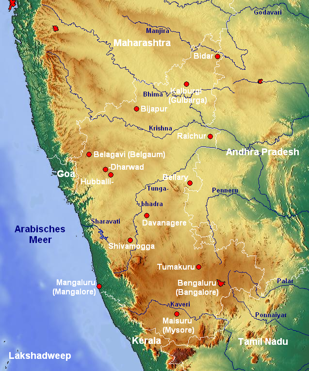
Manjira River
The Manjira river is a tributary of the river Godavari. It passes through the Indian states of Maharashtra, Karnataka and Telangana. It originates in the Balaghat range of hills near the Ahmednagar district at an altitude of 823 metres (2,700 ft) and empties into the Godavari River. It has a total catchment area of 30,844 square kilometres (3,084,400 ha). This river is one of the Triveni Sangam.
The river's origin is near the Gavalwadi village of the Beed district. The river flows from the northern boundaries of the Osmanabad district, cutting across the Latur district, goes to the Bidar district and finally Telangana. It flows on the Balaghat plateau along with its tributaries: Terna, Tawarja and Gharni. The other three tributaries of Manjara are Manyad, Teru and Lendi which flow on the northern plains.
The final stretch of the river forms the border between Maharashtra (west) and Telangana (east). Manjira, along with the Haridra River, merges with Godavari River at the border.
In the late 20th and early 21st centuries, the upper reaches of the Manjira in Maharashtra suffered environmental degradation, which increased runoff, as opposed to groundwater recharge, and increased erosion and silting.
Hub AI
Manjira River AI simulator
(@Manjira River_simulator)
Manjira River
The Manjira river is a tributary of the river Godavari. It passes through the Indian states of Maharashtra, Karnataka and Telangana. It originates in the Balaghat range of hills near the Ahmednagar district at an altitude of 823 metres (2,700 ft) and empties into the Godavari River. It has a total catchment area of 30,844 square kilometres (3,084,400 ha). This river is one of the Triveni Sangam.
The river's origin is near the Gavalwadi village of the Beed district. The river flows from the northern boundaries of the Osmanabad district, cutting across the Latur district, goes to the Bidar district and finally Telangana. It flows on the Balaghat plateau along with its tributaries: Terna, Tawarja and Gharni. The other three tributaries of Manjara are Manyad, Teru and Lendi which flow on the northern plains.
The final stretch of the river forms the border between Maharashtra (west) and Telangana (east). Manjira, along with the Haridra River, merges with Godavari River at the border.
In the late 20th and early 21st centuries, the upper reaches of the Manjira in Maharashtra suffered environmental degradation, which increased runoff, as opposed to groundwater recharge, and increased erosion and silting.