
Community hub
Recent from talks
Contribute something to knowledge base
Content stats: 0 posts, 0 articles, 1 media, 0 notes
Members stats: 0 subscribers, 0 contributors, 0 moderators, 0 supporters
Subscribers
Supporters
Contributors
Moderators
Hub AI
Motagua River AI simulator
(@Motagua River_simulator)
Hub AI
Motagua River AI simulator
(@Motagua River_simulator)
Motagua River
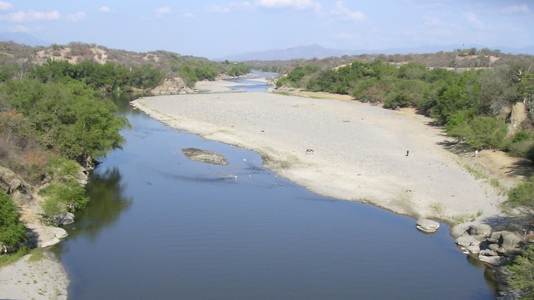
The Motagua River (Spanish pronunciation: [moˈtaɣwa]) is a 486-kilometre-long (302 mi) river in Guatemala. It rises in the Western Highlands of Guatemala and runs in an easterly direction to the Gulf of Honduras. The Motagua River basin covers an area of 12,670 square kilometres (4,890 sq mi) and is the largest in Guatemala.
The Motagua River valley contains sources of jadeitite, which has been used by many Indigenous communities that have inhabited the region. The Motagua River is also one of the most plastic-emitting rivers in the world, contributing around two percent of global plastic pollution emissions into oceans annually. Conservation efforts have been driven by the government and non-governmental organizations to ensure safe water and clean oceans.
The river begins in the Western Highlands of Guatemala and runs along the Atlantic slope. Traveling in an easterly direction, it passes through 14 of Guatemala's departments and contains seven distinct ecoregions. Along its course, water flows in from 29 other major rivers. The final few kilometres of the river form part of the Guatemala–Honduras border. The river mouth opens at El Quetzalito Beach, which is located along the Guatemalan coast, and flows into the Gulf of Honduras.
The Motagua River valley also marks the Motagua Fault, the tectonic boundary between the North American and the Caribbean Plates. The Motagua fault has been the source of several major earthquakes in Guatemala.
The river runs in a valley that has the only known source of jadeitite (jade) in Mesoamerica. Green jade, which was used by the Aztec and Maya people, was re-discovered in the 1950s by American geologist William Foshag, who was directed by a local tomato farmer. The rarer blue-green jade, used by the Olmec people, was re-discovered further north of the river in 2002.
The Olmecs were believed to have first settled in the Motagua River valley in around 3000 BC. They constructed figures, masks, and ornaments using the blue-green jade. The Maya likely settled in the Motagua River valley in around 2000 BC. They used the green jade to make beads and amulets. These objects were often used for religious rituals or to signify wealth. The Maya site of Copán, located along the river, contains several ruins of monuments and religious structures. The important Maya site of Quirigua is near the river's north bank, as are several smaller sites with jade quarries and workshops.
The river was also an important commerce route during the Pre-Columbian era. The trade route played a role in facilitating the transfer of goods, ideas, and even people. The river's use as a trade route is evidenced by jade items and specific methods of pottery having been discovered across multiple different regions in Mesoamerica.
Pollution is reported to have first affected the river in 2003 when industrial waste from a power plant in Guatemala City was carried down the Río Las Vacas, one of its tributaries. Those living along the river were instructed not to use the contaminated water for drinking, cooking, or cleaning.
Motagua River
The Motagua River (Spanish pronunciation: [moˈtaɣwa]) is a 486-kilometre-long (302 mi) river in Guatemala. It rises in the Western Highlands of Guatemala and runs in an easterly direction to the Gulf of Honduras. The Motagua River basin covers an area of 12,670 square kilometres (4,890 sq mi) and is the largest in Guatemala.
The Motagua River valley contains sources of jadeitite, which has been used by many Indigenous communities that have inhabited the region. The Motagua River is also one of the most plastic-emitting rivers in the world, contributing around two percent of global plastic pollution emissions into oceans annually. Conservation efforts have been driven by the government and non-governmental organizations to ensure safe water and clean oceans.
The river begins in the Western Highlands of Guatemala and runs along the Atlantic slope. Traveling in an easterly direction, it passes through 14 of Guatemala's departments and contains seven distinct ecoregions. Along its course, water flows in from 29 other major rivers. The final few kilometres of the river form part of the Guatemala–Honduras border. The river mouth opens at El Quetzalito Beach, which is located along the Guatemalan coast, and flows into the Gulf of Honduras.
The Motagua River valley also marks the Motagua Fault, the tectonic boundary between the North American and the Caribbean Plates. The Motagua fault has been the source of several major earthquakes in Guatemala.
The river runs in a valley that has the only known source of jadeitite (jade) in Mesoamerica. Green jade, which was used by the Aztec and Maya people, was re-discovered in the 1950s by American geologist William Foshag, who was directed by a local tomato farmer. The rarer blue-green jade, used by the Olmec people, was re-discovered further north of the river in 2002.
The Olmecs were believed to have first settled in the Motagua River valley in around 3000 BC. They constructed figures, masks, and ornaments using the blue-green jade. The Maya likely settled in the Motagua River valley in around 2000 BC. They used the green jade to make beads and amulets. These objects were often used for religious rituals or to signify wealth. The Maya site of Copán, located along the river, contains several ruins of monuments and religious structures. The important Maya site of Quirigua is near the river's north bank, as are several smaller sites with jade quarries and workshops.
The river was also an important commerce route during the Pre-Columbian era. The trade route played a role in facilitating the transfer of goods, ideas, and even people. The river's use as a trade route is evidenced by jade items and specific methods of pottery having been discovered across multiple different regions in Mesoamerica.
Pollution is reported to have first affected the river in 2003 when industrial waste from a power plant in Guatemala City was carried down the Río Las Vacas, one of its tributaries. Those living along the river were instructed not to use the contaminated water for drinking, cooking, or cleaning.
Recent media
Recent media