
Community hub
Recent from talks
Contribute something
Nothing was collected or created yet.
Pingyi County
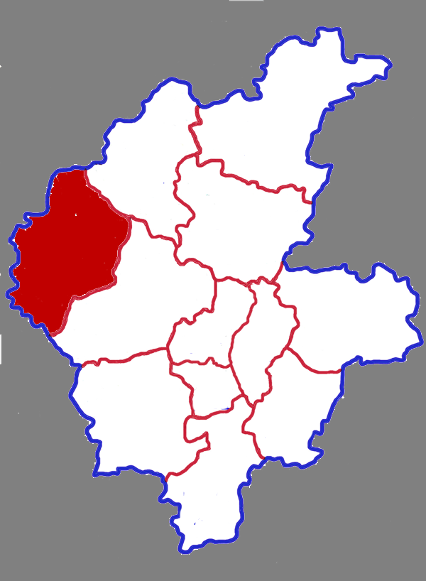
View on WikipediaPingyi County (Chinese: 平邑县; pinyin: Píngyì Xiàn) is a county in the south of Shandong Province, China. It is the westernmost county-level division of the prefecture-level city of Linyi. It has a land area of 1,824.79 km2 (704.56 sq mi) and a population of 980,000 in 2001. Its special local products are honeysuckle and granite. The second highest mountain in Shandong, Mount Meng, is located in Bianqiao Town.
Key Information


Administrative divisions
[edit]Pingyi County consists of 14 towns and 2 townships.
- Towns
- Pingyi (平邑镇)
- Zhongcun (仲村镇)
- Wutai (武台镇)
- Baotai (保太镇)
- Bailin (柏林镇)
- Bianqiao (卞桥镇)
- Difang (地方镇)
- Tongshi (铜石镇)
- Wenshui (温水镇)
- Liuyu (流峪镇)
- Zhengcheng (郑城镇)
- Baiyan (白彦镇)
- Linjian (临涧镇)
- Fengyang (丰阳镇)
- Townships
- Ziqiu Township (资邱乡)
- Weizhuang Township (魏庄乡)
Climate
[edit]It is a monsoon regional continental climate characterized by cold winters, hot summers, abundant light and long frost-free periods.
| Climate data for Pingyi, elevation 161 m (528 ft), (1991–2020 normals, extremes 1981–2010) | |||||||||||||
|---|---|---|---|---|---|---|---|---|---|---|---|---|---|
| Month | Jan | Feb | Mar | Apr | May | Jun | Jul | Aug | Sep | Oct | Nov | Dec | Year |
| Record high °C (°F) | 16.1 (61.0) |
24.4 (75.9) |
28.6 (83.5) |
34.1 (93.4) |
38.0 (100.4) |
39.7 (103.5) |
41.9 (107.4) |
37.4 (99.3) |
37.0 (98.6) |
35.1 (95.2) |
25.7 (78.3) |
18.5 (65.3) |
41.9 (107.4) |
| Mean daily maximum °C (°F) | 4.7 (40.5) |
8.2 (46.8) |
14.4 (57.9) |
21.4 (70.5) |
26.8 (80.2) |
30.5 (86.9) |
31.3 (88.3) |
30.3 (86.5) |
26.9 (80.4) |
21.3 (70.3) |
13.5 (56.3) |
6.6 (43.9) |
19.7 (67.4) |
| Daily mean °C (°F) | −0.3 (31.5) |
2.8 (37.0) |
8.5 (47.3) |
15.3 (59.5) |
21.0 (69.8) |
24.9 (76.8) |
26.8 (80.2) |
25.8 (78.4) |
21.6 (70.9) |
15.5 (59.9) |
8.0 (46.4) |
1.6 (34.9) |
14.3 (57.7) |
| Mean daily minimum °C (°F) | −4.1 (24.6) |
−1.4 (29.5) |
3.5 (38.3) |
9.9 (49.8) |
15.5 (59.9) |
20.0 (68.0) |
23.1 (73.6) |
22.3 (72.1) |
17.3 (63.1) |
10.8 (51.4) |
3.8 (38.8) |
−2.3 (27.9) |
9.9 (49.8) |
| Record low °C (°F) | −13.9 (7.0) |
−13.6 (7.5) |
−10.7 (12.7) |
−2.9 (26.8) |
4.9 (40.8) |
10.9 (51.6) |
16.6 (61.9) |
11.9 (53.4) |
6.8 (44.2) |
−1.7 (28.9) |
−9.8 (14.4) |
−15.0 (5.0) |
−15.0 (5.0) |
| Average precipitation mm (inches) | 8.0 (0.31) |
14.7 (0.58) |
18.3 (0.72) |
34.4 (1.35) |
63.6 (2.50) |
95.4 (3.76) |
211.9 (8.34) |
183.6 (7.23) |
72.7 (2.86) |
27.7 (1.09) |
29.8 (1.17) |
10.8 (0.43) |
770.9 (30.34) |
| Average precipitation days (≥ 0.1 mm) | 3.0 | 3.8 | 4.2 | 5.6 | 6.8 | 7.6 | 12.2 | 12.0 | 7.2 | 5.3 | 5.0 | 3.3 | 76 |
| Average snowy days | 2.9 | 2.4 | 0.8 | 0.1 | 0 | 0 | 0 | 0 | 0 | 0 | 0.7 | 1.7 | 8.6 |
| Average relative humidity (%) | 59 | 58 | 52 | 54 | 59 | 64 | 78 | 80 | 73 | 67 | 65 | 62 | 64 |
| Mean monthly sunshine hours | 153.9 | 156.9 | 203.8 | 224.6 | 243.8 | 212.5 | 184.4 | 186.0 | 183.7 | 181.6 | 160.2 | 156.0 | 2,247.4 |
| Percentage possible sunshine | 49 | 51 | 55 | 57 | 56 | 49 | 42 | 45 | 50 | 53 | 52 | 52 | 51 |
| Source: China Meteorological Administration[3][4] | |||||||||||||
Main tourist attractions
[edit]Mengshan mountains. Mengshan Pingyi Guemeng Scenic Area is a national AAAAA level tourist area, national geopark and national forest park.
Tianyu Nature Museum. It is a national 4A-level tourist area with a display area of 28,000 square meters. The museum has one scientific research hall, one 4D kinetic theater, 28 exhibition halls and more than 390,000 exhibits. It has been named as "Shandong Province Science Education Base" and "China Paleontology Science Education Base".
References
[edit]- ^ 最新人口信息 www.hongheiku.com (in Chinese). hongheiku. Retrieved 2021-01-12.
- ^ 最新人口信息 www.hongheiku.com (in Chinese). hongheiku. Retrieved 2021-01-12.
- ^ 中国气象数据网 – WeatherBk Data (in Simplified Chinese). China Meteorological Administration. Retrieved 12 August 2023.
- ^ 中国气象数据网 (in Simplified Chinese). China Meteorological Administration. Retrieved 12 August 2023.
External links
[edit]
This Shandong location article is a stub. You can help Wikipedia by adding missing information. |