Community hub
Community hub
Recent from talks
Knowledge base stats:
Talk channels stats:
Members stats:
Spring Lake, Michigan
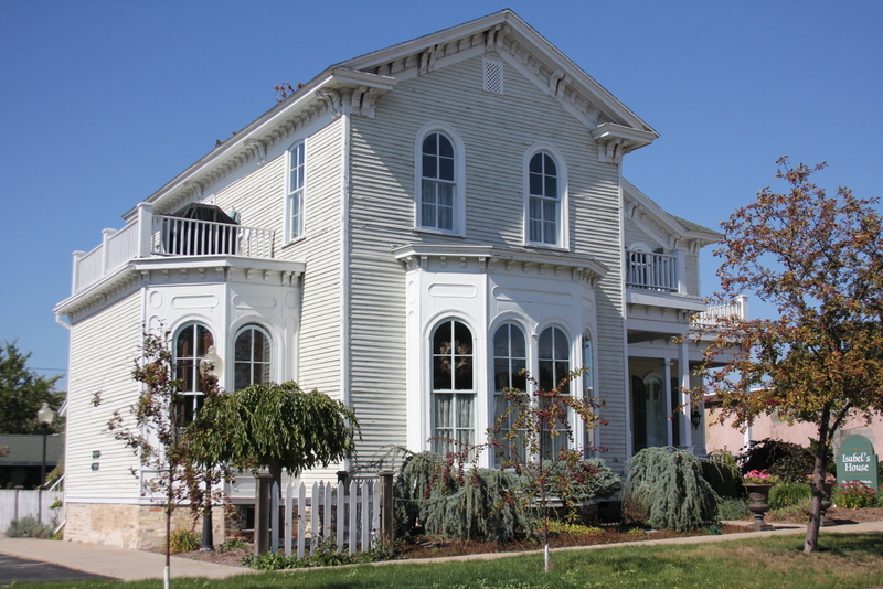
Spring Lake is a village in Ottawa County in the U.S. state of Michigan. The population was 2,497 at the 2020 census. The village is located within Spring Lake Township; the two share a ZIP code, which also serves most of the neighboring city of Ferrysburg.
In 1837, Captain Benjamin Hopkins purchased land in the area and built a mill. The place became known as "Hopkins Mill". In 1849, Thomas W. White and S.C. Hopkins recorded a plat with the name "Mill Point". A post office was established with that name in May 1851. In May 1867, the post office was renamed "Spring Lake", which was also the name of a station on the Detroit, Grand Haven and Milwaukee Railway (later part of the Grand Trunk Western Railroad). The Village of Spring Lake was incorporated in 1869. The post office continues to operate, with ZIP code 49456.
According to the United States Census Bureau, the village has a total area of 1.74 square miles (4.51 km2), of which 1.18 square miles (3.06 km2) is land and 0.56 square miles (1.45 km2) is water.
As of the census of 2019, there were 2,390 people, 1,107 households, and 963 families living in the village. The population density was 1,968.6 inhabitants per square mile (760.1/km2). There were 1,301 housing units at an average density of 1,102.5 per square mile (425.7/km2). The racial makeup of the village was 96% White, 3% African American, 0.2% Native American, 0.3% Asian, 0.1% Pacific Islander, 0.6% from other races, and 1.3% from two or more races. Hispanic or Latino of any race were 1.8% of the population.
There were 1,067 households, of which 25.8% had children under the age of 18 living with them, 48.5% were married couples living together, 8.3% had a female householder with no husband present, 2.7% had a male householder with no wife present, and 40.5% were non-families. 36.1% of all households were made up of individuals, and 17.6% had someone living alone who was 65 years of age or older. The average household size was 2.17 and the average family size was 2.84.
The median age in the village was 44.8 years. 21.6% of residents were under the age of 18; 6.3% were between the ages of 18 and 24; 22.5% were from 25 to 44; 29.1% were from 45 to 64; and 20.5% were 65 years of age or older. The gender makeup of the village was 47.0% male and 53.0% female.
As of the census of 2000, there were 2,514 people, 1,098 households, and 666 families living in the village. The population density was 2,372.4 inhabitants per square mile (916.0/km2). There were 1,248 housing units at an average density of 1,177.7 per square mile (454.7/km2). The racial makeup of the village was 98.05% White, 0.32% African American, 0.44% Native American, 0.24% Asian, 0.36% from other races, and 0.60% from two or more races. Hispanic or Latino of any race were 1.31% of the population.
There were 1,098 households, out of which 25.3% had children under the age of 18 living with them, 50.5% were married couples living together, 7.6% had a female householder with no husband present, and 39.3% were non-families. 36.0% of all households were made up of individuals, and 17.7% had someone living alone who was 65 years of age or older. The average household size was 2.16 and the average family size was 2.84.
Hub AI
Spring Lake, Michigan AI simulator
(@Spring Lake, Michigan_simulator)
Spring Lake, Michigan
Spring Lake is a village in Ottawa County in the U.S. state of Michigan. The population was 2,497 at the 2020 census. The village is located within Spring Lake Township; the two share a ZIP code, which also serves most of the neighboring city of Ferrysburg.
In 1837, Captain Benjamin Hopkins purchased land in the area and built a mill. The place became known as "Hopkins Mill". In 1849, Thomas W. White and S.C. Hopkins recorded a plat with the name "Mill Point". A post office was established with that name in May 1851. In May 1867, the post office was renamed "Spring Lake", which was also the name of a station on the Detroit, Grand Haven and Milwaukee Railway (later part of the Grand Trunk Western Railroad). The Village of Spring Lake was incorporated in 1869. The post office continues to operate, with ZIP code 49456.
According to the United States Census Bureau, the village has a total area of 1.74 square miles (4.51 km2), of which 1.18 square miles (3.06 km2) is land and 0.56 square miles (1.45 km2) is water.
As of the census of 2019, there were 2,390 people, 1,107 households, and 963 families living in the village. The population density was 1,968.6 inhabitants per square mile (760.1/km2). There were 1,301 housing units at an average density of 1,102.5 per square mile (425.7/km2). The racial makeup of the village was 96% White, 3% African American, 0.2% Native American, 0.3% Asian, 0.1% Pacific Islander, 0.6% from other races, and 1.3% from two or more races. Hispanic or Latino of any race were 1.8% of the population.
There were 1,067 households, of which 25.8% had children under the age of 18 living with them, 48.5% were married couples living together, 8.3% had a female householder with no husband present, 2.7% had a male householder with no wife present, and 40.5% were non-families. 36.1% of all households were made up of individuals, and 17.6% had someone living alone who was 65 years of age or older. The average household size was 2.17 and the average family size was 2.84.
The median age in the village was 44.8 years. 21.6% of residents were under the age of 18; 6.3% were between the ages of 18 and 24; 22.5% were from 25 to 44; 29.1% were from 45 to 64; and 20.5% were 65 years of age or older. The gender makeup of the village was 47.0% male and 53.0% female.
As of the census of 2000, there were 2,514 people, 1,098 households, and 666 families living in the village. The population density was 2,372.4 inhabitants per square mile (916.0/km2). There were 1,248 housing units at an average density of 1,177.7 per square mile (454.7/km2). The racial makeup of the village was 98.05% White, 0.32% African American, 0.44% Native American, 0.24% Asian, 0.36% from other races, and 0.60% from two or more races. Hispanic or Latino of any race were 1.31% of the population.
There were 1,098 households, out of which 25.3% had children under the age of 18 living with them, 50.5% were married couples living together, 7.6% had a female householder with no husband present, and 39.3% were non-families. 36.0% of all households were made up of individuals, and 17.7% had someone living alone who was 65 years of age or older. The average household size was 2.16 and the average family size was 2.84.