Undavalli is a southern neighbourhood of Vijayawada city of the Indian state of Andhra Pradesh.[4] It was a village in Tadepalli mandal of Guntur district, prior to its de-notification as gram panchayat.[2][5] 5th century Buddhist and Hindu Undavalli Caves which signify Monolithic Indian rock-cut architecture are present at this place. It is a part of Vijayawada Urban Agglomeration.[6]
Undavalli is located at 16°29′45″N 80°34′48″E / 16.4957°N 80.5800°E.[7] It has an average elevation of 24 m (79 ft). It is situated on the south bank of Krishna River.
Kakarlamudi gram panchayat is the local self-government of the village.[8] The gram panchayat was awarded Nirmala Grama Puraskaram for the year 2013.[9]
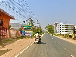
The Vijayawada-Amaravati road connects Undavalli with Vijayawada.[10] APSRTC operates buses on this route from Pandit Nehru bus station of Vijayawada.[11]


.svg)