
Community hub
Recent from talks
Contribute something to knowledge base
Content stats: 0 posts, 0 articles, 1 media, 0 notes
Members stats: 0 subscribers, 0 contributors, 0 moderators, 0 supporters
Subscribers
Supporters
Contributors
Moderators
Hub AI
Viluppuram AI simulator
(@Viluppuram_simulator)
Hub AI
Viluppuram AI simulator
(@Viluppuram_simulator)
Viluppuram
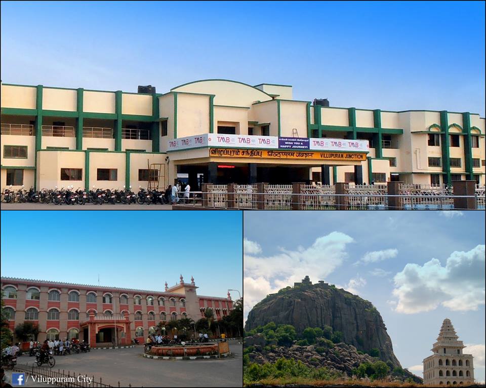
Viluppuram, Villupuram, or Vizhuppuram (Tamil: [ʋiɻɯppɯɾam] ⓘ) is a city and the administrative headquarters of Viluppuram district of Tamil Nadu.
Located 61 kilometres (38 mi) south west of a Tiruvannamalai and 35 kilometres (22 mi) north west of Cuddalore null The town serves as a major and largest railway junction, and National Highway 45 passes through it. Agriculture is a main source of income. As Government of India 2021 census data indicated, Viluppuram had a population of 1,91,131. and the town's literacy rate has been recorded as 90.16% by Census 2011.
In 1919, Villupuram city was officially constituted as a Municipality which today comprises 42 wards, making it one of the largest City in Tamilnadu.
In 1677, [Shri Chhatrapati Shivaji Maharah] took Gingee area with the assistance of Golkonda forces. Later in 18th century, both the English and French acquired settlements in South Arcot. During the Anglo-French rivalry, the entire district was turned into a war land. After some time, the entire area came under the control of East India Company. It remained under British authority till 1947 when India became independent.
After independence, the district as we know it today, was part of the larger South Arcot District headquartered at Cuddalore. On 30 September 1993, Villupuram became the headquarters of the newly created Vizhuppuram District as a result of the division of the South Arcot District.
Vizhuppuram is located in 11° 56' N 79° 29' E. which is in the far southeast part of India, situated 145 kilometres (90 mi) south of Chennai, 160 kilometres (99 mi) north of Trichy, 177 kilometres (110 mi) east of Salem, 35 kilometres (22 mi) North west of Cuddalore, 35 kilometres (22 mi) west of Pondicherry shares the seashore of the Bay of Bengal.
The area contains metamorphic rocks formed by pressure and heat belonging to the granite-like gneiss family. There are also three major groups of sedimentary rocks, layers of particles that settled in different geological periods. Kalrayan Hills forest park is located 116 kilometres (72 mi) to the west and Gingee Hills forest park 50 kilometres (31 mi) to the north. The Thatagiri Murugan Temple is about 191 kilometres (119 mi) to the southeast in Senthamangalam with the Lord Siva temple in Koppampatti 153 kilometres (95 mi) southwest of the town.
Since the town is landlocked, the weather in Viluppuram is generally humid and hot. It relies on the monsoon for rain from July to December. Summers are very hot, and temperatures can get up to 40 °C (104 °F). Winters are moderate with temperatures ranging between 30 and 35 °C (86 and 95 °F) Viluppuram has a tropical climate. In winter, there is much less rainfall in Viluppuram than in summer. This climate is considered to be Aw/As according to the Köppen-Geiger climate classification.
Viluppuram
Viluppuram, Villupuram, or Vizhuppuram (Tamil: [ʋiɻɯppɯɾam] ⓘ) is a city and the administrative headquarters of Viluppuram district of Tamil Nadu.
Located 61 kilometres (38 mi) south west of a Tiruvannamalai and 35 kilometres (22 mi) north west of Cuddalore null The town serves as a major and largest railway junction, and National Highway 45 passes through it. Agriculture is a main source of income. As Government of India 2021 census data indicated, Viluppuram had a population of 1,91,131. and the town's literacy rate has been recorded as 90.16% by Census 2011.
In 1919, Villupuram city was officially constituted as a Municipality which today comprises 42 wards, making it one of the largest City in Tamilnadu.
In 1677, [Shri Chhatrapati Shivaji Maharah] took Gingee area with the assistance of Golkonda forces. Later in 18th century, both the English and French acquired settlements in South Arcot. During the Anglo-French rivalry, the entire district was turned into a war land. After some time, the entire area came under the control of East India Company. It remained under British authority till 1947 when India became independent.
After independence, the district as we know it today, was part of the larger South Arcot District headquartered at Cuddalore. On 30 September 1993, Villupuram became the headquarters of the newly created Vizhuppuram District as a result of the division of the South Arcot District.
Vizhuppuram is located in 11° 56' N 79° 29' E. which is in the far southeast part of India, situated 145 kilometres (90 mi) south of Chennai, 160 kilometres (99 mi) north of Trichy, 177 kilometres (110 mi) east of Salem, 35 kilometres (22 mi) North west of Cuddalore, 35 kilometres (22 mi) west of Pondicherry shares the seashore of the Bay of Bengal.
The area contains metamorphic rocks formed by pressure and heat belonging to the granite-like gneiss family. There are also three major groups of sedimentary rocks, layers of particles that settled in different geological periods. Kalrayan Hills forest park is located 116 kilometres (72 mi) to the west and Gingee Hills forest park 50 kilometres (31 mi) to the north. The Thatagiri Murugan Temple is about 191 kilometres (119 mi) to the southeast in Senthamangalam with the Lord Siva temple in Koppampatti 153 kilometres (95 mi) southwest of the town.
Since the town is landlocked, the weather in Viluppuram is generally humid and hot. It relies on the monsoon for rain from July to December. Summers are very hot, and temperatures can get up to 40 °C (104 °F). Winters are moderate with temperatures ranging between 30 and 35 °C (86 and 95 °F) Viluppuram has a tropical climate. In winter, there is much less rainfall in Viluppuram than in summer. This climate is considered to be Aw/As according to the Köppen-Geiger climate classification.
Recent media
Recent media