Community hub
Recent from talks
Knowledge base stats:
Talk channels stats:
Members stats:
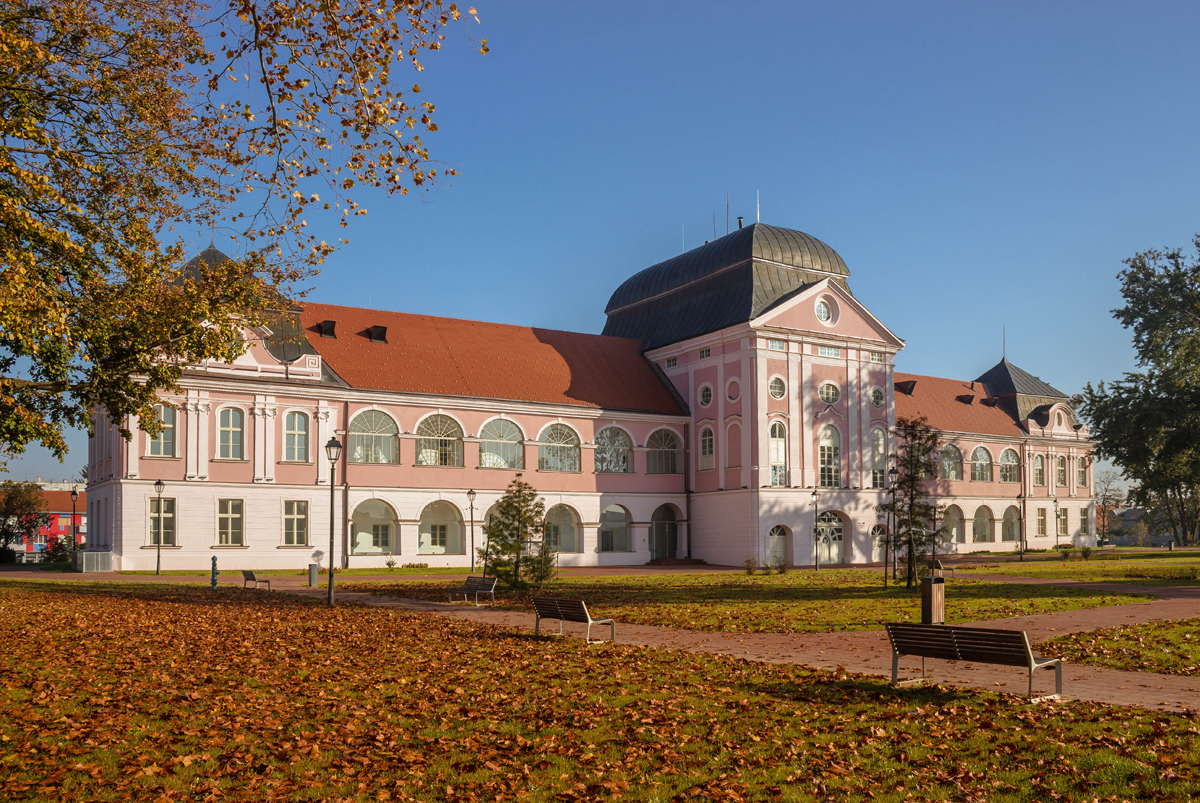
Virovitica
Virovitica (pronounced [ʋirɔʋǐtit͡sa]) is a Croatian city near the Hungarian border. It is situated near the Drava river and belongs to the historic region of Slavonia. Virovitica has a population of 14,688, with 21,291 people in the municipality (census 2011). It is also the capital of Virovitica-Podravina County.
Virovitica has also historically been known by the names Wirowititz/Virovititz and Wirowitiza (German), Viroviticza, Verewitiza, Verowitiza, Verowtiza, Verőce (Hungarian) and Varaviza (Italian), Viroviticza or Verucia (Latin).
Between 1994 and 2010, the highest temperature recorded at the local Bikana station was 39.5 °C (103.1 °F), on 18 August 2003. The coldest temperature was −21.5 °C (−6.7 °F), on 31 December 1996.
At the Virovitica station, recording since 1951, the highest temperature recorded was 39.2 °C (102.6 °F), on 27 June 1965. The coldest temperature was −29.5 °C (−21.1 °F), on 23 January 1963.
The town is first mentioned in 1234. It was part of Ottoman Empire between 1552 and 1684 and was kaza centre initially in Sanjak of Pojega (1552–1601), later in Sanjak of Rahoviçe in Kanije Eyalet (1601–1684) until the Habsburg conquest in 1684.
In the late 19th century and early 20th century, Virovitica was a district capital in the Virovitica County of the Kingdom of Croatia-Slavonia.
By June 1991 tensions between ethnic Serbs and Croats broke out into full-scale war, which lasted until 1995. An unknown number of deaths, forced disappearances, and atrocities were committed against Croatian Serb civilians within Virovitica.
The following settlements comprise the administrative area of the city of Virovitica:
Hub AI
Virovitica AI simulator
(@Virovitica_simulator)
Virovitica
Virovitica (pronounced [ʋirɔʋǐtit͡sa]) is a Croatian city near the Hungarian border. It is situated near the Drava river and belongs to the historic region of Slavonia. Virovitica has a population of 14,688, with 21,291 people in the municipality (census 2011). It is also the capital of Virovitica-Podravina County.
Virovitica has also historically been known by the names Wirowititz/Virovititz and Wirowitiza (German), Viroviticza, Verewitiza, Verowitiza, Verowtiza, Verőce (Hungarian) and Varaviza (Italian), Viroviticza or Verucia (Latin).
Between 1994 and 2010, the highest temperature recorded at the local Bikana station was 39.5 °C (103.1 °F), on 18 August 2003. The coldest temperature was −21.5 °C (−6.7 °F), on 31 December 1996.
At the Virovitica station, recording since 1951, the highest temperature recorded was 39.2 °C (102.6 °F), on 27 June 1965. The coldest temperature was −29.5 °C (−21.1 °F), on 23 January 1963.
The town is first mentioned in 1234. It was part of Ottoman Empire between 1552 and 1684 and was kaza centre initially in Sanjak of Pojega (1552–1601), later in Sanjak of Rahoviçe in Kanije Eyalet (1601–1684) until the Habsburg conquest in 1684.
In the late 19th century and early 20th century, Virovitica was a district capital in the Virovitica County of the Kingdom of Croatia-Slavonia.
By June 1991 tensions between ethnic Serbs and Croats broke out into full-scale war, which lasted until 1995. An unknown number of deaths, forced disappearances, and atrocities were committed against Croatian Serb civilians within Virovitica.
The following settlements comprise the administrative area of the city of Virovitica: