
Community hub
Recent from talks
Contribute something
Nothing was collected or created yet.
West Branch Delaware River
View on Wikipedia
| West Branch Mohock Branch | |
|---|---|
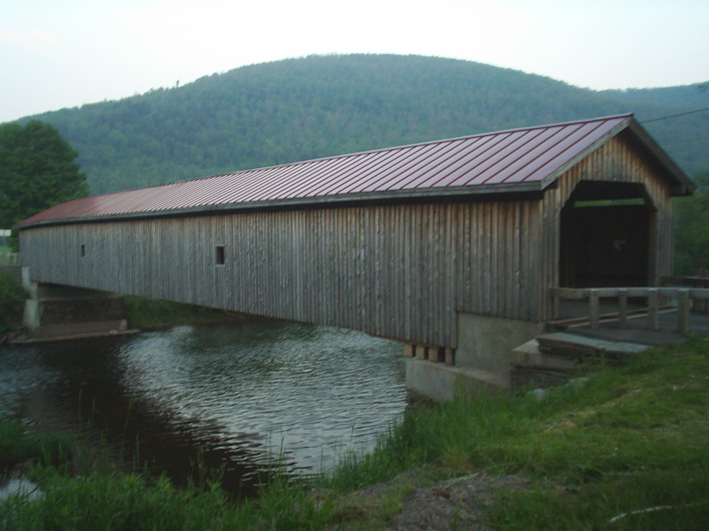
 West Branch flowing under the Hamden Covered Bridge | |
 Map of the upper Delaware River watershed, showing major tributaries | |
| Location | |
| Country | United States |
| State | New York |
| Region | Catskills |
| Counties | Schoharie, Delaware |
| Towns | Stamford, Delhi, Hancock, Deposit |
| Physical characteristics | |
| Source | Unnamed spring |
| • location | Between Woodchuck Hill and Mine Hill in Jefferson, Schoharie County, New York |
| • coordinates | 42°27′16″N 74°36′01″W / 42.45444°N 74.60028°W[1] |
| Mouth | Delaware River |
• location | Hancock |
• coordinates | 41°56′20″N 75°16′45″W / 41.9389755°N 75.2790615°W[1] |
• elevation | 883 ft (269 m)[1] |
| Length | 90 mi (140 km) |
| Basin size | 666 sq mi (1,720 km2)[2] |
| Discharge | |
| • location | Walton |
| • average | 469 cu ft (13.3 m3) |
| • minimum | 12 cu ft (0.34 m3) |
| • maximum | 28,600 cu ft (810 m3) |
| Discharge | |
| • location | Hale Eddy |
| • average | 780 cu ft (22 m3) |
| • minimum | 17 cu ft (0.48 m3) |
| • maximum | 43,400 cu ft (1,230 m3) |
| Basin features | |
| River system | Delaware River |
| Tributaries | |
| • left | Little Delaware River |
| • right | West Brook, Oquaga Creek |
The West Branch Delaware River is one of two branches that form the Delaware River. It is approximately 90 mi (144 km) long, and flows through the U.S. states of New York and Pennsylvania. It winds through a mountainous area of New York in the western Catskill Mountains for most of its course, before joining the East Branch along the northeast border of Pennsylvania with New York.[2] Midway or so it is impounded by the Cannonsville Dam to form the Cannonsville Reservoir, both part of the New York City water supply system for delivering drinking water to the City.[3][4]
Course
[edit]
It rises in Jefferson, Schoharie County, New York and flows generally southwest, entering Delaware County and flowing past Stamford and Delhi. In southwestern Delaware County it flows in an increasingly winding course through the mountains, generally southwest. At Stilesville it is impounded to form the Cannonsville Reservoir. At Deposit, on the border between Broome and Delaware counties, it turns sharply to the southeast and is paralleled by New York State Route 17. It joins the East Branch at Hancock to form the Delaware. For the lower 6 mi (10 km) it forms part of the boundary between New York and Pennsylvania.
Hydrology
[edit]The United States Geological Survey (USGS) maintains many stream gauges along the West Branch Delaware River.
The station by the Village of Delhi, in operation since 1937, but making daily measurements since November 1996, is located .6 miles (0.97 km) upstream from the bridge on Route 28, and 1.9 miles (3.1 km) upstream from the confluence of the Little Delaware River.[5] This station had a maximum discharge of about 13,000 cubic feet per second (370 m3/s) and a gauge height of 9.8 feet (3.0 m) from floodmark on January 19, 1996 and a maximum gauge height of 12.53 feet (3.82 m) on August 28, 2011 as Hurricane Irene passed through the area. It had a minimum discharge of 2.6 cubic feet per second (0.074 m3/s) on September 25, 1964 and a minimum gauge height of 1.72 feet (0.52 m) on September 16–17, 2016.[5]
The Hobart station, in service since 2000, is located 300 feet (91 m) upstream from Maple Street in the Hamlet of Hobart. This station had a maximum discharge of about 995 cubic feet per second (28.2 m3/s) and a gauge height of 3.22 feet (0.98 m) on August 28, 2011 caused by Hurricane Irene. It had a minimum discharge of .05 cubic feet per second (0.0014 m3/s) on November 13, 2001 and November 19, 2001.[6]
The Walton station, in service since 1950, is located 100 feet (30 m) downstream from West Brook in the Village of Walton. This station had a maximum discharge of about 28,600 cubic feet per second (810 m3/s) and a gauge height of 16.85 feet (5.14 m) on June 28, 2006 during the 2006 Mid-Atlantic United States flood. It had a minimum discharge of 12 cubic feet per second (0.34 m3/s) on September 15 and November 22, 1964.[7]
The Hale Eddy station, in service since 1912, is located 9 miles (14 km) upstream from the confluence of East and West Branches. Since the construction of the Cannonsville Reseevoir this station had a maximum discharge of 43,400 cubic feet per second (1,230 m3/s) and a gauge height of 19.1 feet (5.8 m) on June 28, 2006 during the 2006 Mid-Atlantic United States flood. It had a minimum discharge of 17 cubic feet per second (0.48 m3/s) on October 20, 1963. The maximum discharge, prior to the construction of Cannonsville Reservoir in 1963, was 28,900 cubic feet per second (820 m3/s) on March 22, 1948. Outside the period of record: In the flood of October 10, 1903 this station reached a discharge of roughly 46,000 cubic feet per second (1,300 m3/s)[8]
Fishing
[edit]The West Branch is a tailwater fishery. This means the same cold water releases that keep it cooler in the summer, keep the river a little warmer in the winter and early spring. The upper section can be cleaner than other rivers during periods of heavy runoff. During high water on the Cannonsville Reservoir, many bait fish spill over the dam. These factors all provide an excellent environment for trout to thrive in.[9]
The trout population in this river is naturally reproducing. During the warm months stocked trout from smaller and warmer tributaries will seek sanctuary in their cool water. The West Branch Delaware River was divided into two sections when the Cannonsville Reservoir was formed. Downstream of the Cannonsville Reservoir, there are large numbers of wild populations of brown trout and rainbow trout and an occasional brook trout can be caught although none are stocked. Seasonal anadromous runs of American shad with reports of occasional striped bass.[10] This section is considered one of the best fly fishing trout streams in the United States, due to the cold water released from the reservoir.[11]
Tributaries
[edit]Not including tributaries of Cannonsville Reservoir
Right
- Basset Brook
- Lake Brook
- McMurdy Brook
- Betty Brook
- Kiff Brook
- Wright Brook
- Kidd Brook
- Elk Creek
- Falls Creek
- Steele Brook
- Peaks Brook
- Platner Brook
- East Brook
- West Brook[12]
- Pines Brook
- Bobs Brook
- Wakeman Brook
- Cold Spring Creek
- Butler Brook
- Oquaga Creek[13]
- Sherman Creek
- Faulkner Brook
- Balls Creek
Left
See also
[edit]References
[edit]- ^ a b c "West Branch Delaware River". Geographic Names Information System. United States Geological Survey, United States Department of the Interior. Retrieved 2019-05-24.
- ^ a b "USGS 0142712905 W BR DELAWARE RIVER AT MOUTH AT HANCOCK PA". usgs.gov. usgs. 2019. Retrieved 24 May 2019.
data
- ^ "Cannonsville Reservoir". Geographic Names Information System. United States Geological Survey, United States Department of the Interior. Retrieved 2018-09-23.
- ^ "Cannonsville Dam". Geographic Names Information System. United States Geological Survey, United States Department of the Interior. Retrieved 2018-09-23.
- ^ a b "USGS 01421900 WEST BRANCH DELAWARE RIVER UPSTREAM FROM DELHI NY". waterdata.usgs.gov. waterdata.usgs.gov. May 24, 2019. Retrieved 24 May 2019.
data
- ^ "USGS 01421610 WEST BRANCH DELAWARE RIVER AT HOBART NY". waterdata.usgs.gov. waterdata.usgs.gov. May 24, 2019. Retrieved 24 May 2019.
data
- ^ "USGS 01423000 WEST BRANCH DELAWARE RIVER AT WALTON NY". waterdata.usgs.gov. waterdata.usgs.gov. May 28, 2019. Retrieved 28 May 2019.
data
- ^ "USGS 01426500 WEST BRANCH DELAWARE RIVER AT HALE EDDY NY". waterdata.usgs.gov. waterdata.usgs.gov. May 28, 2019. Retrieved 28 May 2019.
data
- ^ "EARLY SEASON TROUT: WEST BRANCH OF THE DELAWARE". thefisherman.com. 2019. Retrieved 25 May 2019.
- ^ "Public Fishing Rights Maps: West Branch of the Delaware River". dec.ny.gov. 2019. Retrieved 25 May 2019.
- ^ Miri, Larry (Jun 13, 2000). "Fly Fishing The West Branch Of The Delaware River In New York And Pennsylvania". The Flyfishing Connection. Retrieved 25 March 2012.
- ^ "West Brook". usgs.gov. usgs. 1998. Retrieved 17 May 2017.
data
- ^ "Oquaga Creek". Geographic Names Information System. United States Geological Survey, United States Department of the Interior. Retrieved 2018-09-23.
- ^ "Little Delaware River". usgs.gov. usgs. 1998. Retrieved 17 May 2017.
data