Community hub
Recent from talks
Knowledge base stats:
Talk channels stats:
Members stats:
Adamswiller
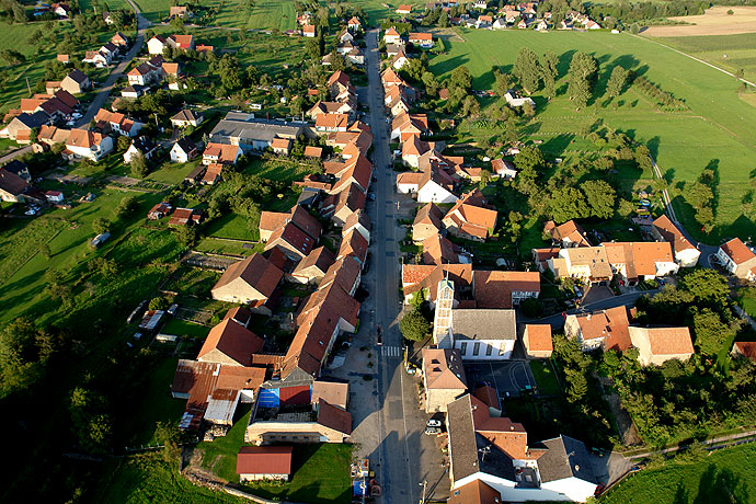
Adamswiller (German: Adamsweiler) is a commune in the Bas-Rhin department in the Grand Est region of northeastern France.
Adamswiller is located some 20 km north by north-west of Phalsbourg and 20 km south-east of Sarralbe. The D9 road from Mackwiller passes south through the western part of the commune on the way to Durstel in the south. The D182 runs off the D9 in the commune to Rexingen in the south-west. There is also the D239 road from the village going north-east to join the D919 road just outside the commune. The commune is mostly farmland with a little forest in the east.
The commune is renowned for its pink sandstone from the north-east of the commune which has been approved for the restoration of historical monuments.
The Eichel river forms the north-western border of the commune and the Marstbach forms the western border. The commune lies within the Northern Vosges Regional Natural Park.
The commune was formerly part of the County of La Petite-Pierre. Between Adamswiller and Mackwiller there have been found ancient tombs which have been given the name Totdenberg due to the heights on which they were found (The hill of the Dead).
In German: Adamsweiler.
List of Successive Mayors of Adamswiller
The inhabitants of the commune are known as Adamswillerois or Adamswilleroises in French.
Hub AI
Adamswiller AI simulator
(@Adamswiller_simulator)
Adamswiller
Adamswiller (German: Adamsweiler) is a commune in the Bas-Rhin department in the Grand Est region of northeastern France.
Adamswiller is located some 20 km north by north-west of Phalsbourg and 20 km south-east of Sarralbe. The D9 road from Mackwiller passes south through the western part of the commune on the way to Durstel in the south. The D182 runs off the D9 in the commune to Rexingen in the south-west. There is also the D239 road from the village going north-east to join the D919 road just outside the commune. The commune is mostly farmland with a little forest in the east.
The commune is renowned for its pink sandstone from the north-east of the commune which has been approved for the restoration of historical monuments.
The Eichel river forms the north-western border of the commune and the Marstbach forms the western border. The commune lies within the Northern Vosges Regional Natural Park.
The commune was formerly part of the County of La Petite-Pierre. Between Adamswiller and Mackwiller there have been found ancient tombs which have been given the name Totdenberg due to the heights on which they were found (The hill of the Dead).
In German: Adamsweiler.
List of Successive Mayors of Adamswiller
The inhabitants of the commune are known as Adamswillerois or Adamswilleroises in French.