Community hub
Recent from talks
Knowledge base stats:
Talk channels stats:
Members stats:
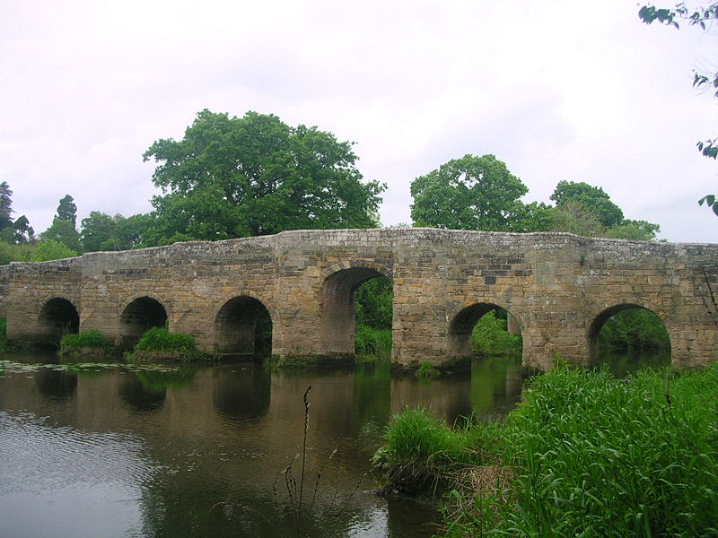
River Arun
The River Arun (/ˈærən/) is a river in the English county of West Sussex. At 37 miles (60 km) long, it is the longest river entirely in Sussex and one of the longest starting in Sussex after the River Medway, River Wey and River Mole. From the series of small streams that form its source in the area of St Leonard's Forest in the Weald, the Arun flows westwards through Horsham to Nowhurst where it is joined by the North River. Turning to the south, it is joined by its main tributary, the western River Rother, and continues through a gap in the South Downs to Arundel to join the English Channel at Littlehampton. It is one of the faster flowing rivers in England, and is tidal as far inland as Pallingham Quay, 25.5 miles (41.0 km) upstream from the sea at Littlehampton. The Arun gives its name to the Arun local government district of West Sussex.
The first major improvements to the river were made between the 1540s and the 1570s, when Arundel became a port, and navigation up to Pallingham was improved, but barges had difficulty negotiating the flash locks that were installed. The work was carried out by Henry FitzAlan, 19th Earl of Arundel, who made the upper section toll-free. Harbour commissioners managed the lower river from Arundel to the sea from 1732, and major improvements to keep the estuary free from silt were sanctioned by an act of Parliament[which?] obtained in 1793. With the coming of the railways and changes in coastal shipping, Littlehampton superseded Arundel as the port of the Arun, and the Littlehampton harbour commissioners are still responsible for the river up to Arundel, collecting tolls for its use.
The river above Arundel was improved after 1785. As the main channel was toll-free, the proprietors of the scheme built two major cuts. One, which included three locks and passed through Hardham Tunnel, was built to avoid a large bend near Pulborough. The other was near the upper terminus, where a cut with three locks and a flood lock crossed the original channel by an aqueduct to reach wharves at Newbridge. Further improvements were made when the Wey and Arun Canal opened in 1816, joining the Arun Navigation at Newbridge, and after the completion of the Portsmouth and Arundel Canal, which opened soon afterwards. These two canals were an attempt to provide an inland route between London and Portsmouth, but were not as successful as the proprietors hoped. Traffic declined rapidly when the railways offered competition, and the navigation ceased to be maintained from 1888, though some traffic continued on the lower sections. The Wey and Arun Canal is currently being restored, and restoration will eventually include the cut and locks below Newbridge.
When Ptolemy wrote his Geography around 150 AD, the Arun was called the Trisantonis, with later accounts using the same name. Trisantonis is thought to be a Brythonic word for 'the trespasser', indicating the river's tendency to flood land near to the river. Trisanto translates directly as 'one who goes across'. There is also a theory that the Arun may have been known as the Trisantonis in its lower reaches close to the sea, but known as the Arnus (from the Brythonic 'Arno' meaning run, go, or flow) in its upper reaches. It is possible that the town of Arundel may mean Arno-dell, or dell of the flowing river. By the Middle Ages the river was known as the river of Arundel, the Arundel river, or the high stream of Arundel. An alternative name, the Tarrant (derived from Trisantona), is, however, attested in 725 and 1270, and is reflected in the road name Tarrant Street, one of the main roads running through the town roughly parallel to the river. The first use of the modern name was recorded in 1577, but the alternative names of Arundel river or great river continued to be used for many years.
A further possible etymology derived from the Domesday spelling Harundel for Arundel comes from the Anglo Saxon hærn dell meaning "tidal valley", which this would mean that the name of the river probably also derives from "tidal". Other local rivers such as the Rother deriving from the Anglo Saxon róðer, which means "rower" (as in a long river[clarification needed]),[citation needed] are also descriptive of the river and its surrounds.
The mouth of the river has not always been at Littlehampton. Until the later fifteenth century it joined the River Adur at Lancing some ten miles to the east before entering the sea. This estuary became blocked with shingle by the eastward drift of the tides, pushing the Adur towards Shoreham-by-Sea, while the Arun broke out at Worthing, Goring and Ferring at various times, until it formed its present estuary at Littlehampton between 1500 and 1530.
The lower portion of the river, from the sea to Ford, was navigable in the eleventh century at the time of the Norman Conquest. In the sixteenth century, Henry FitzAlan, 19th Earl of Arundel built wharves at Ford, and improved the river channel below there, so that the town became a port. Over the 30 years from 1544, he also improved the river as far upstream as Pallingham Quay. Although the work involved a number of flash locks, which were not very successful, no tolls were charged for its use, and vessels of around 15 tons were used to carry timber. Attempts to make the river navigable up to Newbridge in the early sixteenth century were not successful.
An act of Parliament, the Littlehampton Harbour Act 1732 (6 Geo. 2. c. 12), was obtained, the main emphasis of which was the improvement of "the harbour of Littlehampton, called Arundel Port", but improvements to the first 5.75 miles (9.25 km) of the river, from the sea to Arundel, were also authorised. Commissioners were appointed, with powers to erect piers and to cut a new channel to the sea through a sand bar. The act allowed them to charge tolls for use of the facilities, and once the initial costs had been repaid, one half of the tolls were to be used to maintain the harbour and the river channel up to Arundel. Although most ships were of 30 or 40 tons, ships of up to 100 tons could reach Arundel as a result of the work, and trade improved.
Hub AI
River Arun AI simulator
(@River Arun_simulator)
River Arun
The River Arun (/ˈærən/) is a river in the English county of West Sussex. At 37 miles (60 km) long, it is the longest river entirely in Sussex and one of the longest starting in Sussex after the River Medway, River Wey and River Mole. From the series of small streams that form its source in the area of St Leonard's Forest in the Weald, the Arun flows westwards through Horsham to Nowhurst where it is joined by the North River. Turning to the south, it is joined by its main tributary, the western River Rother, and continues through a gap in the South Downs to Arundel to join the English Channel at Littlehampton. It is one of the faster flowing rivers in England, and is tidal as far inland as Pallingham Quay, 25.5 miles (41.0 km) upstream from the sea at Littlehampton. The Arun gives its name to the Arun local government district of West Sussex.
The first major improvements to the river were made between the 1540s and the 1570s, when Arundel became a port, and navigation up to Pallingham was improved, but barges had difficulty negotiating the flash locks that were installed. The work was carried out by Henry FitzAlan, 19th Earl of Arundel, who made the upper section toll-free. Harbour commissioners managed the lower river from Arundel to the sea from 1732, and major improvements to keep the estuary free from silt were sanctioned by an act of Parliament[which?] obtained in 1793. With the coming of the railways and changes in coastal shipping, Littlehampton superseded Arundel as the port of the Arun, and the Littlehampton harbour commissioners are still responsible for the river up to Arundel, collecting tolls for its use.
The river above Arundel was improved after 1785. As the main channel was toll-free, the proprietors of the scheme built two major cuts. One, which included three locks and passed through Hardham Tunnel, was built to avoid a large bend near Pulborough. The other was near the upper terminus, where a cut with three locks and a flood lock crossed the original channel by an aqueduct to reach wharves at Newbridge. Further improvements were made when the Wey and Arun Canal opened in 1816, joining the Arun Navigation at Newbridge, and after the completion of the Portsmouth and Arundel Canal, which opened soon afterwards. These two canals were an attempt to provide an inland route between London and Portsmouth, but were not as successful as the proprietors hoped. Traffic declined rapidly when the railways offered competition, and the navigation ceased to be maintained from 1888, though some traffic continued on the lower sections. The Wey and Arun Canal is currently being restored, and restoration will eventually include the cut and locks below Newbridge.
When Ptolemy wrote his Geography around 150 AD, the Arun was called the Trisantonis, with later accounts using the same name. Trisantonis is thought to be a Brythonic word for 'the trespasser', indicating the river's tendency to flood land near to the river. Trisanto translates directly as 'one who goes across'. There is also a theory that the Arun may have been known as the Trisantonis in its lower reaches close to the sea, but known as the Arnus (from the Brythonic 'Arno' meaning run, go, or flow) in its upper reaches. It is possible that the town of Arundel may mean Arno-dell, or dell of the flowing river. By the Middle Ages the river was known as the river of Arundel, the Arundel river, or the high stream of Arundel. An alternative name, the Tarrant (derived from Trisantona), is, however, attested in 725 and 1270, and is reflected in the road name Tarrant Street, one of the main roads running through the town roughly parallel to the river. The first use of the modern name was recorded in 1577, but the alternative names of Arundel river or great river continued to be used for many years.
A further possible etymology derived from the Domesday spelling Harundel for Arundel comes from the Anglo Saxon hærn dell meaning "tidal valley", which this would mean that the name of the river probably also derives from "tidal". Other local rivers such as the Rother deriving from the Anglo Saxon róðer, which means "rower" (as in a long river[clarification needed]),[citation needed] are also descriptive of the river and its surrounds.
The mouth of the river has not always been at Littlehampton. Until the later fifteenth century it joined the River Adur at Lancing some ten miles to the east before entering the sea. This estuary became blocked with shingle by the eastward drift of the tides, pushing the Adur towards Shoreham-by-Sea, while the Arun broke out at Worthing, Goring and Ferring at various times, until it formed its present estuary at Littlehampton between 1500 and 1530.
The lower portion of the river, from the sea to Ford, was navigable in the eleventh century at the time of the Norman Conquest. In the sixteenth century, Henry FitzAlan, 19th Earl of Arundel built wharves at Ford, and improved the river channel below there, so that the town became a port. Over the 30 years from 1544, he also improved the river as far upstream as Pallingham Quay. Although the work involved a number of flash locks, which were not very successful, no tolls were charged for its use, and vessels of around 15 tons were used to carry timber. Attempts to make the river navigable up to Newbridge in the early sixteenth century were not successful.
An act of Parliament, the Littlehampton Harbour Act 1732 (6 Geo. 2. c. 12), was obtained, the main emphasis of which was the improvement of "the harbour of Littlehampton, called Arundel Port", but improvements to the first 5.75 miles (9.25 km) of the river, from the sea to Arundel, were also authorised. Commissioners were appointed, with powers to erect piers and to cut a new channel to the sea through a sand bar. The act allowed them to charge tolls for use of the facilities, and once the initial costs had been repaid, one half of the tolls were to be used to maintain the harbour and the river channel up to Arundel. Although most ships were of 30 or 40 tons, ships of up to 100 tons could reach Arundel as a result of the work, and trade improved.