
Community hub
0 subscribers8 pages, 0 posts
Recent from talks
All channels
Be the first to start a discussion here.
Be the first to start a discussion here.
Be the first to start a discussion here.
Be the first to start a discussion here.
Contribute something
Welcome to the community hub built to collect knowledge and have discussions related to Dunluce Upper.
Nothing was collected or created yet.
Dunluce Upper
View on Wikipediafrom Wikipedia
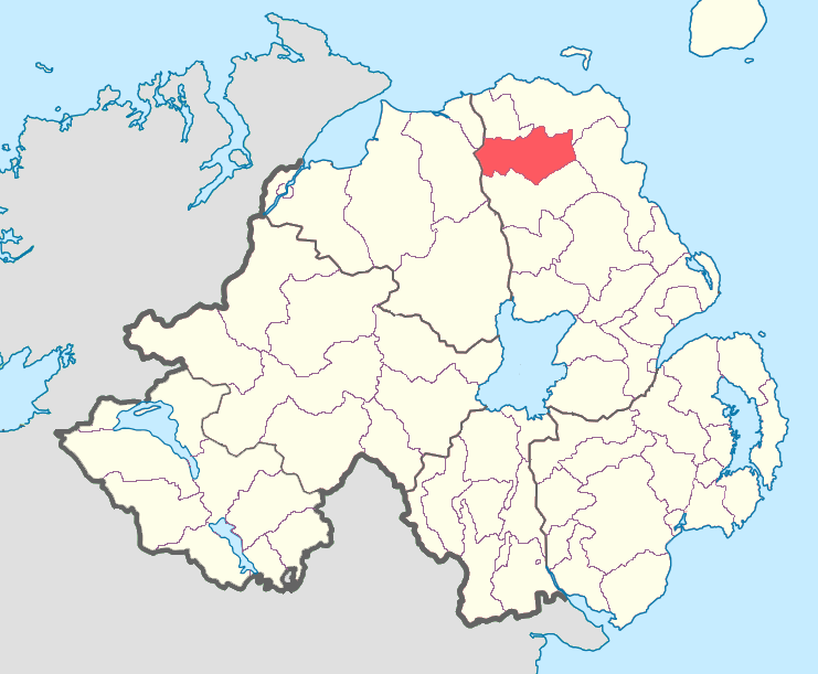
Dunluce Upper is a barony in County Antrim, Northern Ireland.[2] It is bordered by six other baronies: Dunluce Lower to the north; Cary to the north-east; North East Liberties of Coleraine to the north-west; Coleraine to the west; Kilconway to the south; and Glenarm Lower to the east.[2] Dunluce Upper also formed part of the medieval territory known as the Route.[3]
Key Information

History
[edit]List of settlements
[edit]Below is a list of settlements in Dunluce Upper:[1]
Towns
[edit]Population centres
[edit]- Corkey
- Glenbush
- Loughguile (part in barony of Kilconway)
List of civil parishes
[edit]Below is a list of civil parishes in Dunluce Upper:[4][5]
- Armoy (split with barony of Cary)
- Ballymoney (also partly in barony of Kilconway, County Antrim and North East Liberties of Coleraine, County Londonderry)
- Killagan (split with barony of Kilconway)
- Kilraghts
- Loughguile (split with barony of Kilconway)
References
[edit]- ^ a b "Dunluce Upper". Placenames Database of Ireland. Department of Community, Rural and Gaeltacht Affairs. Retrieved 5 June 2011.
- ^ a b "Public Record Office of Northern Ireland (PRONI) – nidirect". proni.gov.uk. 4 March 2016. Retrieved 17 April 2018.
- ^ Ulster Archaeological Society. "Ulster journal of archaeology". Belfast [Ulster Archaeological Society]. Retrieved 17 April 2018 – via Internet Archive.
- ^ "Unavailable". applications.proni.gov.uk. Archived from the original on 27 July 2011. Retrieved 17 April 2018.
- ^ "Unavailable". applications.proni.gov.uk. Archived from the original on 27 July 2011. Retrieved 17 April 2018.

This article related to the geography of County Antrim, Northern Ireland is a stub. You can help Wikipedia by adding missing information. |