
Community hub
Recent from talks
Contribute something
Nothing was collected or created yet.
Fairlands
View on Wikipedia
Fairlands is the largest settlement (neighbourhood) of Worplesdon, a village with a civil parish council in the Borough of Guildford, Surrey, England. The neighbourhood is centred 2.6 miles (4.2 km) north-west of Guildford, to which it is linked by a relatively straight road. The arbitrary centre of Worplesdon, a linear settlement, its church, is 1.2 miles (1.9 km) north-east.
Key Information


Amenities
[edit]Fairlands has a parade of eight shops, a post office, a doctor's surgery, primary school, recreation ground and community centre. The latter is used for resident's association meetings, meetings of other groups of cross-sections of the community, and private hire events.
Directly north of Fairlands is the Equestrian Centre of Merrist Wood College, which specialises in horticulture, landscaping, garden design, animal care, countryside, golf, sports turf, floristry, arboriculture and equine studies - it encompasses 400 acres (160 ha) of land.
Residents Association
[edit]The Fairlands, Liddington Hall and Gravetts Lane Community Association (FLGCA) is formed of residents of Fairlands and the surrounding residential areas. The FLGCA administer the community centre, form an umbrella organisation for various groups specific to the neighbourhoods, and more generally act for the benefit of residents. A free monthly magazine is delivered to every house within its scope.
Youth outreach
[edit]The Normandy Youth Center serves the area by sponsoring community-based programs targeting youth in the area (especially marginal groups and minorities) for the purpose of increasing exposure to educational opportunities and building a stronger community.[2]
History
[edit]Fairlands and Littlefields Farms, together comprising around 250 acres (100 ha), were sold for development in 1926.[3] Plans for an estate of around 1,000 houses were approved by the borough council in December 1934 and construction began the following year.[4][5][6] A second phase of housebuilding began in the late-1950s[7] and Fairlands County Primary School, designed by the architect, Raymond Ash, opened in 1966.[8] The settlement is not bisected by any main roads and continues to reject street lighting.[9] Today 12 residential roads and closes form a clustered hamlet.[9]
Transport
[edit]Road
[edit]The A323 Aldershot road adjoins Fairlands and provides an almost straight route from the community to Guildford, merging with the A322 road from Bagshot shortly before the A3's Wooden Bridge interchange.
Rail
[edit]Worplesdon railway station is 2.5 miles (4.0 km) north-east.
Religion
[edit]Church of England
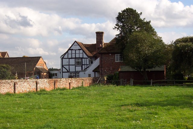
[edit]A 13th century ecclesiastical parish church (before the establishment of civil parishes providing a quasi-local government role with a vestry and poor relief for this neighbourhood), is an arbitrary centre of Worplesdon, a linear settlement around its central street and partially along intersecting routes, 1.2 miles (1.9 km) north-east.[10] The church, St Mary's, has as its patron Eton College.
Roman Catholic Church
[edit]The nearest Roman Catholic church, linked to Fairlands by the Aldershot Road, is the Church of St Mary, Rydes Hill.[11][12]
References
[edit]- ^ Surrey County Council Census data Archived October 25, 2007, at the Wayback Machine
- ^ Award for Mother Who Transformed Her Village Archived October 24, 2010, at the Wayback Machine; 18 October 2010 article; at (Surrey Herald etc titles via Get Surrey) News; retrieved 30 January 2013.
- ^ "Notice of Sale". Surrey Advertiser and County Times. Vol. CV, no. 8859. 31 July 1926. p. 1.
- ^ "Guildford Town topics". Surrey Advertiser and County Times. Vol. CXXXI, no. 9726. 15 December 1934. p. 10.
- ^ "Big estate development near Guildford". Surrey Advertiser and County Times. Vol. CXXXII, no. 9763. 27 April 1935. p. 9.
- ^ "Fairlands Estate, Guildford". Surrey Advertiser and County Times. Vol. CXXXII, no. 9763. 27 April 1935. p. 2.
- ^ "Kingstons Estate Developers". Surrey Advertiser and County Times. No. 11935. 26 December 1959. p. 14.
- ^ "First of new schools is opened". Surrey Advertiser. No. 12475. 19 November 1966. p. 13.
- ^ a b [1][permanent dead link] Ordnance survey website
- ^ Church of England - Diocese of St Mary the Virgin, Worplesdon
- ^ RC Diocese of Arundel & Brighton - St Mary's Church Archived 2014-08-10 at the Wayback Machine
- ^ "Map of Alternative Churches of Guildford Deanery". Archived from the original on 8 February 2015. Retrieved 9 October 2013.
External links
[edit]- www.fairlands.org.uk, the FLGCA website
