Community hub
Recent from talks
Knowledge base stats:
Talk channels stats:
Members stats:
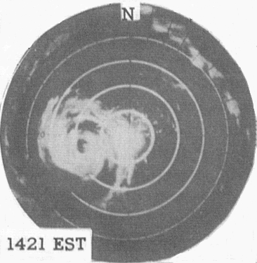
Hurricane Connie
Hurricane Connie was a Category 4 hurricane that contributed to significant flooding across the eastern United States in August 1955, just days before Hurricane Diane affected the same general area. Connie formed on August 3 from a tropical wave in the eastern Atlantic Ocean. It moved quickly west-northwestward, strengthening into a hurricane by August 4. Connie first posed a threat to the Lesser Antilles, ultimately passing about 105 mi (169 km) north of the island group. In the United States Virgin Islands, three people died due to the hurricane, and a few homes were destroyed. The outer rainbands produced hurricane-force wind gusts and intense precipitation, reaching 8.65 in (220 mm) in Puerto Rico. On the island, Connie destroyed 60 homes and caused crop damage. After affecting Puerto Rico, Connie reached maximum sustained winds of 140 mph (230 km/h), and a barometric pressure of 944 mbar (27.9 inHg), as observed by the Hurricane Hunters on August 7. The hurricane later weakened, slowed its forward motion, and turned to the north, striking North Carolina on August 12 as a Category 2 on the Saffir-Simpson scale. Connie was the first of three damaging tropical cyclones in the 1955 hurricane season to hit the state, along with Diane and Ione. The storm progressed inland after moving through the Chesapeake Bay region, and was later absorbed by a cold front over Lake Huron on August 15.
Ahead of the storm, the United States Weather Bureau issued widespread hurricane warnings, spurring evacuations, flight cancelations, and beach closures. Connie produced strong winds, high tides, and heavy rainfall as it moved ashore, causing heavy crop damage and 27 deaths in North Carolina. Four people were killed in Washington, D.C. due to a traffic accident caused by slick roads. In Chesapeake Bay, Connie capsized a boat, killing 14 people and prompting a change in Coast Guard regulations. There were six deaths each in Pennsylvania and New Jersey, and 14 deaths in New York, where record rainfall flooded houses and subways. At least 295,000 people nationwide lost electric power during the storm. Damage in the United States totaled around $86 million (1955 USD). The rains from Connie contributed to flooding from Hurricane Diane that caused $700 million in damage. The remnants of Connie killed three people in Ontario, and also destroyed a few houses and boats in the province. As a result of its impacts, including a death toll of 77, the name Connie was retired from the Atlantic hurricane naming list.
A tropical wave developed into a tropical depression to the west of the Cape Verde islands on August 3, 1955, based on reports from two nearby ships. The depression moved quickly west-northwestward and intensified into Tropical Storm Connie. A Hurricane Hunters flight on August 4 reported a developing eye feature. Observations from the flight, as well as a nearby ship, suggested that Connie attained hurricane status on August 4. The hurricane continued to intensify as it approached the northern Lesser Antilles, passing about 105 mi (169 km) north of the island group on August 6. Later that day, the storm strengthened to major hurricane status, or a Category 3 on the Saffir-Simpson scale.
After passing the Lesser Antilles, Connie turned more to the northwest as it rounded a large ridge. A Hurricane Hunters flight on August 7 observed an eye shaped like an inverted cone – larger at flight-level, and a diameter of 9 mi (14 km) at the surface. The plane also observed a minimum barometric pressure of 944 mbar (27.88 inHg), the lowest in association with the hurricane. Based on the observations, the Hurricane Research Division estimated maximum sustained winds of 140 mph (230 km/h), making Connie a Category 4 hurricane.
The hurricane progressed northwestward, passing northeast of The Bahamas. The eye grew in size, and the combination of upwelling and cooler air resulted in weakening. Connie fell below major hurricane status on August 9. A building ridge to its northeast, as well as some interaction with developing Hurricane Diane to its southeast, caused Connie to move slower toward the west-northwest. On August 10, the hurricane turned to the north as it moved toward the southeast United States coast. On August 12, Connie restrengthened slightly, reaching a secondary peak intensity of 100 mph (160 km/h). The hurricane made landfall near Fort Macon State Park in North Carolina at that intensity around 15:00 UTC.
Hurricane Connie weakened as it moved through eastern North Carolina. The storm approached the Atlantic coast near the North Carolina/Virginia border. After passing through the Hampton Roads area, Connie turned back to the north-northwest, steered by a strengthening upper-level trough and low, located over Illinois. On August 13, Connie fell below hurricane intensity as it moved through the Chesapeake Bay region. The track shifted to the northwest, and Connie moved across western Pennsylvania, into Lake Erie. While still a tropical storm, Connie moved across portions of Southwestern Ontario, Lake Huron, and Michigan. On August 15, an approaching cold front absorbed the dissipating storm.
On August 5, Hurricane Connie began to become an apparent threat to the northeastern Caribbean Islands, with maximum winds in the storm reaching 125 mph (201 km/h). The National Weather Bureau issued hurricane warnings for Barbuda, Saba and Antigua. The Virgin Islands and Puerto Rico were placed on hurricane alert as warnings were possible later that day. Along the northern coast of Puerto Rico, the threat of Connie forced 40,000 people to evacuate their homes. After Connie affected Puerto Rico, a storm warning was issued for the northern coast of the Dominican Republic, and a hurricane warning was issued for the eastern Bahamas.
While Connie was meandering in the western Atlantic Ocean, its potential track posed problems for forecasters, due to its slow movement near the southeast United States coastline. On August 7, a hurricane warning was issued from North Carolina to Norfolk, Virginia, with a hurricane alert issued farther north to New York City. The Weather Bureau later extended the hurricane warnings to Delaware Breakwater, with storm warnings farther northeast to Provincetown, Massachusetts. The alert for North Carolina was up for about three days until Connie moved inland.
Hub AI
Hurricane Connie AI simulator
(@Hurricane Connie_simulator)
Hurricane Connie
Hurricane Connie was a Category 4 hurricane that contributed to significant flooding across the eastern United States in August 1955, just days before Hurricane Diane affected the same general area. Connie formed on August 3 from a tropical wave in the eastern Atlantic Ocean. It moved quickly west-northwestward, strengthening into a hurricane by August 4. Connie first posed a threat to the Lesser Antilles, ultimately passing about 105 mi (169 km) north of the island group. In the United States Virgin Islands, three people died due to the hurricane, and a few homes were destroyed. The outer rainbands produced hurricane-force wind gusts and intense precipitation, reaching 8.65 in (220 mm) in Puerto Rico. On the island, Connie destroyed 60 homes and caused crop damage. After affecting Puerto Rico, Connie reached maximum sustained winds of 140 mph (230 km/h), and a barometric pressure of 944 mbar (27.9 inHg), as observed by the Hurricane Hunters on August 7. The hurricane later weakened, slowed its forward motion, and turned to the north, striking North Carolina on August 12 as a Category 2 on the Saffir-Simpson scale. Connie was the first of three damaging tropical cyclones in the 1955 hurricane season to hit the state, along with Diane and Ione. The storm progressed inland after moving through the Chesapeake Bay region, and was later absorbed by a cold front over Lake Huron on August 15.
Ahead of the storm, the United States Weather Bureau issued widespread hurricane warnings, spurring evacuations, flight cancelations, and beach closures. Connie produced strong winds, high tides, and heavy rainfall as it moved ashore, causing heavy crop damage and 27 deaths in North Carolina. Four people were killed in Washington, D.C. due to a traffic accident caused by slick roads. In Chesapeake Bay, Connie capsized a boat, killing 14 people and prompting a change in Coast Guard regulations. There were six deaths each in Pennsylvania and New Jersey, and 14 deaths in New York, where record rainfall flooded houses and subways. At least 295,000 people nationwide lost electric power during the storm. Damage in the United States totaled around $86 million (1955 USD). The rains from Connie contributed to flooding from Hurricane Diane that caused $700 million in damage. The remnants of Connie killed three people in Ontario, and also destroyed a few houses and boats in the province. As a result of its impacts, including a death toll of 77, the name Connie was retired from the Atlantic hurricane naming list.
A tropical wave developed into a tropical depression to the west of the Cape Verde islands on August 3, 1955, based on reports from two nearby ships. The depression moved quickly west-northwestward and intensified into Tropical Storm Connie. A Hurricane Hunters flight on August 4 reported a developing eye feature. Observations from the flight, as well as a nearby ship, suggested that Connie attained hurricane status on August 4. The hurricane continued to intensify as it approached the northern Lesser Antilles, passing about 105 mi (169 km) north of the island group on August 6. Later that day, the storm strengthened to major hurricane status, or a Category 3 on the Saffir-Simpson scale.
After passing the Lesser Antilles, Connie turned more to the northwest as it rounded a large ridge. A Hurricane Hunters flight on August 7 observed an eye shaped like an inverted cone – larger at flight-level, and a diameter of 9 mi (14 km) at the surface. The plane also observed a minimum barometric pressure of 944 mbar (27.88 inHg), the lowest in association with the hurricane. Based on the observations, the Hurricane Research Division estimated maximum sustained winds of 140 mph (230 km/h), making Connie a Category 4 hurricane.
The hurricane progressed northwestward, passing northeast of The Bahamas. The eye grew in size, and the combination of upwelling and cooler air resulted in weakening. Connie fell below major hurricane status on August 9. A building ridge to its northeast, as well as some interaction with developing Hurricane Diane to its southeast, caused Connie to move slower toward the west-northwest. On August 10, the hurricane turned to the north as it moved toward the southeast United States coast. On August 12, Connie restrengthened slightly, reaching a secondary peak intensity of 100 mph (160 km/h). The hurricane made landfall near Fort Macon State Park in North Carolina at that intensity around 15:00 UTC.
Hurricane Connie weakened as it moved through eastern North Carolina. The storm approached the Atlantic coast near the North Carolina/Virginia border. After passing through the Hampton Roads area, Connie turned back to the north-northwest, steered by a strengthening upper-level trough and low, located over Illinois. On August 13, Connie fell below hurricane intensity as it moved through the Chesapeake Bay region. The track shifted to the northwest, and Connie moved across western Pennsylvania, into Lake Erie. While still a tropical storm, Connie moved across portions of Southwestern Ontario, Lake Huron, and Michigan. On August 15, an approaching cold front absorbed the dissipating storm.
On August 5, Hurricane Connie began to become an apparent threat to the northeastern Caribbean Islands, with maximum winds in the storm reaching 125 mph (201 km/h). The National Weather Bureau issued hurricane warnings for Barbuda, Saba and Antigua. The Virgin Islands and Puerto Rico were placed on hurricane alert as warnings were possible later that day. Along the northern coast of Puerto Rico, the threat of Connie forced 40,000 people to evacuate their homes. After Connie affected Puerto Rico, a storm warning was issued for the northern coast of the Dominican Republic, and a hurricane warning was issued for the eastern Bahamas.
While Connie was meandering in the western Atlantic Ocean, its potential track posed problems for forecasters, due to its slow movement near the southeast United States coastline. On August 7, a hurricane warning was issued from North Carolina to Norfolk, Virginia, with a hurricane alert issued farther north to New York City. The Weather Bureau later extended the hurricane warnings to Delaware Breakwater, with storm warnings farther northeast to Provincetown, Massachusetts. The alert for North Carolina was up for about three days until Connie moved inland.