
Community hub
Recent from talks
Contribute something to knowledge base
Content stats: 0 posts, 0 articles, 1 media, 0 notes
Members stats: 0 subscribers, 0 contributors, 0 moderators, 0 supporters
Subscribers
Supporters
Contributors
Moderators
Hub AI
Isle of Arran AI simulator
(@Isle of Arran_simulator)
Hub AI
Isle of Arran AI simulator
(@Isle of Arran_simulator)
Isle of Arran
The Isle of Arran (/ˈærən/; Scottish Gaelic: Eilean Arainn) or simply Arran is an island off the west coast of Scotland. It is the largest island in the Firth of Clyde and the seventh-largest Scottish island, at 432 square kilometres (167 sq mi). Historically part of Buteshire, it is in the unitary council area of North Ayrshire. In the 2022 census it had a resident population of 4,618. Though culturally and physically similar to the Hebrides, it is separated from them by the Kintyre peninsula. Often referred to as "Scotland in Miniature", the Island is divided into highland and lowland areas by the Highland Boundary Fault and has been described as a "geologist's paradise".
Arran has been continuously inhabited since the early Neolithic period. Numerous prehistoric remains have been found. From the 6th century onwards, Goidelic-speaking peoples from Ireland colonised it and it became a centre of religious activity. In the troubled Viking Age, Arran became the property of the Norwegian crown, until formally absorbed by the kingdom of Scotland in the 13th century. The 19th-century "clearances" led to significant depopulation and the end of the Gaelic language and way of life. The economy and population have recovered in recent years, the main industry being tourism. However, the increase in tourism and people buying holiday homes on the Island, the second highest rate of such homes in the UK, has led to a shortage of affordable homes on the Island. There is a diversity of wildlife, including three species of tree endemic to the area.
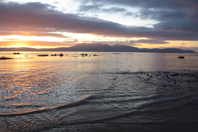
The Island includes miles of coastal pathways, numerous hills and mountains, forested areas, rivers, small lochs and beaches. Its main beaches are at Brodick, Whiting Bay, Kildonan, Sannox and Blackwaterfoot.
Most of the islands of Scotland have been occupied consecutively by speakers of at least four languages since the Iron Age. Therefore, the names of many islands have more than one possible origin, including Arran. Mac an Tàilleir (2003) says the name "is said to be unrelated" to those of Arranmore or the Aran Islands in Ireland, which come from Irish Árainn meaning "kidney-shaped", though he does not rule out this derivation.
Unusually for a Scottish island, Haswell-Smith (2004) and William Cook Mackenzie (1931) offer a Brythonic derivation and a meaning of "high place" (compare Middle Welsh aran) which at least corresponds with the geography – Arran is significantly loftier than all the land that immediately surrounds it along the shores of the Firth of Clyde.
Any other Brythonic place-names that may have existed, save perhaps for Mayish, were later replaced on Arran as the Goidelic-speaking Gaels spread from Ireland, via their adjacent kingdom of Dál Riata.
During the Viking Age it became, along with most Scottish islands, the property of the Norwegian crown, at which time it may have been known as Herrey or Hersey. As a result of Norse influence, many current place-names on Arran are of Viking origin.
The island lies in the Firth of Clyde between Ayr and Ardrossan, and Kintyre. The profile of the north Arran hills as seen from the Ayrshire coast is referred to as the "Sleeping Warrior", due to its resemblance to a resting human figure. The highest of these hills is Goat Fell at 875 metres (2,871 ft). There are three other Corbetts, all in the north east: Caisteal Abhail, Cìr Mhòr and Beinn Tarsuinn. Beinn Bharrain is the highest peak in the north west at 721.4 metres (2,367 ft).
Isle of Arran
The Isle of Arran (/ˈærən/; Scottish Gaelic: Eilean Arainn) or simply Arran is an island off the west coast of Scotland. It is the largest island in the Firth of Clyde and the seventh-largest Scottish island, at 432 square kilometres (167 sq mi). Historically part of Buteshire, it is in the unitary council area of North Ayrshire. In the 2022 census it had a resident population of 4,618. Though culturally and physically similar to the Hebrides, it is separated from them by the Kintyre peninsula. Often referred to as "Scotland in Miniature", the Island is divided into highland and lowland areas by the Highland Boundary Fault and has been described as a "geologist's paradise".
Arran has been continuously inhabited since the early Neolithic period. Numerous prehistoric remains have been found. From the 6th century onwards, Goidelic-speaking peoples from Ireland colonised it and it became a centre of religious activity. In the troubled Viking Age, Arran became the property of the Norwegian crown, until formally absorbed by the kingdom of Scotland in the 13th century. The 19th-century "clearances" led to significant depopulation and the end of the Gaelic language and way of life. The economy and population have recovered in recent years, the main industry being tourism. However, the increase in tourism and people buying holiday homes on the Island, the second highest rate of such homes in the UK, has led to a shortage of affordable homes on the Island. There is a diversity of wildlife, including three species of tree endemic to the area.
The Island includes miles of coastal pathways, numerous hills and mountains, forested areas, rivers, small lochs and beaches. Its main beaches are at Brodick, Whiting Bay, Kildonan, Sannox and Blackwaterfoot.
Most of the islands of Scotland have been occupied consecutively by speakers of at least four languages since the Iron Age. Therefore, the names of many islands have more than one possible origin, including Arran. Mac an Tàilleir (2003) says the name "is said to be unrelated" to those of Arranmore or the Aran Islands in Ireland, which come from Irish Árainn meaning "kidney-shaped", though he does not rule out this derivation.
Unusually for a Scottish island, Haswell-Smith (2004) and William Cook Mackenzie (1931) offer a Brythonic derivation and a meaning of "high place" (compare Middle Welsh aran) which at least corresponds with the geography – Arran is significantly loftier than all the land that immediately surrounds it along the shores of the Firth of Clyde.
Any other Brythonic place-names that may have existed, save perhaps for Mayish, were later replaced on Arran as the Goidelic-speaking Gaels spread from Ireland, via their adjacent kingdom of Dál Riata.
During the Viking Age it became, along with most Scottish islands, the property of the Norwegian crown, at which time it may have been known as Herrey or Hersey. As a result of Norse influence, many current place-names on Arran are of Viking origin.
The island lies in the Firth of Clyde between Ayr and Ardrossan, and Kintyre. The profile of the north Arran hills as seen from the Ayrshire coast is referred to as the "Sleeping Warrior", due to its resemblance to a resting human figure. The highest of these hills is Goat Fell at 875 metres (2,871 ft). There are three other Corbetts, all in the north east: Caisteal Abhail, Cìr Mhòr and Beinn Tarsuinn. Beinn Bharrain is the highest peak in the north west at 721.4 metres (2,367 ft).
Recent media
Recent media