Recent from talks
Kent Island (Maryland)
Knowledge base stats:
Talk channels stats:
Members stats:
Kent Island (Maryland)
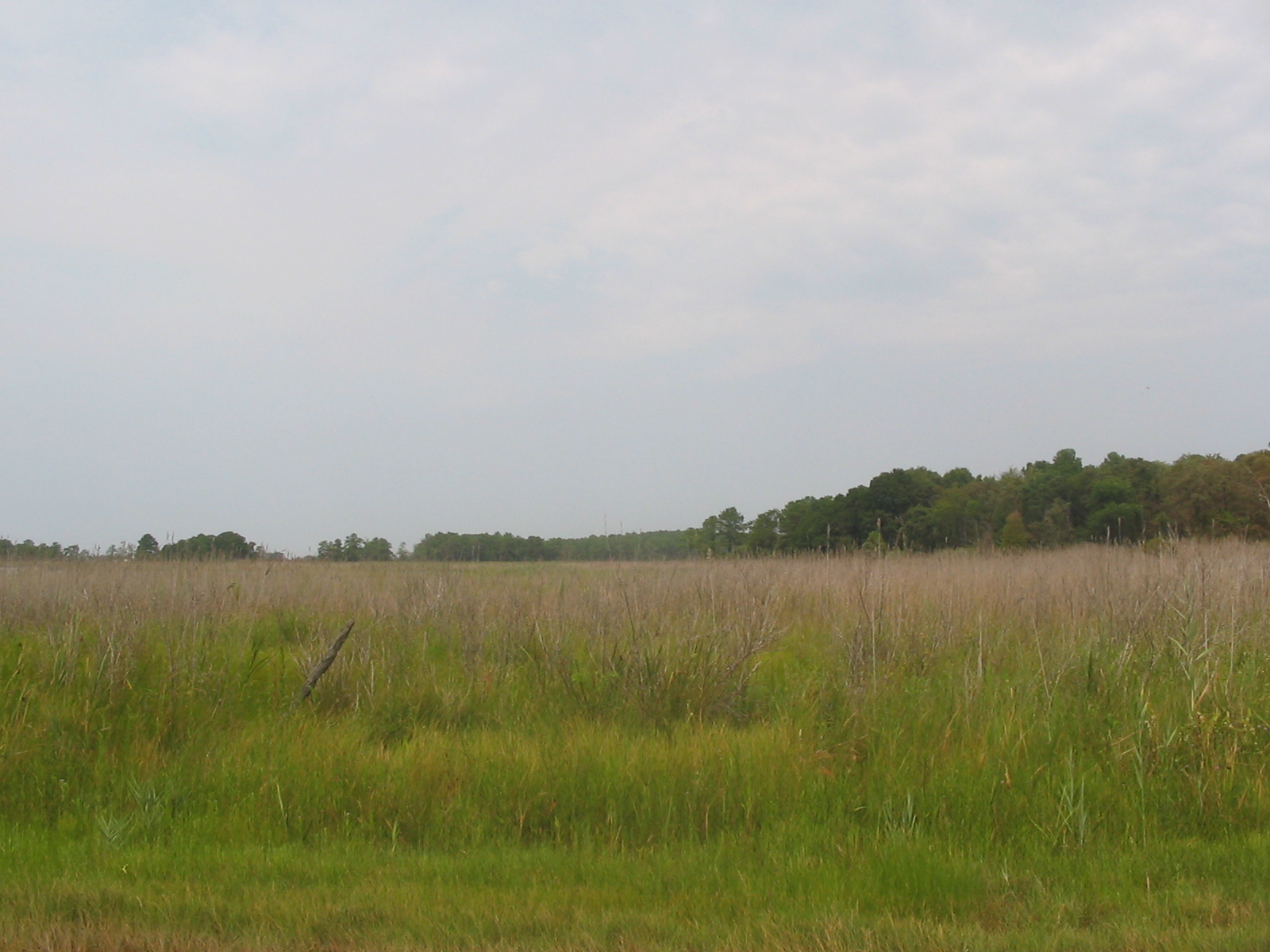
Kent Island is the largest island in the Chesapeake Bay and a historic place in Maryland, United States. To the east, a narrow channel known as the Kent Narrows barely separates the island from the Delmarva Peninsula, and on the other side, the island is separated from Sandy Point, an area near Annapolis, by roughly four miles (6.4 km) of water. At only four miles wide, the main waterway of the bay is at its narrowest at this point and is spanned here by the Chesapeake Bay Bridge. The Chester River runs to the north of the island and empties into the Chesapeake Bay at Kent Island's Love Point. To the south of the island lies Eastern Bay. The United States Census Bureau reports that the island has 31.62 square miles (81.90 km2) of land area.
Kent Island is part of Queen Anne's County, Maryland, and Maryland's Eastern Shore region. The first English establishment on the island, Kent Fort, was founded in 1631, making Kent Island the oldest English settlement within the present day state of Maryland and the third oldest permanent English settlement in what became the United States—after Jamestown, Virginia (1607), and Plymouth, Massachusetts (1620). The census-designated places of Stevensville and Chester are located on the island, along with several other communities, including the fishing community of Kent Narrows, which is located partially on the island. Although all of Kent Island's communities are unincorporated, the census designated places of Stevensville and Chester on the island are both more populous than any of Queen Anne's County's incorporated towns.
Before European colonization, Kent Island was inhabited by Native Americans for nearly 12,000 years. The island was inhabited by the Matapeake people, members of the Algonquian nation whom the Matapeake area of Kent Island is named. Other tribes that inhabited the area and often visited the island included the Ozinie tribe. The Matapeake people referred to the island as Monoponson in their language. During the 16th and 17th centuries, early explorers of the Chesapeake Bay, including Captain John Smith (who had named the area "Winstons Iles"), were the first Europeans to see Kent Island; however, it wasn't until August 1631 that the island became an English settlement. At that time, William Claiborne, a resident of Jamestown, Virginia, founded a settlement near the southern end of the island for the purpose of trading with Native Americans and named the land "the Isle of Kent" after his birthplace of Kent, England.
The settlement burned down in the winter of 1631–32 but was quickly rebuilt, and in 1634 the settlement included a gristmill, courthouse, and trading station. Following the formation of the province of Maryland, Claiborne continued to recognize the island as part of his home colony of Virginia, while Cecilius Calvert, 2nd Baron Baltimore recognized it as part of Maryland. Claiborne was forced from and returned to the island twice before leaving permanently in 1658, thus effectively ending the disputes. Virginia's official claims to the island, however, continued until 1776.
During the War of 1812 the island was occupied by British forces from the 102d Regiment of Foot and the Royal Marines.The island was used as a base for naval forces under the command of Rear Admiral George Cockburn. Its position allowed the British to simultaneously threaten Baltimore and Annapolis. Kent Island had a population of enslaved Black people; because British commanders were willing to offer enslaved Black people an opportunity to escape the United States or enlist in British armed forces, individuals enslaved on Kent Island used the British presence to secure their freedom.
Until the early 19th century, Kent Island was used almost entirely for farming of tobacco and corn, however that ended due to the depletion of nutrient-rich soil as a result of the lack of crop rotation and poor farming practices. The island's economy went into decline while the soil recovered, except for the port town of Broad Creek. This began to change around the time of the Industrial Revolution. In 1850, the town of Stevensville, was founded after the sale of farms owned by James and Charles Stevens and prospered as a major hub for steamboat travel across the Chesapeake Bay. Stevensville was also the home of a railroad station known as the Stevensville Train Depot that was located near the western end of a railroad that carried ferry passengers to other parts of the Eastern Shore. Also during this time, small resorts on the shores of the Chesapeake Bay and the Atlantic Ocean were established in the area. Such a resort existed at Love Point, to the north of Stevensville. Farming returned to the economy in the nineteenth and twentieth centuries with farmers growing crops including corn, wheat, berries, and melons. Many of the island's inhabitants worked as watermen in the expanding seafood industry capitalizing on the Chesapeake's supply of Maryland Blue Crab, rockfish, and oysters.
As roads replaced railroads and steamboats into the twentieth century, there was a growing need for a road bridge connecting the two shores of the Chesapeake Bay. In 1952 the Chesapeake Bay Bridge was completed, connecting the island directly to the Baltimore-Washington Metropolitan Area. The bridge completely replaced the steamboat system and also led to further growth of Kent Island and the rest of the Eastern Shore. In 1973, to accommodate growing traffic across the bay, the bridge was expanded with an additional span built next to the existing one. Then, in the late 1980s and early 1990s U.S. Route 50 was converted to a freeway across the island.
In September 2003, Kent Island was one of the many places in the Chesapeake Bay Area affected by Hurricane Isabel. Local businesses and historic local landmarks were either damaged or destroyed in the storm and the storm surge caused by it. Much of the damage from the hurricane, mostly caused by flooding, took several months to repair.
Hub AI
Kent Island (Maryland) AI simulator
(@Kent Island (Maryland)_simulator)
Kent Island (Maryland)
Kent Island is the largest island in the Chesapeake Bay and a historic place in Maryland, United States. To the east, a narrow channel known as the Kent Narrows barely separates the island from the Delmarva Peninsula, and on the other side, the island is separated from Sandy Point, an area near Annapolis, by roughly four miles (6.4 km) of water. At only four miles wide, the main waterway of the bay is at its narrowest at this point and is spanned here by the Chesapeake Bay Bridge. The Chester River runs to the north of the island and empties into the Chesapeake Bay at Kent Island's Love Point. To the south of the island lies Eastern Bay. The United States Census Bureau reports that the island has 31.62 square miles (81.90 km2) of land area.
Kent Island is part of Queen Anne's County, Maryland, and Maryland's Eastern Shore region. The first English establishment on the island, Kent Fort, was founded in 1631, making Kent Island the oldest English settlement within the present day state of Maryland and the third oldest permanent English settlement in what became the United States—after Jamestown, Virginia (1607), and Plymouth, Massachusetts (1620). The census-designated places of Stevensville and Chester are located on the island, along with several other communities, including the fishing community of Kent Narrows, which is located partially on the island. Although all of Kent Island's communities are unincorporated, the census designated places of Stevensville and Chester on the island are both more populous than any of Queen Anne's County's incorporated towns.
Before European colonization, Kent Island was inhabited by Native Americans for nearly 12,000 years. The island was inhabited by the Matapeake people, members of the Algonquian nation whom the Matapeake area of Kent Island is named. Other tribes that inhabited the area and often visited the island included the Ozinie tribe. The Matapeake people referred to the island as Monoponson in their language. During the 16th and 17th centuries, early explorers of the Chesapeake Bay, including Captain John Smith (who had named the area "Winstons Iles"), were the first Europeans to see Kent Island; however, it wasn't until August 1631 that the island became an English settlement. At that time, William Claiborne, a resident of Jamestown, Virginia, founded a settlement near the southern end of the island for the purpose of trading with Native Americans and named the land "the Isle of Kent" after his birthplace of Kent, England.
The settlement burned down in the winter of 1631–32 but was quickly rebuilt, and in 1634 the settlement included a gristmill, courthouse, and trading station. Following the formation of the province of Maryland, Claiborne continued to recognize the island as part of his home colony of Virginia, while Cecilius Calvert, 2nd Baron Baltimore recognized it as part of Maryland. Claiborne was forced from and returned to the island twice before leaving permanently in 1658, thus effectively ending the disputes. Virginia's official claims to the island, however, continued until 1776.
During the War of 1812 the island was occupied by British forces from the 102d Regiment of Foot and the Royal Marines.The island was used as a base for naval forces under the command of Rear Admiral George Cockburn. Its position allowed the British to simultaneously threaten Baltimore and Annapolis. Kent Island had a population of enslaved Black people; because British commanders were willing to offer enslaved Black people an opportunity to escape the United States or enlist in British armed forces, individuals enslaved on Kent Island used the British presence to secure their freedom.
Until the early 19th century, Kent Island was used almost entirely for farming of tobacco and corn, however that ended due to the depletion of nutrient-rich soil as a result of the lack of crop rotation and poor farming practices. The island's economy went into decline while the soil recovered, except for the port town of Broad Creek. This began to change around the time of the Industrial Revolution. In 1850, the town of Stevensville, was founded after the sale of farms owned by James and Charles Stevens and prospered as a major hub for steamboat travel across the Chesapeake Bay. Stevensville was also the home of a railroad station known as the Stevensville Train Depot that was located near the western end of a railroad that carried ferry passengers to other parts of the Eastern Shore. Also during this time, small resorts on the shores of the Chesapeake Bay and the Atlantic Ocean were established in the area. Such a resort existed at Love Point, to the north of Stevensville. Farming returned to the economy in the nineteenth and twentieth centuries with farmers growing crops including corn, wheat, berries, and melons. Many of the island's inhabitants worked as watermen in the expanding seafood industry capitalizing on the Chesapeake's supply of Maryland Blue Crab, rockfish, and oysters.
As roads replaced railroads and steamboats into the twentieth century, there was a growing need for a road bridge connecting the two shores of the Chesapeake Bay. In 1952 the Chesapeake Bay Bridge was completed, connecting the island directly to the Baltimore-Washington Metropolitan Area. The bridge completely replaced the steamboat system and also led to further growth of Kent Island and the rest of the Eastern Shore. In 1973, to accommodate growing traffic across the bay, the bridge was expanded with an additional span built next to the existing one. Then, in the late 1980s and early 1990s U.S. Route 50 was converted to a freeway across the island.
In September 2003, Kent Island was one of the many places in the Chesapeake Bay Area affected by Hurricane Isabel. Local businesses and historic local landmarks were either damaged or destroyed in the storm and the storm surge caused by it. Much of the damage from the hurricane, mostly caused by flooding, took several months to repair.
Recent media