Hubbry Logo
search
search button
Sign in
Historyarrow-down
starMorearrow-down
Hubbry Logo
search
search button
Sign in
Modren Peak
Community hub for the Wikipedia article
logoWikipedian hub
Welcome to the community hub built on top of the Modren Peak Wikipedia article. Here, you can discuss, collect, and organize anything related to Modren Peak. The purpose of the hub is to connect people, foster deeper knowledge, and help improve the root Wikipedia article.
Add your contribution
Inside this hub
Modren Peak

Location of Sentinel Range in Western Antarctica.
Map of Sentinel Range.

Modren Peak (Bulgarian: връх Модрен, romanizedvrah Modren, IPA: [ˈvrɤx ˈmɔdrɛn]) is the peak rising to 1748 m[1] in Owen Ridge, the southernmost portion of the main ridge of Sentinel Range in Ellsworth Mountains, Antarctica. It has steep and partly ice-free north and southwest slopes, and surmounts lower Nimitz Glacier to the west.

The peak is named after the historical settlement of Modren in Southern Bulgaria.

Location

[edit]

Modren Peak is located at 78°48′55.8″S 85°03′40″W / 78.815500°S 85.06111°W / -78.815500; -85.06111, which is 4.3 km southwest of Mount Inderbitzen, 5.35 km west-northwest of Peristera Peak, and 16.34 km east-northeast of Bergison Peak in Bastien Range. US mapping in 1961 and 1988.

See also

[edit]

Maps

[edit]
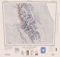
  • Vinson Massif. Scale 1:250 000 topographic map. Reston, Virginia: US Geological Survey, 1988.
  • Antarctic Digital Database (ADD). Scale 1:250000 topographic map of Antarctica. Scientific Committee on Antarctic Research (SCAR). Since 1993, regularly updated.

Notes

[edit]
[edit]
[edit]
Add your contribution
Related Hubs