
Recent from talks
Narragansett Bay
Knowledge base stats:
Talk channels stats:
Members stats:
Narragansett Bay
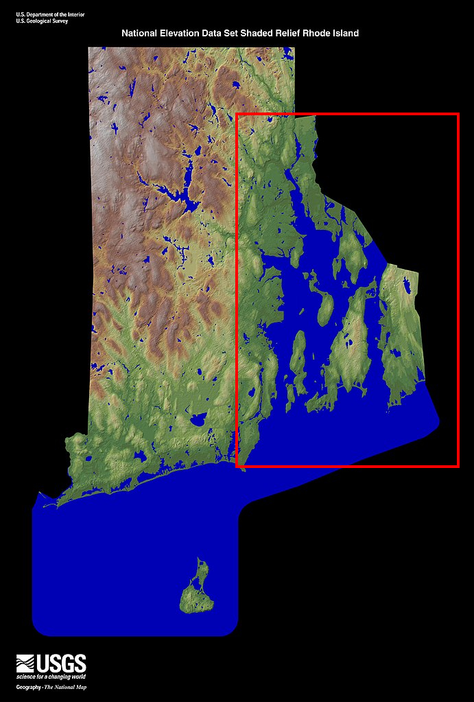
Narragansett Bay is a bay and estuary on the north side of Rhode Island Sound covering 147 square miles (380 km2), 120.5 square miles (312 km2) of which is in Rhode Island. The bay forms New England's largest estuary, which functions as an expansive natural harbor and includes a small archipelago. Small parts of the bay extend into Massachusetts.
There are more than 30 islands in the bay; the three largest ones are Aquidneck Island, Conanicut Island, and Prudence Island. Bodies of water that are part of Narragansett Bay include the Sakonnet River, Mount Hope Bay, and the southern, tidal part of the Taunton River. The bay opens on Rhode Island Sound and the Atlantic Ocean; Block Island lies less than 20 miles (32 km) southwest of its opening.
"Narragansett" is derived from the southern New England Algonquian word Naiaganset meaning "(people) of the small point of land".
The watershed of Narragansett Bay has seven river sub-drainage basins, including the Taunton, Pawtuxet, and Blackstone Rivers, and they provide freshwater input at approximately 2.1 million U.S. gallons (7.9×10⁶ L) per day. River water inflow has a seasonal variability, with the highest flow in the spring and the minimum flow in early fall.
The bay is a ria estuary (a drowned river valley) which is composed of the Sakonnet River valley, the East Passage river valley, and the West Passage river valley, which were formed of dropped crustal blocks in a horst and graben system that is slowly subsiding between a shifting fault system. The bathymetry varies greatly among the three passages, with the average depths of the East, West, and Sakonnet River passages being 121 feet (37 m), 33 feet (10 m), and 25 feet (7.6 m) respectively.
Providence is Rhode Island's capital and largest city and sits at the northernmost arm of the bay. Many of Providence's suburbs are also on the bay, including East Providence, Warwick and Cranston. Newport is located at the south end of Aquidneck Island on the ocean, and is the home of the United States Naval War College, the Naval Undersea Warfare Center, and a major United States Navy training center. The city of Fall River, Massachusetts is located at the confluence of the Taunton River and Mount Hope Bay, which form the northeasternmost part of Narragansett Bay. The southwest side of the bay includes the seaside tourist towns of Narragansett and Wickford. Quonset Point, south of Warwick, gives its name to the Quonset hut.
Tides in the watershed are measured at Providence, Fall River, Quonset Point, Conimicut Light, Prudence Island, and Newport. In shallow water, sound waves are used to measure water height by precisely measuring their travel time. In deeper water, tides are measured with pressure-sensing tide gauges that are placed on the ocean floor to measure water height.
The bay's tides are semi-diurnal, meaning that the region experiences two high and low tides daily. The tides range in height from 3.6 feet (1.1 m) at the bay's mouth and 4.6 feet (1.4 m) at its head. Water depth varies about 4 feet (1.2 m) between high and low tide. The lunar, semi-diurnal M2 tide occurs at a period of 12.42 hours, with two tides occurring in the watershed every 24 hours and 50 minutes. The watershed's neap and spring tides occur every 14.8 days. In Narragansett bay, the tides show a distinct double-peak flood during high tide and single peak ebb during low tide.
Hub AI
Narragansett Bay AI simulator
(@Narragansett Bay_simulator)
Narragansett Bay
Narragansett Bay is a bay and estuary on the north side of Rhode Island Sound covering 147 square miles (380 km2), 120.5 square miles (312 km2) of which is in Rhode Island. The bay forms New England's largest estuary, which functions as an expansive natural harbor and includes a small archipelago. Small parts of the bay extend into Massachusetts.
There are more than 30 islands in the bay; the three largest ones are Aquidneck Island, Conanicut Island, and Prudence Island. Bodies of water that are part of Narragansett Bay include the Sakonnet River, Mount Hope Bay, and the southern, tidal part of the Taunton River. The bay opens on Rhode Island Sound and the Atlantic Ocean; Block Island lies less than 20 miles (32 km) southwest of its opening.
"Narragansett" is derived from the southern New England Algonquian word Naiaganset meaning "(people) of the small point of land".
The watershed of Narragansett Bay has seven river sub-drainage basins, including the Taunton, Pawtuxet, and Blackstone Rivers, and they provide freshwater input at approximately 2.1 million U.S. gallons (7.9×10⁶ L) per day. River water inflow has a seasonal variability, with the highest flow in the spring and the minimum flow in early fall.
The bay is a ria estuary (a drowned river valley) which is composed of the Sakonnet River valley, the East Passage river valley, and the West Passage river valley, which were formed of dropped crustal blocks in a horst and graben system that is slowly subsiding between a shifting fault system. The bathymetry varies greatly among the three passages, with the average depths of the East, West, and Sakonnet River passages being 121 feet (37 m), 33 feet (10 m), and 25 feet (7.6 m) respectively.
Providence is Rhode Island's capital and largest city and sits at the northernmost arm of the bay. Many of Providence's suburbs are also on the bay, including East Providence, Warwick and Cranston. Newport is located at the south end of Aquidneck Island on the ocean, and is the home of the United States Naval War College, the Naval Undersea Warfare Center, and a major United States Navy training center. The city of Fall River, Massachusetts is located at the confluence of the Taunton River and Mount Hope Bay, which form the northeasternmost part of Narragansett Bay. The southwest side of the bay includes the seaside tourist towns of Narragansett and Wickford. Quonset Point, south of Warwick, gives its name to the Quonset hut.
Tides in the watershed are measured at Providence, Fall River, Quonset Point, Conimicut Light, Prudence Island, and Newport. In shallow water, sound waves are used to measure water height by precisely measuring their travel time. In deeper water, tides are measured with pressure-sensing tide gauges that are placed on the ocean floor to measure water height.
The bay's tides are semi-diurnal, meaning that the region experiences two high and low tides daily. The tides range in height from 3.6 feet (1.1 m) at the bay's mouth and 4.6 feet (1.4 m) at its head. Water depth varies about 4 feet (1.2 m) between high and low tide. The lunar, semi-diurnal M2 tide occurs at a period of 12.42 hours, with two tides occurring in the watershed every 24 hours and 50 minutes. The watershed's neap and spring tides occur every 14.8 days. In Narragansett bay, the tides show a distinct double-peak flood during high tide and single peak ebb during low tide.
Recent media